
On January 4, 2009, a mountainside in northern Guatemala suddenly collapsed, sending thousands of tons of rock and debris downhill and burying a nearby road. The event occurred in the state of Alta Verapaz, some 200 kilometers (124 miles) north of Guatemala’s capital city.
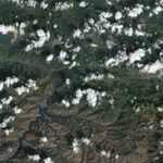
The Advanced Land Imager (ALI) on NASA ’s Earth Observing-1 (EO-1) satellite captured this true-color image of the area on January 9, 2009, five days after the landslide. In this image, the landslide forms a wide, beige-colored gash on the lush green landscape. The source of the landslide is toward the north, and near the source, the landslide is roughly half a kilometer (one-third of a mile) wide. The debris field narrows farther downhill. The landslide crosses the road, which appears as a meandering, east-west beige line. Clouds float overhead, casting their shadows on the land surface below, but they do not impede the satellite’s view of the disaster.
As of January 5, the landslide had killed more than 30 people, and left dozens more missing, according to news reports. On January 6, authorities suspended rescue efforts, citing unstable terrain and continued rock falls that posed a risk to rescuers. An earlier rock fall the previous month had killed at least two people, prompting officials to close the local road. Roughly 140 people, however, were believed to have ignored the closure warnings, left their vehicles, and walked past the road barricades on foot on the day of the January 5 landslide.
References & Resources
- BBC. (2009, January 5). Dozens die in Guatemala landslide. Accessed January 14, 2009.
- Voice of America News. (2009, January 6). Guatemala landslide kills 33, more missing. Accessed January 14, 2009.
- Voice of America News. (2009, January 5). Search halted in deadly Guatemala landslide. Accessed January 14, 2009.
NASA image created by Jesse Allen, using EO-1 ALI data provided courtesy of the NASA EO-1 Team. Caption by Michon Scott.