


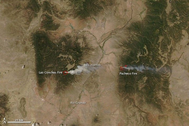
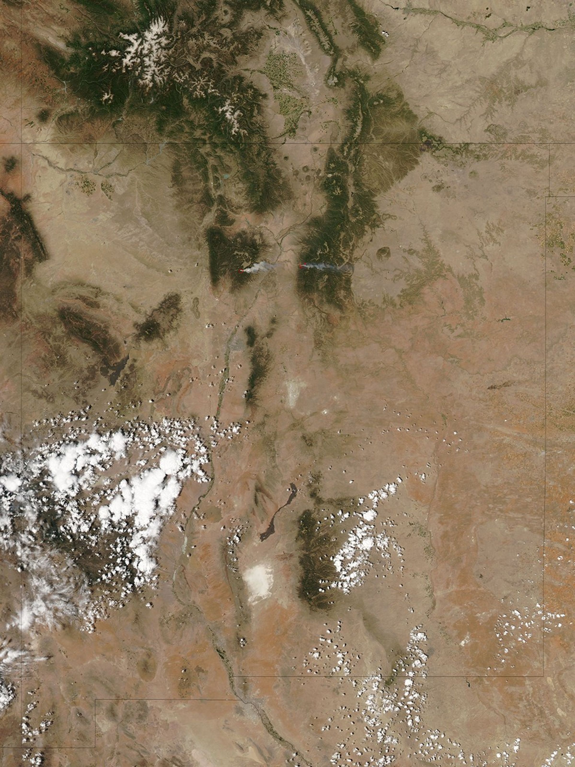
High temperatures, low humidity, and strong winds allowed the Las Conchas Fire, burning near Los Alamos, New Mexico, to grow very quickly on June 26, 2011. The Moderate Resolution Imaging Spectroradiometer (MODIS) on NASA’s Aqua satellite captured this image about an hour and a half after the fire started. Within that short time, the fire had already become intense enough to send a towering plume of smoke east over Los Alamos, about 12 miles (19 kilometers) to the northeast. The active fire region is outlined in red.
By the morning of June 27, the fire had burned 43,597 acres (17,643 hectares or 176 square km), bringing down power and phone lines. The fire forced about 100 people out of their homes in the communities of Cochiti Mesa and Las Conchas and closed Bandelier National Monument and Los Alamos National Laboratory. As of about 10 a.m. local time, the fire was about a mile from the southwest boundary of the lab.
The image also shows the smaller Pacheco Fire burning in the Santa Fe National Forest east of the Rio Grande. The Pacheco Fire started on June 18 and has burned 9,334 acres (3,777 hectares or 38 square km).
References & Resources
- InciWeb. (2011, June 27). Las Conchas Fire. Accessed June 27, 2011.
- InciWeb. (2011, June 27). Pacheco Fire. Accessed June 27, 2011.
- Los Alamos Monitor. (2011, June 27). Las Conchas wildfire at 43,000+ acres; County under voluntary evacuation; Lab closed today. Accessed June 27, 2011.
- Remote Sensing Applications Center. (2011, June 27). Fire detection map, Southwest (AZ, NM, Southwestern TX). United States Department of Agriculture Forest Service. Accessed June 27, 2011.
NASA image courtesy the MODIS Rapid Response Team at NASA GSFC. Caption by Holli Riebeek.


