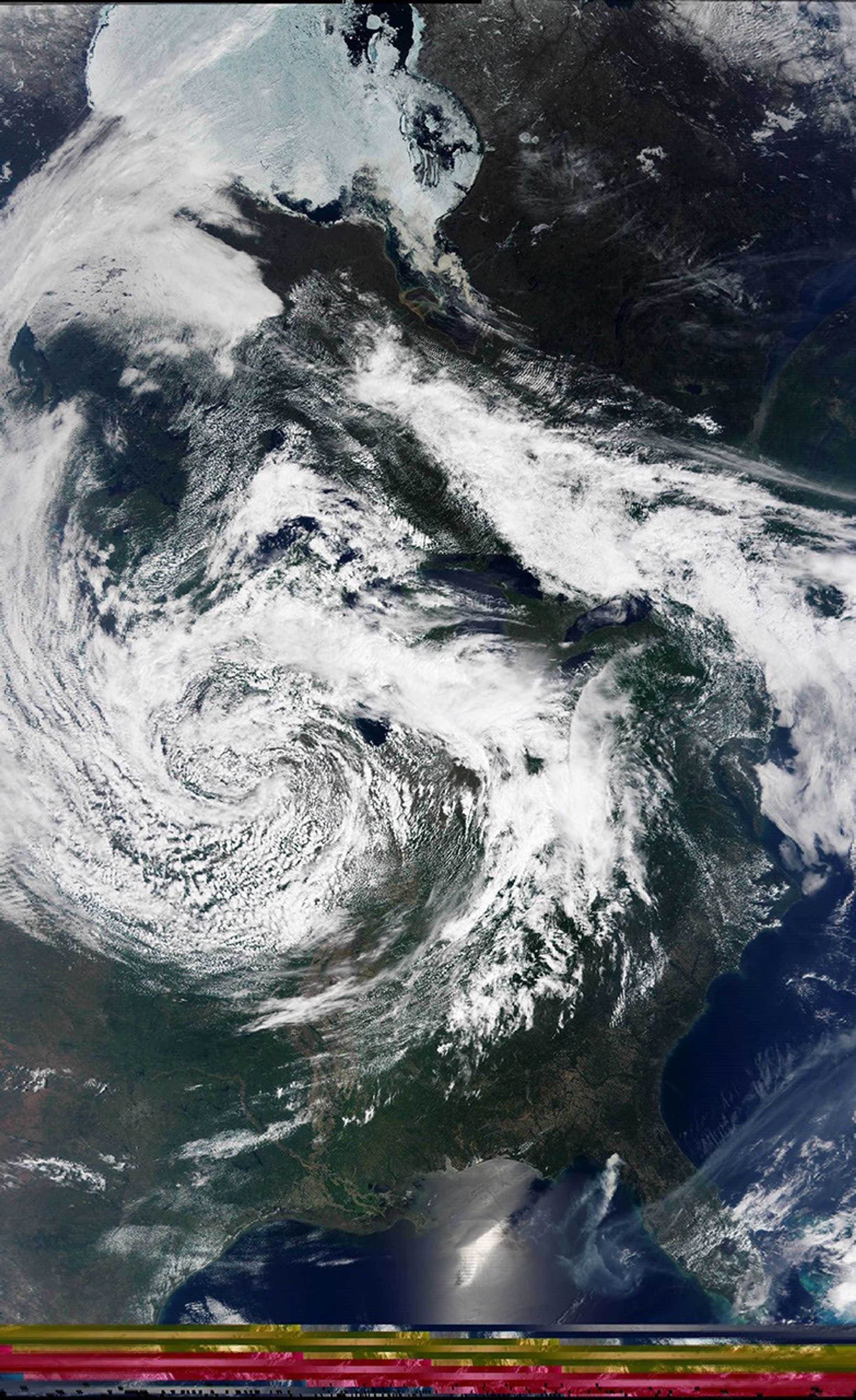
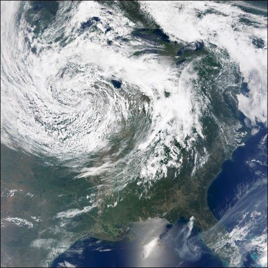
A large low-pressure system approached the U.S. East Coast on May 24, 2001,bringing with it forecasts of rain through Memorial Day weekend. This true-color imagefrom the Moderate-resolution Imaging Spectroradiometer (MODIS), flying aboardNASA's Terrasatellite, shows the storm while it was centered over Illinois, Iowa, and Missouri.The smoke plume from a large fire northeast of Steinhatchee, Florida, is also visible to thelower right. In the Gulf of Mexico, the bright sun glint reveals a swath of relativelysmooth water. The dark area in the patch of sun glint is a cloud shadow.
Every day, MODIS imagery is collected by the direct broadcast receiving stationat Goddard Space flight center as well as about two dozen other direct broadcast receiving stations around the world. Previews from NASA Goddard's receiving stationare available from the Earth Observatory'sMissions section.Direct broadcast stations receive data from MODIS as Terra flies overhead, enabling scientists to monitor regional meteorological and environmental conditions in near real time.
Click for more details on how to receive MODIS direct broadcast data.
References & Resources
Image courtesy Patrick Coronado and the Direct Readout Laboratory at NASA's Goddard Space Flight Center