

September 27, 2012
Marine Layer Clouds off the California Coast
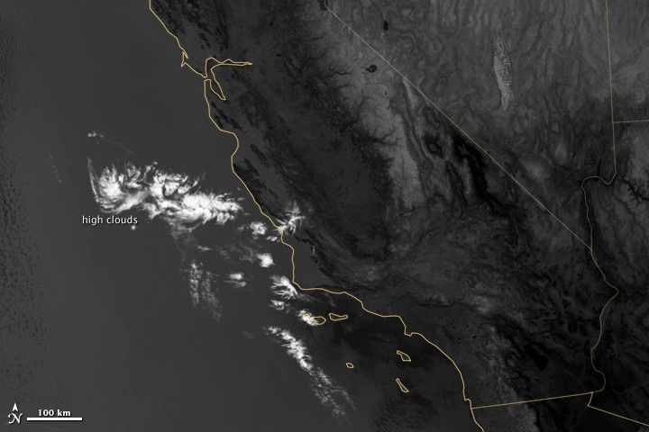
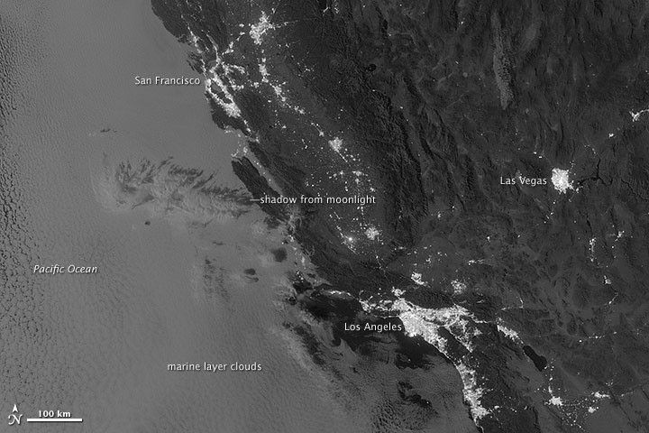
On September 27, 2012, the Visible Infrared Imaging Radiometer Suite (VIIRS) on the Suomi NPP satellite captured this nighttime view of low-lying marine layer clouds along the coast of California.
The image was captured by the VIIRS “day-night band,” which detects light in a range of wavelengths from green to near-infrared and uses filtering techniques to observe signals such as gas flares, auroras, wildfires, city lights, and reflected moonlight.
An irregularly-shaped patch of high clouds hovered off the coast of California, and moonlight caused the high clouds to cast distinct shadows on the marine layer clouds below. VIIRS acquired the image when the Moon was in its waxing gibbous phase, meaning it was more than half-lit, but less than full.
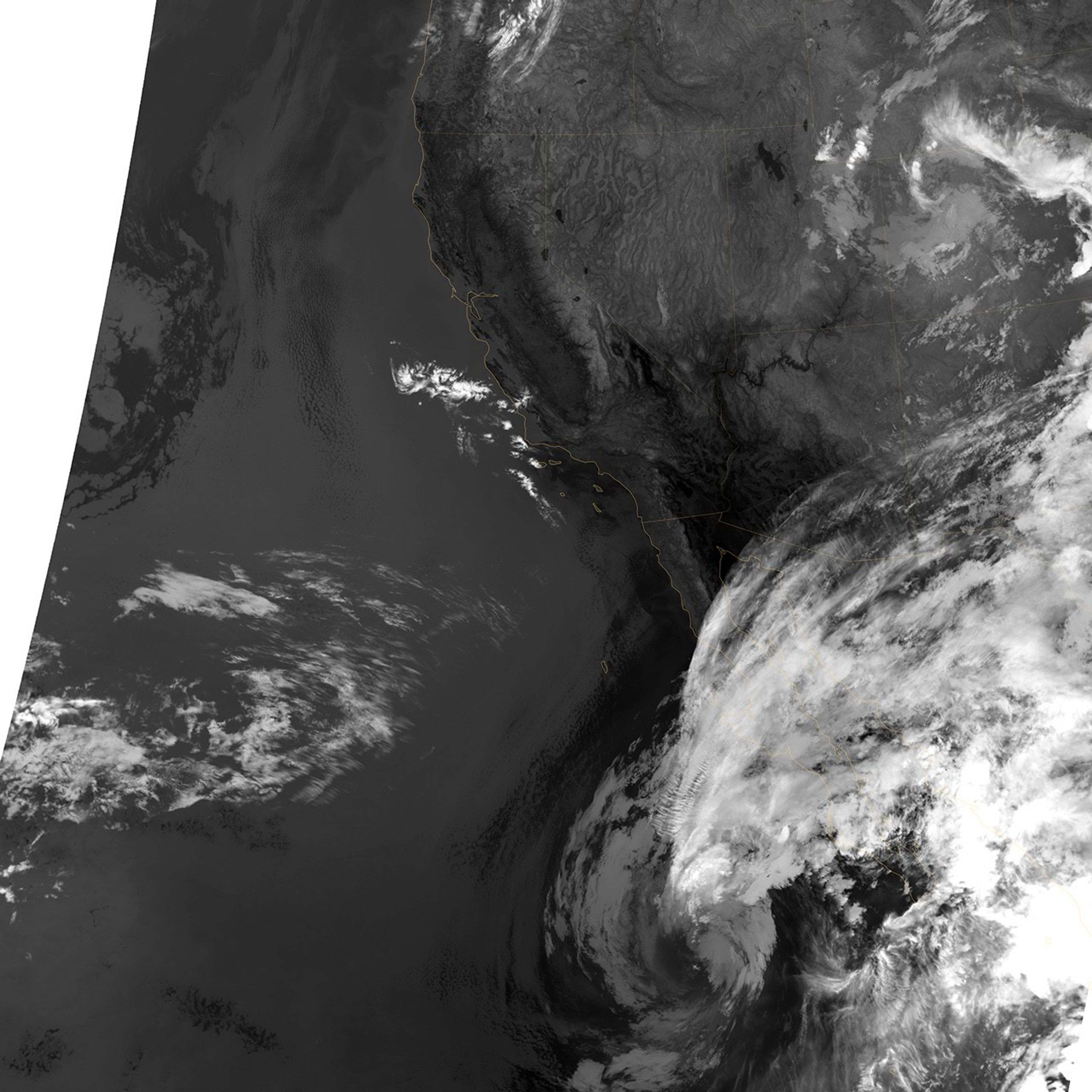
Low clouds pose serious hazards for air and ship traffic, but satellites have had difficulty detecting them in the past. To illustrate this, the second image shows the same scene in thermal infrared, the band that meteorologists generally use to monitor clouds at night. Only high clouds are visible; the low clouds do not show up at all because they are roughly the same temperature as the ground.
Learn more about the VIIRS day-night band and nighttime imaging of Earth in our new feature story: Out of the Blue and Into the Black.
References & Resources
- Earth Observatory (2012, September 11) Another Foggy Day in San Francisco. Accessed Nov. 29, 2012.
- Lee, T. (2006, Feb) The NPOESS VIIRS Day/Night Visible Sensor. Bulletin of the American Meteorological Society.
- Miller, S. (2012, Aug. 10) Suomi Satellite Brings to Light a Unique Frontier of Nighttime Environmental Sensing Capabilities. Proceeding of the National Academy of Sciences.
- NASA (n.d.) Suomi NPP. Accessed Nov. 29, 2012.
NASA Earth Observatory image by Jesse Allen and Robert Simmon, using VIIRS Day-Night Band data from the Suomi National Polar-orbiting Partnership. Suomi NPP is the result of a partnership between NASA, the National Oceanic and Atmospheric Administration, and the Department of Defense. Caption by Adam Voiland.