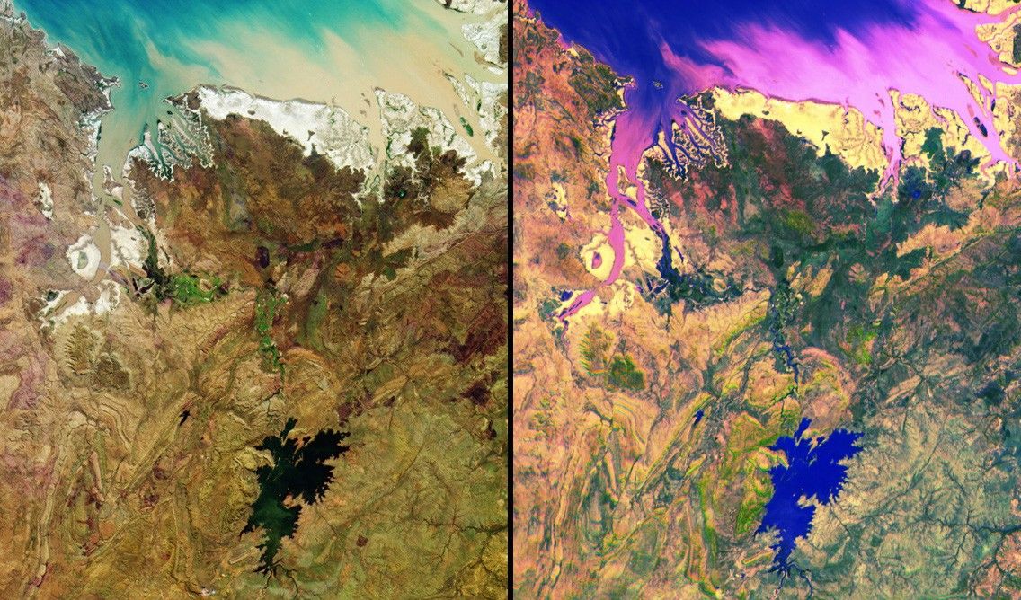
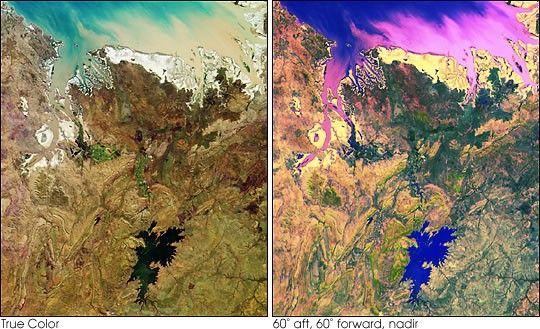
MISR images of tropical northern Australia acquired on June 1, 2000(Terra orbit 2413) during the long dry season. Left: color composite ofvertical (nadir) camera blue, green, and red band data. Right:multi-angle composite of red band data only from the cameras viewing 60degrees aft, 60 degrees forward, and nadir. Color and contrast have beenenhanced to accentuate subtle details. In the left image, colorvariations indicate how different parts of the scene reflect lightdifferently at blue, green, and red wavelengths; in the right imagecolor variations show how these same scene elements reflect lightdifferently at different angles of view. Water appears in blue shades inthe right image, for example, because glitter makes the water lookbrighter at the aft camera's view angle. The prominent inland water bodyis Lake Argyle, the largest human-made lake in Australia, which supplieswater for the Ord River Irrigation Area and the town of Kununurra (pop.6500) just to the north. At the top is the southern edge of JosephBonaparte Gulf; the major inlet at the left is Cambridge Gulf, thelocation of the town of Wyndham (pop. 850), the port for this region.This area is sparsely populated, and is known for its remote,spectacular mountains and gorges. Visible along much of the coastlineare intertidal mudflats of mangroves and low shrubs; to the south theterrain is covered by open woodland merging into open grassland in thelower half of the pictures.
MISR was built and is managed by NASA's Jet Propulsion Laboratory,Pasadena, CA, for NASA's Office of Earth Science, Washington, DC. TheTerra satellite is managed by NASA's Goddard Space Flight Center,Greenbelt, MD. JPL is a division of the California Institute ofTechnology.
References & Resources
Image by NASA/GSFC/JPL, MISR Science Team