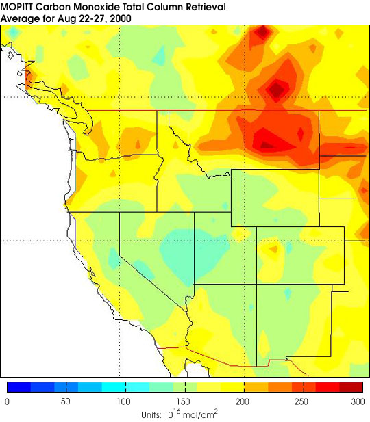
This false-color image shows concentrations of carbon monoxide in the atmosphere. Note the relatively high concentrations of the gas blowing eastward over Montana and northward across the Canadian border. These measurements were taken by the Measurements Of Pollution In The Troposphere (MOPITT) and averaged for the period Aug. 22 - 27, 2000. Red pixels show relatively high levels of carbon monoxide, yellows are intermediate values, and blues are relatively low values.
During the time these data were collected by MOPITT, there were widespread wildfires across Montana and Idaho. Along with smoke and particulate emissions, carbon monoxide is another byproduct of fire. These data are preliminary.
References & Resources
Image courtesy the NCAR MOPITT Team and the MOPITT Science Team
None