


June 20, 2006
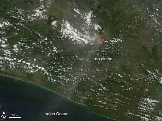
Merapi Volcano continued its prolonged period of unrest on June 20, 2006. The Moderate Resolution Imaging Spectroradiometer (MODIS) flying onboard NASA’s Terra satellite took this picture of the volcano as it emitted a plume of ash and/or steam. This image also shows a hotspot at the volcano’s summit. The hotspot, outlined in red, shows where the satellite sensor detected ground surface temperatures much hotter than the surroundings. The volcanic plume blows toward the southwest, over the Indian Ocean, gradually dissipating as it goes.
References & Resources
NASA image created by Jesse Allen, Earth Observatory, using data provided courtesy of the MODIS Rapid Response Team, Goddard Space Flight Center.