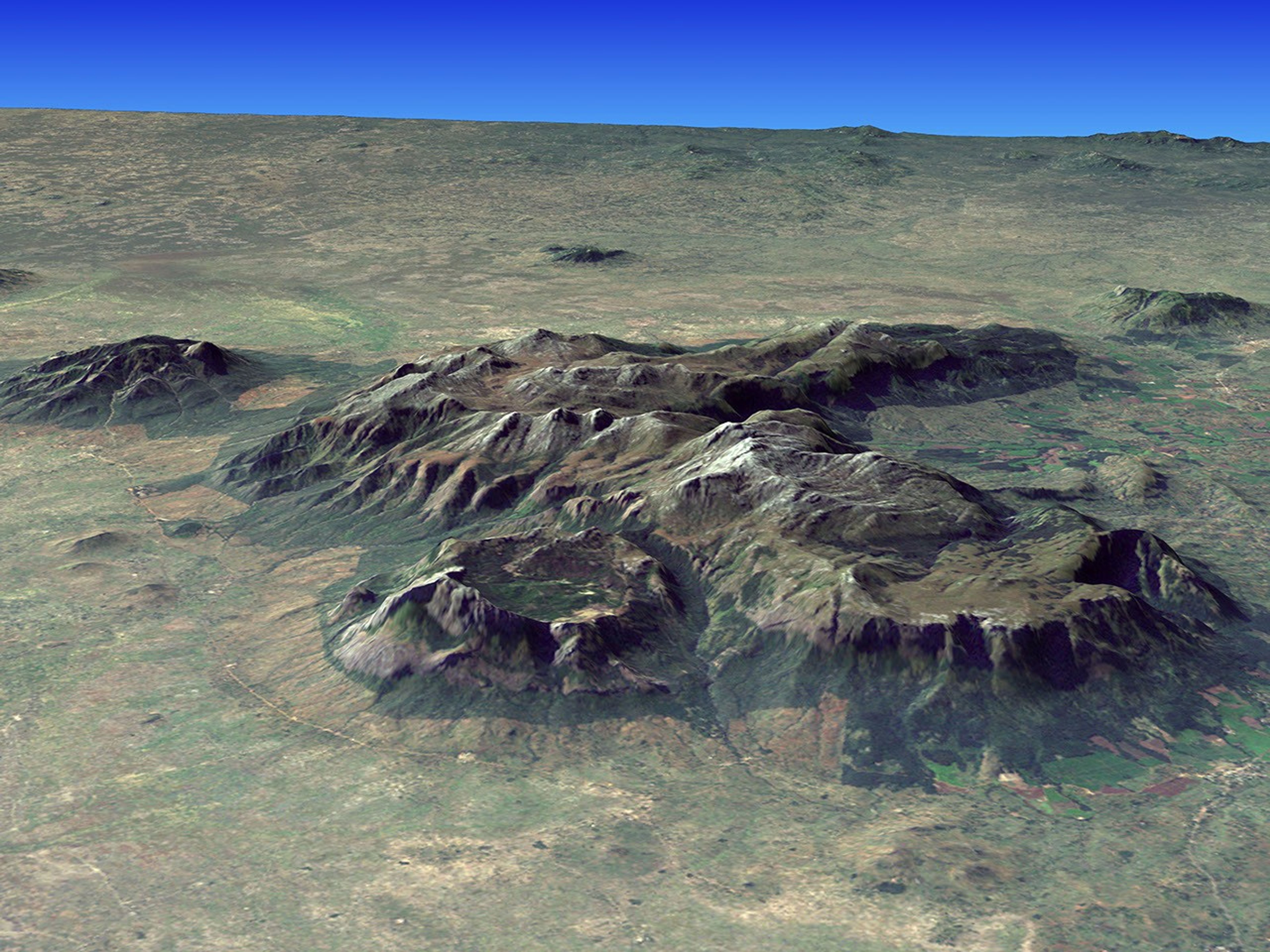
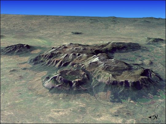
Mount Mulanje is a granite inselberg in southern Malawi, Africa. At 3,000 meters (9,824 feet)high, it is one of the largest inselbergs in the world as well as the tallest peak insouth-central Africa. Inselbergs are isolated stands of hard igneous rock which havebeen left standing isolated on level plains, formed because their rock mass resistederosion while the plains around them did not. The elevation of the mountain ishigh enough for it disturb upper level air flow and induce rain clouds to form around it, making it an important source of rain water at the head of almost every river that runs through this part of Malawi.
The mountain itself is part of a protected area, which can be clearly discerned in these Landsat images. The park boundaries show a distinct, sharp transition from thelowland forests, which have been intensely used and cleared, to the protected mid-leveland peak area forests, and grasslands on the tops of the plateau. The nativeMulanje cedar has been so heavily logged that itis considered endangered and the park contains the last remaining stands of this tree,as well as a number of other plant and animal species—many of them endemic to the area.Examples include forest butterfies, birds such as the cholo alethe and white-winged apalis,dwarf chameleon, geckos, skinks, the squeaker frog, and a rare limbless burrowing skinkspecies. The land around the park is threatened by growing population, land use patterns such as forest clearing for farming and firewood, and invasive species such asMexican pine and Himalayan raspberry.
The image above is a visualization created by merging imagery from the Landsat 7satellite’s Enhanced Thematic Mapper Plus (ETM+) instrument with elevation datafrom the Shuttle Radar Topography Mission (SRTM). This true-color image was created by combining the red, green, and blue wavelengths (ETM+ bands 3, 2, and 1).The resulting image was then draped over a visualization of the SRTM data with novertical exaggeration. The ETM+ scene was acquired on May 26, 2002, while the elevationdata were collected by the STRM instrument during its flight on the Space ShuttleEndeavour in February 2000.
References & Resources
NASA image by Jesse Allen, Earth Observatory, using Landsat data and SRTM data courtesy of the University of Maryland’s Global Land Cover Facility