


Full-size images
June 17, 2001 (2.0 MB JPEG)
June 14, 2000 (2.1 MB JPEG)
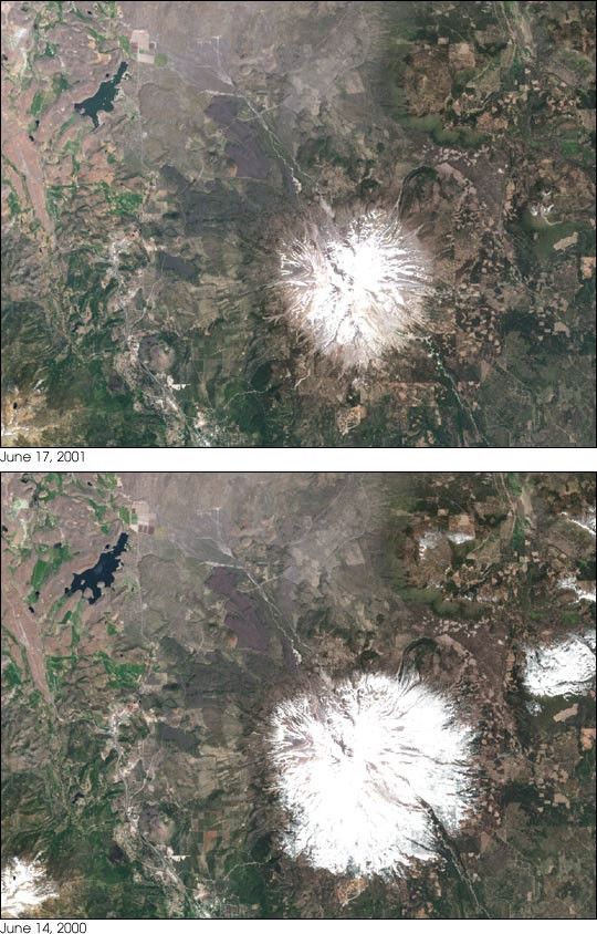
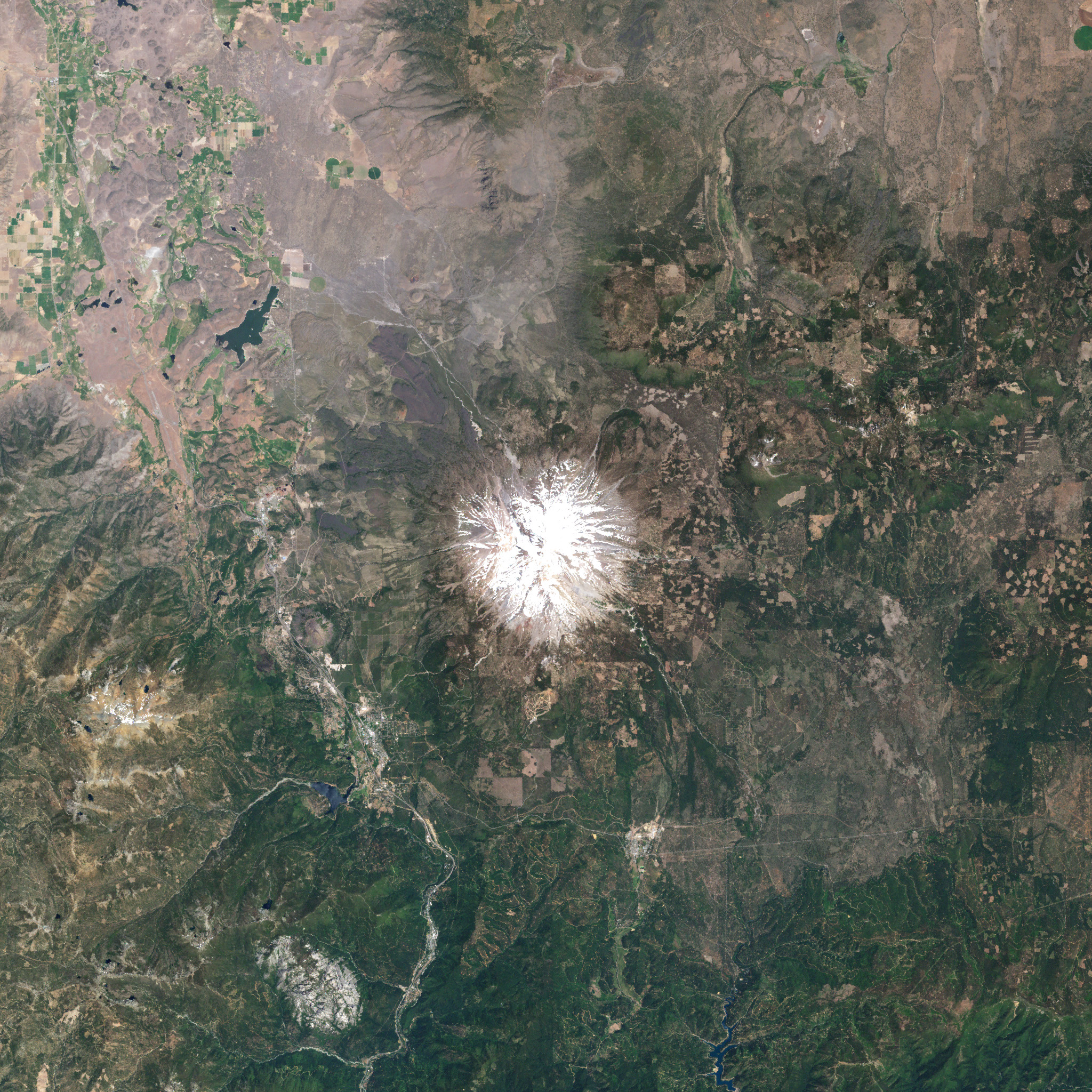
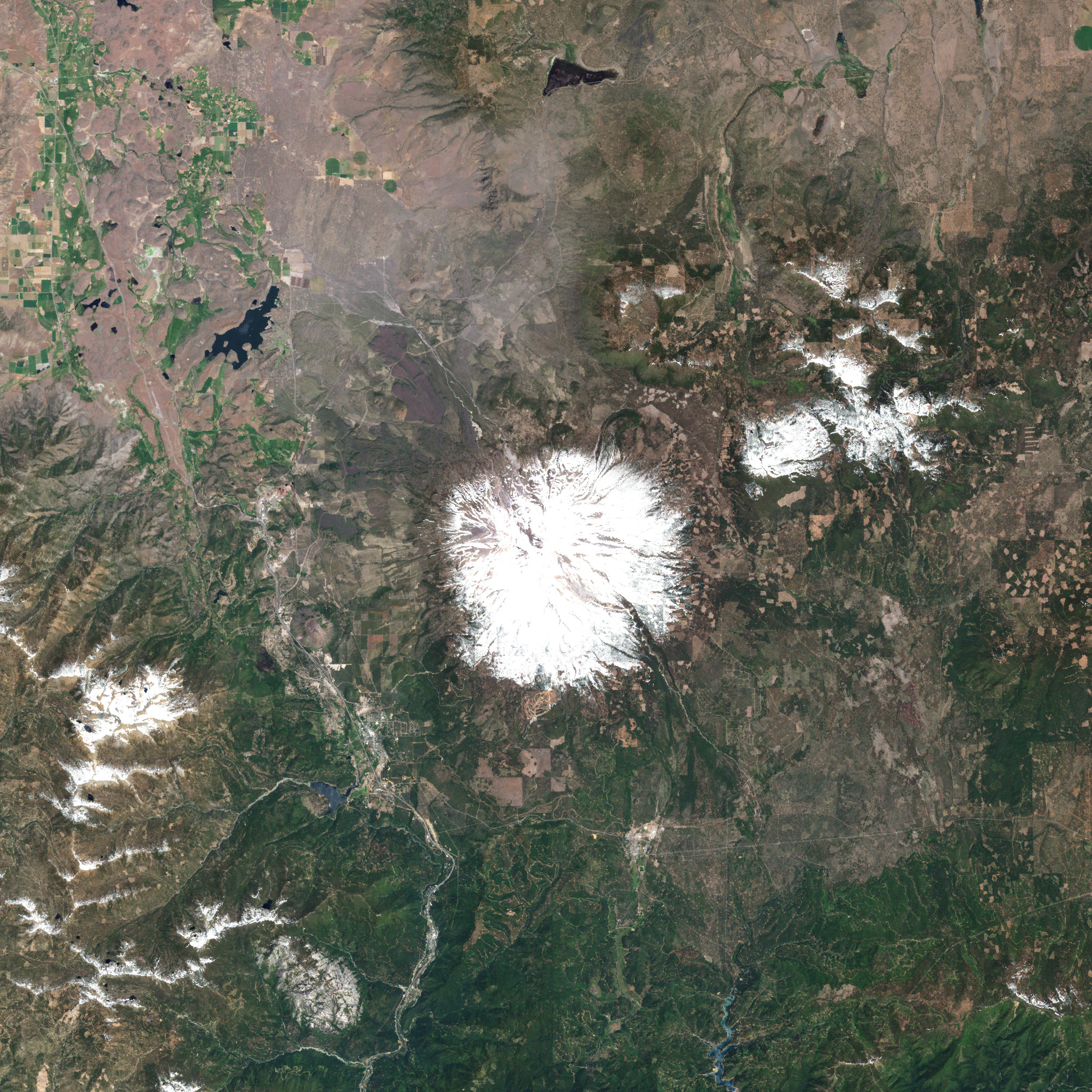
Light snowfall in the winter of 2000–01 led to a dry summer inthe Pacific Northwest. The drought led to a conflict between farmers andfishing communities in the KlamathRiver Basin over water rights, and a series of forest firesin Washington, Oregon, and Northern California.
The pair of images above, both acquired by the Enhanced Thematic Mapper Plus (ETM+) aboardthe Landsat 7 satellite, show the snowpack on Mt. Shasta in June 2000 and 2001. On June 14, 2000, thesnow extends to the lower slopes of the 4,317-meter (14,162-foot) volcano. At nearly the same timethis year (June 17, 2001) the snow had retreated well above the tree-line. The drought in the regionwas categorized as moderate to severe by the National Oceanographic and Atmospheric Administration(NOAA), and the United States Geological Survey (USGS) reported that streamflow during June was onlyabout 25 percent of the average. Above and to the left of Mt. Shasta is Lake Shastina, a reservoir whichis noticeably lower in the 2001 image than the 2000 image.
References & Resources
Images courtesy USGS EROS Data Center and the Landsat 7 Science Team


