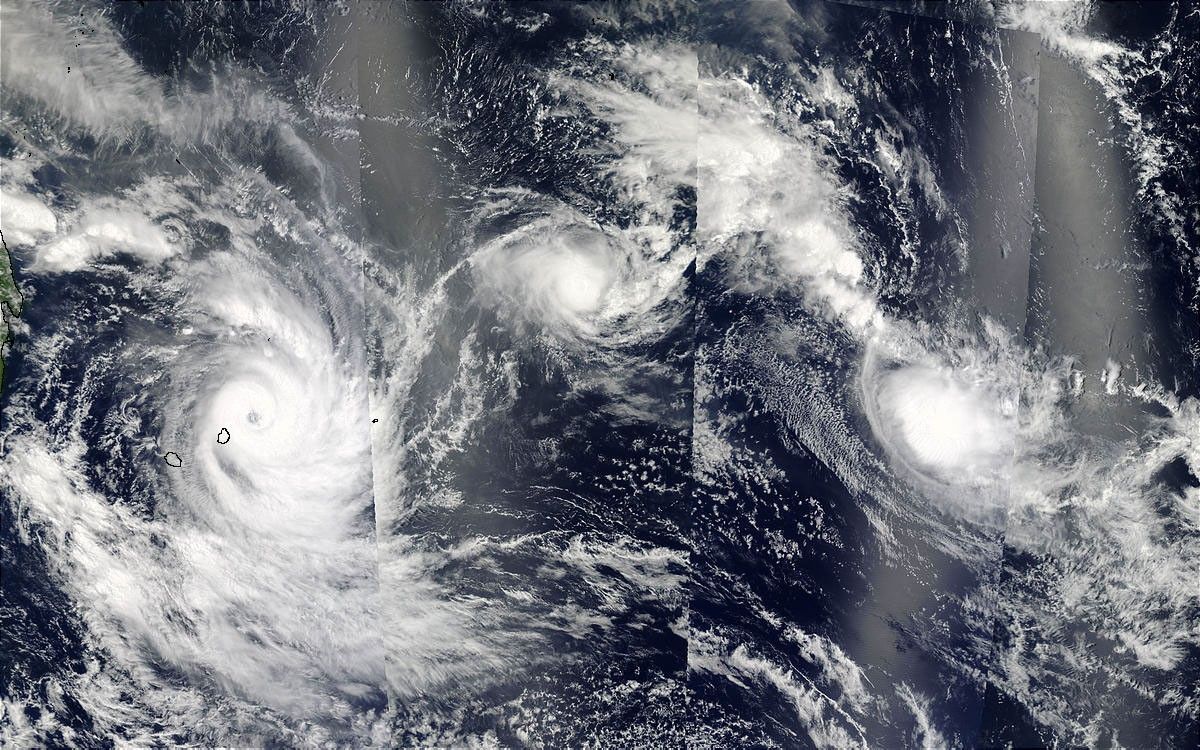
In the southern Indian Ocean, multiple tropical cyclones are still lined up east of Madagascar (far left) on February 13, 2003. This true-color image of three of the storms was made by combining alternating passes of the Terra and Aqua satellites. Over a four-hour-and-35-minute period, the Terra MODIS instrument collected (from right to left) sections two and four of the image (moving from east to west), and then Aqua MODIS collected sections one and three (also from east to west). Storms pictured are (west to east) Isha(formerly Tropical Cyclone 18S), Hape, and Gerry.
The high-resolution image provided above is 1 kilometer per pixel. The MODIS Rapid Response System provides this image at a spatial resolution of 500 meters.
References & Resources
Image courtesy Jeff Schmaltz, MODIS Rapid Response Team, NASA GSFC