![Request for Information – Potential [Placeholder for Prize]](https://assets.science.nasa.gov/dynamicimage/assets/science/missions/a-step/FFR_Earth_Background_20251120%20.png?w=1024)


October 20, 2019
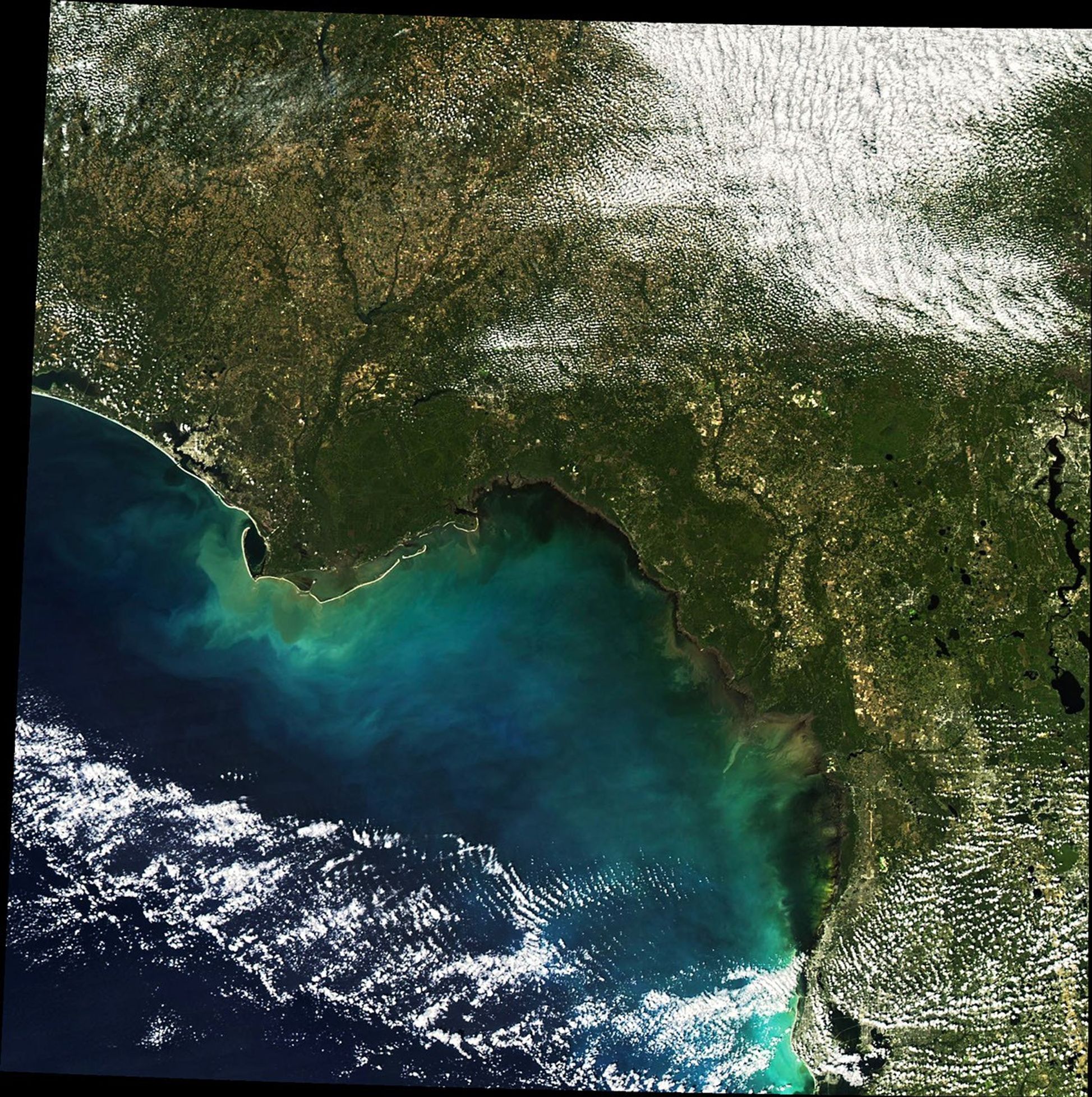
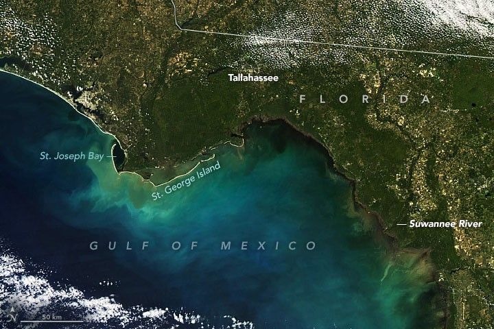
Although Tropical Storm Nestor weakened to a post-tropical cyclone a few hours before making landfall on Florida’s Panhandle, the storm still dropped several inches of rain.
As seen in this natural-color image captured by the Moderate Resolution Imaging Spectroradiometer (MODIS) on NASA’s Aqua satellite, that was enough to stir up sediment in coastal bays and the Gulf of Mexico.
Although Nestor brought the Southeast some welcome rain, it also spun out several tornadoes in Florida and Georgia.
References & Resources
- National Hurricane Center (2019, October 19) Post-Tropical Cyclone NESTOR. Accessed October 21, 2019.
- Tampa Bay Times (2019, October 19) Nestor makes landfall on Florida Panhandle, becomes post-tropical cyclone. Accessed October 21, 2019.
- Weather Underground (2019, October 19) Tornadoes, Heavy Rains Pepper Florida as Nestor Makes Landfall. Accessed October 21, 2019.
NASA Earth Observatory image by Joshua Stevens, using MODIS data from NASA EOSDIS/LANCE and GIBS/Worldview. Caption by Adam Voiland.