


April 23, 2025
New Jersey Pine Barrens Ablaze
Wildland fires have long been integral to New Jersey’s Pinelands, or Pine Barrens. These highly flammable coastal forests host pitch pines and other trees that thrive with occasional burns.
Yet with hundreds of thousands of people living within these coastal forests, burns can shift rapidly from rejuvenating ecosystems to destroying infrastructure and threatening human life, particularly during droughts. A fire that began in a wildlife management area near Waretown on April 22, 2025, offered a stark reminder of this delicate balance. Within two days, the fire had grown into one of the largest fires New Jersey has seen in decades.
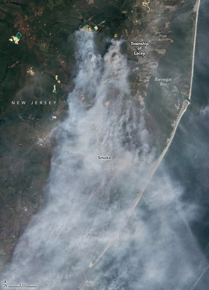
The OLI-2 (Operational Land Imager-2) on Landsat 9 captured images of the Jones Road fire on April 23. In the natural-color scene (left), thick smoke obscures the fire’s mark on the land below. The burned area is evident in the false-color image (right) showing shortwave infrared, near infrared, and visible light (OLI bands 6-5-3). This band combination makes it easier to identify unburned vegetated areas (green) and the recently burned landscape (brown). A sand mine is visible in the upper left of the images. A broader view of the natural-color image is below.
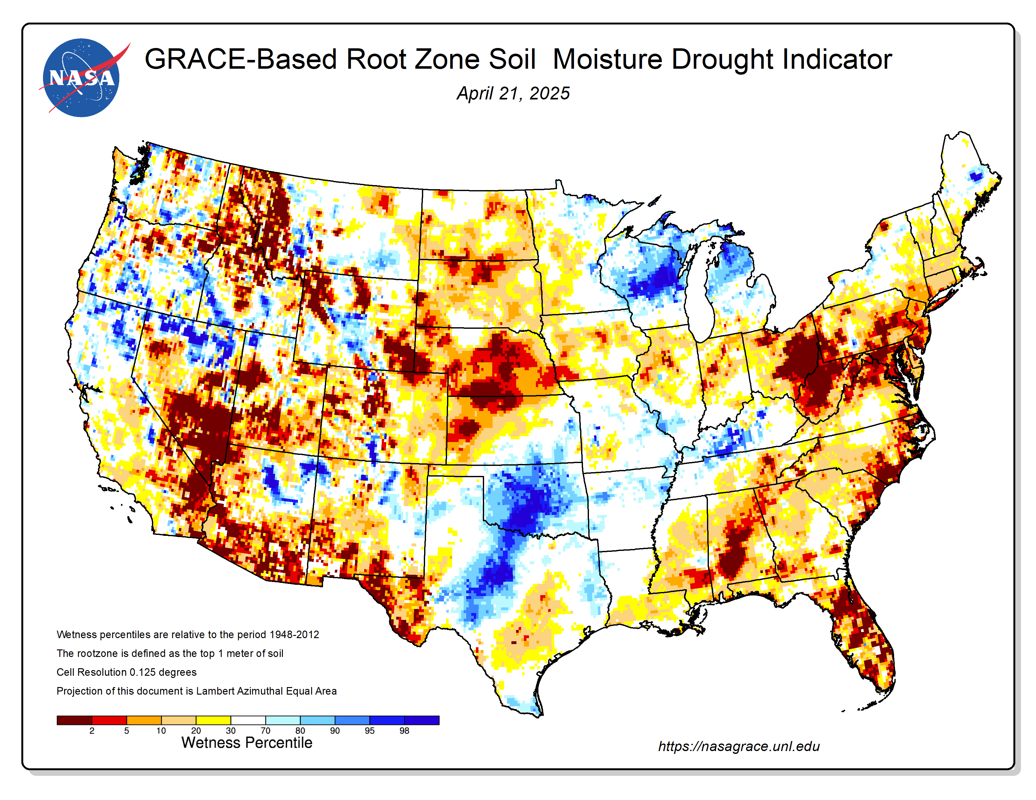
An ongoing drought made the Pine Barrens particularly susceptible to fire in spring 2025. An April analysis of shallow groundwater and soil moisture using NASA observations from the GRACE (Gravity Recovery and Climate Experiment) and GRACE-FO (GRACE Follow On) satellites showed anomalously dry conditions, according to data posted by the National Drought Mitigation Center. At the time of the fire, the U.S. Drought Monitor had classified drought in the region as “severe.”
According to news reports, the fast-moving fire led to evacuations of large numbers of people from Lacey and Ocean townships, threatened many homes, and sent smoke wafting toward New York City. At times, officials closed both the Garden State Parkway and Route 532. As of April 24, more than 15,000 acres had burned, and the fire was 50 percent contained, according to the New Jersey Forest Fire Service. As of that date, all evacuation orders had been lifted and the Garden State Parkway had been reopened, the fire service noted.
NASA’s satellite data is part of a global system of observations that are used to track fire behavior and analyze emerging trends. Among the real-time wildfire monitoring tools that NASA makes available are FIRMS (Fire Information for Resource Management System) and the Worldview browser.
References & Resources
- Appalachian Mountain Club Fire in the forest: The science and history of prescribed burns in the New Jersey Pine Barrens. Accessed April 24, 2025.
- EBSCO (2022) New Jersey Pine Barrens. Accessed April 24, 2025.
- Forestry Notes (2011, May) Pitch pine—A tree born of fire. Accessed April 24, 2025.
- NASA Applied Sciences Tracking Damage and Air Quality Impacts from Fires. Accessed April 24, 2025.
- NASA Earthdata Wildfires. Accessed April 24, 2025.
- New Jersey Forest Fire Service (2025, April 24) Current fire conditions and restrictions. Accessed April 24, 2025.
- New Jersey Forest Fire Service The wildfire environment. Accessed April 24, 2025.
- New Jersey Forest Fire Service, via Facebook (2025, April 24) WILDFIRE UPDATE: Jones Road Wildfire - Ocean & Lacey Townships, Ocean County. Accessed April 24, 2025.
- The New York Times (2025, April 24) Smoke from New Jersey wildfire moves toward New York City. Accessed April 24, 2025.
- NJ.com (2025, April 23) Garden State Parkway, Route 9 back open as massive N.J. wildfire continues to burn. Accessed April 24, 2025.
- NJ.com (2025, April 24) Fast-moving wildfire ranks among N.J.’s 20 biggest in past century. Accessed April 24, 2025.
- Today (2025, April 24) How NASA is helping first responders combat wildfires. Accessed April 24, 2025.
NASA Earth Observatory images by Wanmei Liang , using Landsat data from the U.S. Geological Survey . Story by Adam Voiland .


