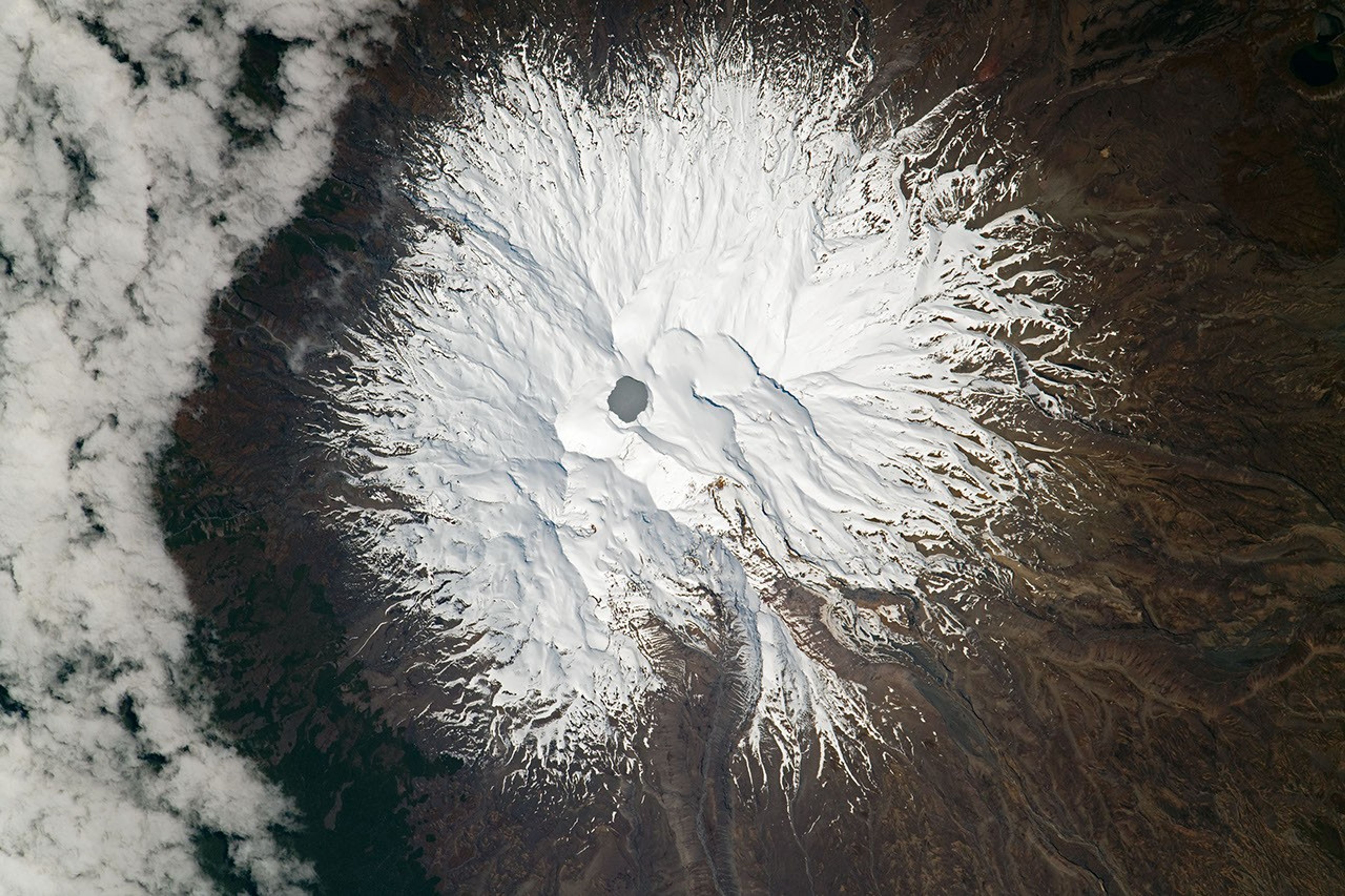


While passing over the North Island of New Zealand, an astronaut onboard the International Space Station (ISS) took a photograph of Mount Ruapehu, offering a nadir (straight down) view of the mountain and Tongariro National Park. Ruapehu is an active stratovolcano that stands 2,797 meters (9,177 feet) at its highest point. It is the tallest mountain on North Island.
Near the summit lies Crater Lake (Te Wai ā-moe), which is heated by a hydrothermal system within the volcano. The lake remains warm year round (15 to 45 degrees Celsius) and is highly acidic (pH <1). Lake temperatures usually fluctuate within this temperature range, so prolonged spikes in temperatures can signal impending volcanic activity. Because Crater Lake is the only geologically active part of the stratovolcano that is visible at the surface, changes in lake water temperatures and gas emissions are key to detecting impending volcanic activity.
Following a period of dormancy dating back to 2011, volcanic unrest was reported at Ruapehu in 2022. Moderate tremors started in March and led volcanologists to issue an alert about heightened volcanic activity. They took periodic lake temperature measurements and sulfur dioxide emission samples to monitor changes. Water temperature peaked around 40 degrees Celsius in May 2022, but cooled to 24 degrees Celsius in the following months. By July, temperatures and emissions dropped enough to lower the volcanic alert level.
During the period of unrest, a magmatic intrusion was detected beneath the volcano. The intrusion suggested that magma was rising slowly under the volcano but had halted. As a result of the magma rising, scientists suggested that the likelihood of an eruption may have increased within the Crater Lake basin.
References & Resources
Astronaut photograph ISS065-E-415587 was acquired on September 23, 2021, with a Nikon D5 digital camera using a focal length of 1150 millimeters. It is provided by the ISS Crew Earth Observations Facility and the Earth Science and Remote Sensing Unit, Johnson Space Center. The image was taken by a member of the Expedition 65 crew. The image has been cropped and enhanced to improve contrast, and lens artifacts have been removed. The International Space Station Program supports the laboratory as part of the ISS National Lab to help astronauts take pictures of Earth that will be of the greatest value to scientists and the public, and to make those images freely available on the Internet. Additional images taken by astronauts and cosmonauts can be viewed at the NASA/JSC Gateway to Astronaut Photography of Earth. Caption by Cadan Cummings, Jacobs, JETS Contract at NASA-JSC.