Suggested Searches

1 min read

Niger River in Mali


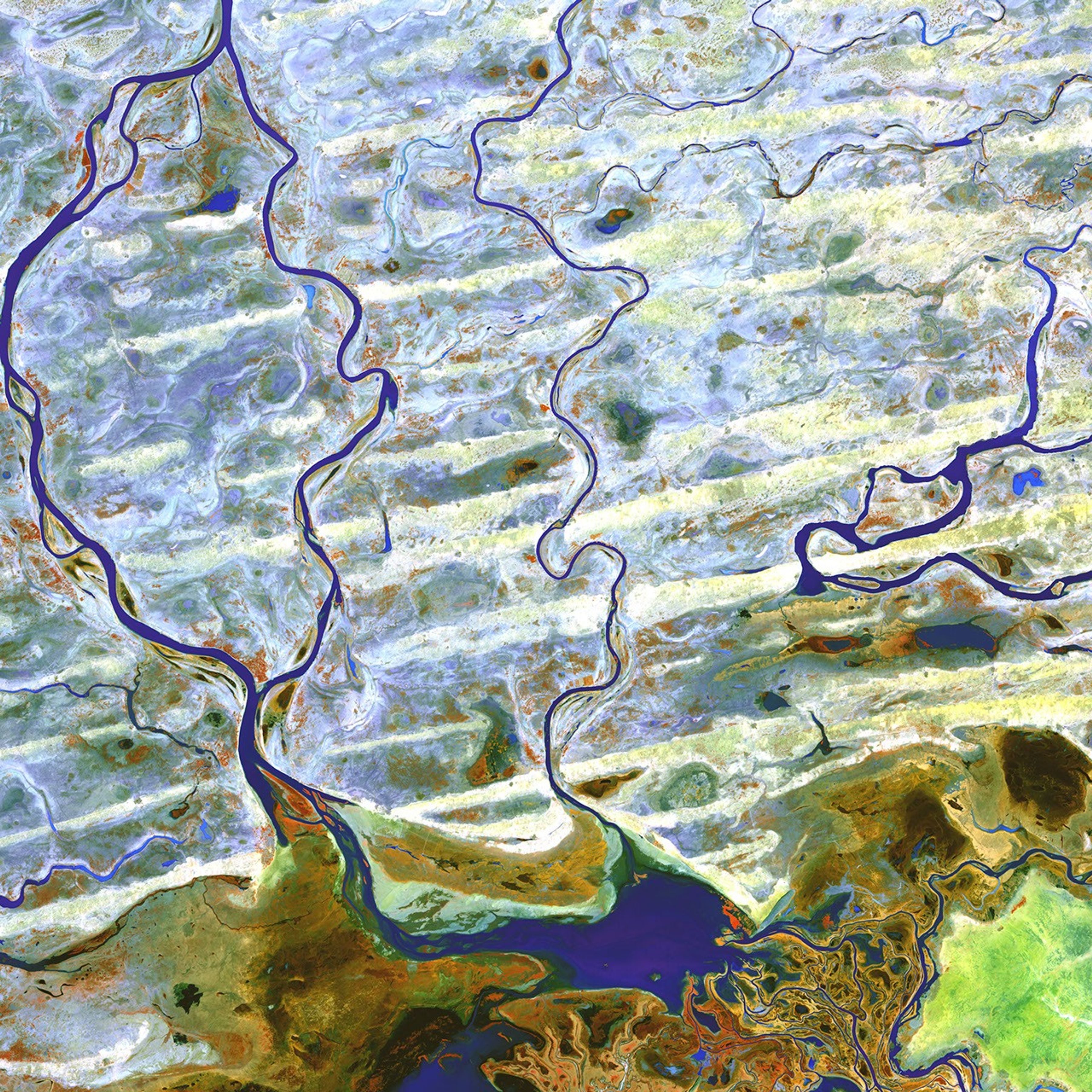
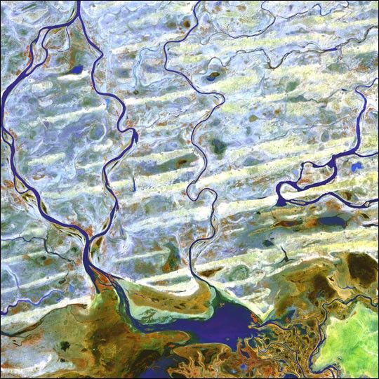
Coursing through parched, landlocked Mali in Western Africa, the Niger Riverskirts the edge of the dune-striped Sahara before turning sharply south to jointhe Bani River. At the confluence of the two rivers is an inland delta completewith narrow, twisting waterways, lagoons, and tiny islands.

This scene was acquired by the ASTER instrument on NASA’s Terra satellite onAugust 2, 2003.

References & Resources

Image provided by the USGS EROS Data Center Satellite Systems Branch as part of the Earth as Art II image series

You may also be interested in:

Stay up-to-date with the latest content from NASA as we explore the universe and discover more about our home planet.

Winter Transforms the Mississippi River Delta
3 min read

A Gulf Coast storm followed by snowmelt in January 2025 temporarily increased the Mississippi River’s outflow, sending a surge of…

Article
Islands of Fire and Ice Veiled in Cloud
3 min read

Puffs of low-level clouds mingle with the volcanic terrain of Candlemas and Vindication islands in the remote South Atlantic.

Article
Reaching the Precipice in Angola 
3 min read

The Huíla plateau, bounded by dramatic cliffs and chasms, stands above the arid coastal plains in the country’s southwest.

Article