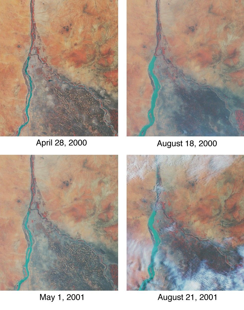
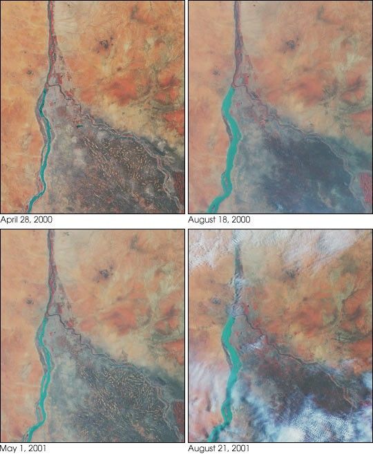
Throughout history, the rising and falling waters of the mighty NileRiver have directly impacted the lives of the people who live along itsbanks. These images of the area around Sudan’s capital city of Khartoumcapture the river’s dynamic nature. Acquired by the Multi-angle ImagingSpectroRadiometer’s nadir (vertical-viewing) camera, they display theextent of the Nile waters before and after the onset of the rainyseasons of 2000 (top pair) and 2001 (bottom pair). The images aredisplayed in “false color”, using the camera’s near-infrared, green, andblue bands. With this particular spectral combination, water appears inshades of blue and turquoise, and highly vegetated areas show up asbright red.
Originating in Uganda and Ethiopia, respectively, the waters of theWhite Nile (western branch) and Blue Nile (eastern branch) converge atKhartoum (about half-way between image center and the left-hand side),and continue to flow northward as the Great Nile. Although the mostobvious feature in these images is the increased width of the White Nilebetween spring and summer, careful inspection shows that the Great Nileis at its widest in August 2001 (note in particular the area between theclouds near the top of this panel). Heavy rains in the Blue Nilecatchment area of the Ethiopian highlands led to a rapid overflow of theriver’s floodwaters into the main stream of the Great Nile, leading toextensive flooding, the worst effects of which occurred north ofKhartoum. According to the Food and Agriculture Organization of theUnited Nations, tens of thousands of people have fled their homes, andthe number of people in need of urgent food assistance in Sudan,estimated at three million earlier in the year, was likely to increasewith the onset of these floods.
South of the confluence of the White Nile and the Blue Nile, the areaof a cross-hatched appearance is the irrigated plain of El Gezira. TheGezira irrigation scheme uses water from the Makwar Dam (now called theSennar Dam), located across the Blue Nile south of Khartoum. Among themain agricultural products of this region are cotton, millet, peanutsand fodder crops.
Overall prospects for Sudan’s 2001 grain crop were already poor priorto the flooding due to a late start of the rainy season in parts of thecountry. Following two consecutive years of serious drought,precipitation arrived too late to save the grain harvest that normallybegins in late August. Lower harvests for the past two years coupledwith depletion of stocks have led to a rise in cereal prices, reducingaccess to food for the Sudan’s poorer citizens, already suffering fromthe effects of Africa’s longest running civil war.
Each of these images represents an area of about 130 kilometers x 150kilometers.
References & Resources
Image courtesy NASA/GSFC/LaRC/JPL, MISR Team.