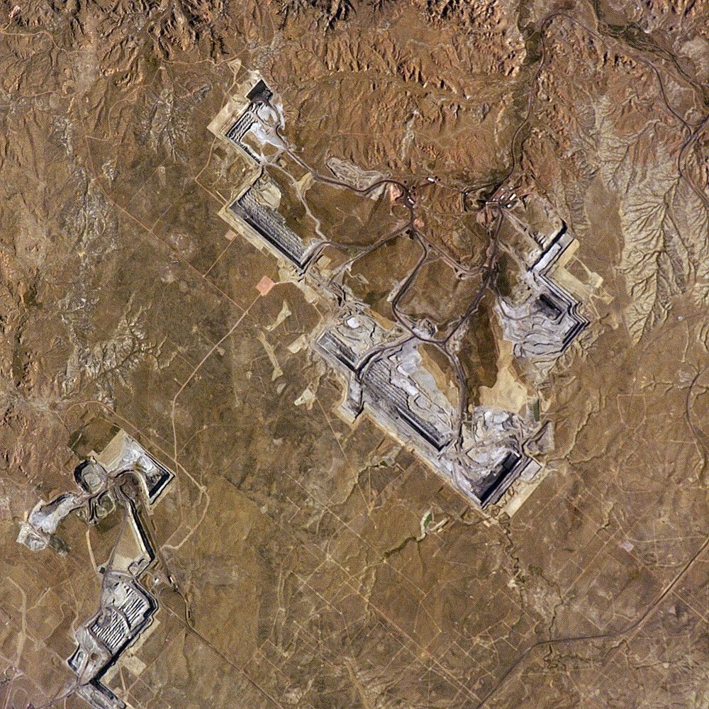
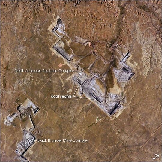
The United States’ highest rate of coal production is in Wyoming, with almost 400 million short tons extracted in 2004. The majority of this coal is burned to generate electrical power within the United States, but a small percentage is also goes to Spain and Canada. The Powder River Basin in the northeastern portion of the state is the most productive of Wyoming’s coal fields. The extensive coal deposits - ranging in thickness from 21 to 53 meters (70 to 175 feet) - formed over 38-66 million years ago. The source of organic material for the coal originated in swamps, estuaries, and deltas associated with the regression (retreat) of a large inland seaway that occupied central North America during the Cretaceous Period, which spanned the years between about 144 to 65 million years ago.
Open-pit strip mining is the technique that coal operators prefer for removing the sparsely vegetated surface (overburden in mining terminology) of northeastern Wyoming that covers the coal seams. One of the largest of these mines, Peabody Energy’s North Antelope Rochelle Complex, is located at the center of this astronaut photograph. A portion of Arch Coal’s Black Thunder Mine Complex is visible to north. Active coal seam faces are visible as black lines, and the stepped benches along the sides of the pit allow access for trucks carrying coal and overburden from the mine. Large draglines and shovels remove the overburden and expose the coal seam; blasting reduces the coal to loadable fragments. The coal is then transported from Wyoming by up to 2000 rail cars per day. Following removal of the coal, mining companies are required by federal law to reclaim and revegetate the former mine workings.
References & Resources
Astronaut photograph ISS011-E-12863 was acquired September 11, 2005, with a Kodak 760C digital camera fitted with a 400 mm lens, and is provided by the ISS Crew Earth Observations experiment and the Image Science & Analysis Group, Johnson Space Center. The International Space Station Program supports the laboratory to help astronauts take pictures of Earth that will be of the greatest value to scientists and the public, and to make those images freely available on the Internet. Additional images taken by astronauts and cosmonauts can be viewed at the NASA/JSC Gateway to Astronaut Photography of Earth.