An estimated 42,000 gallons of oil per day were leaking from an oil well in the Gulf of Mexico in late April, following an explosion at an offshore drilling rig on April 20, 2010. The rig eventually capsized and sank.
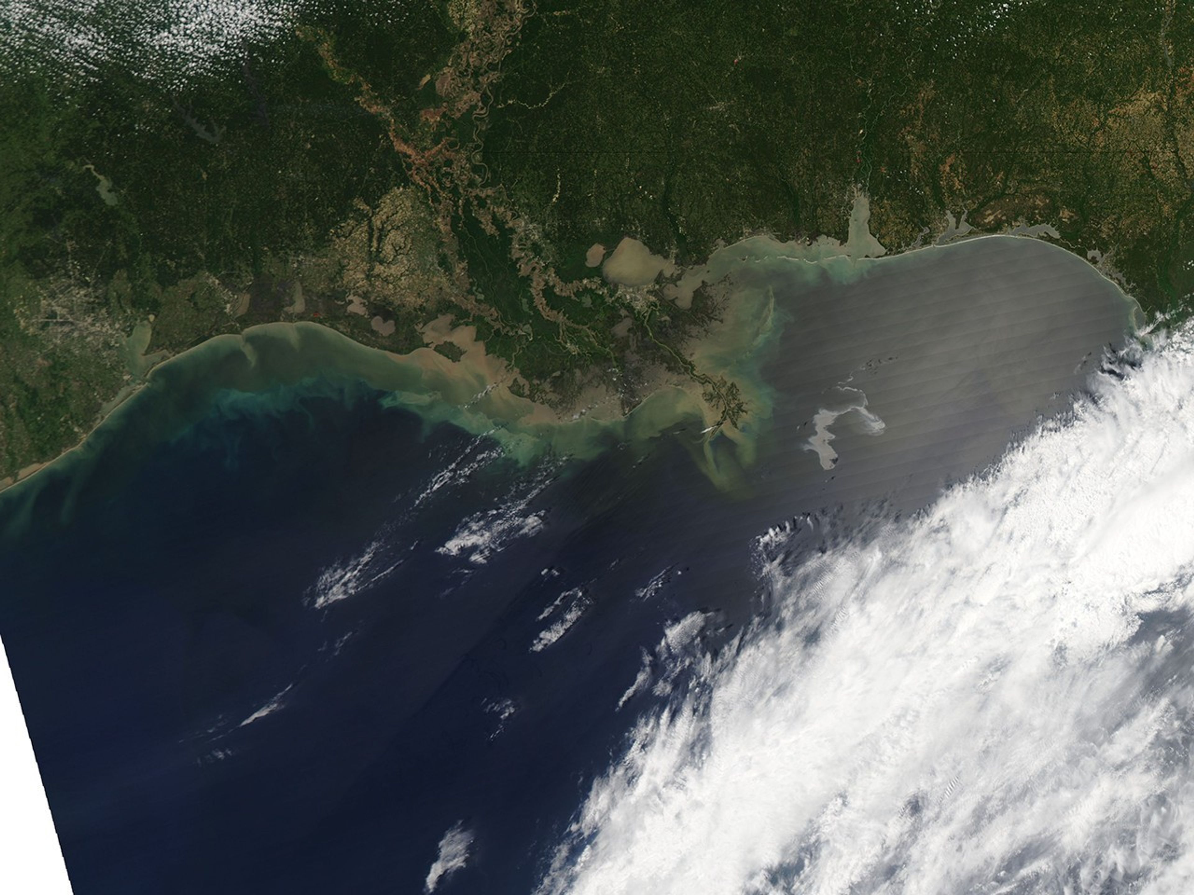
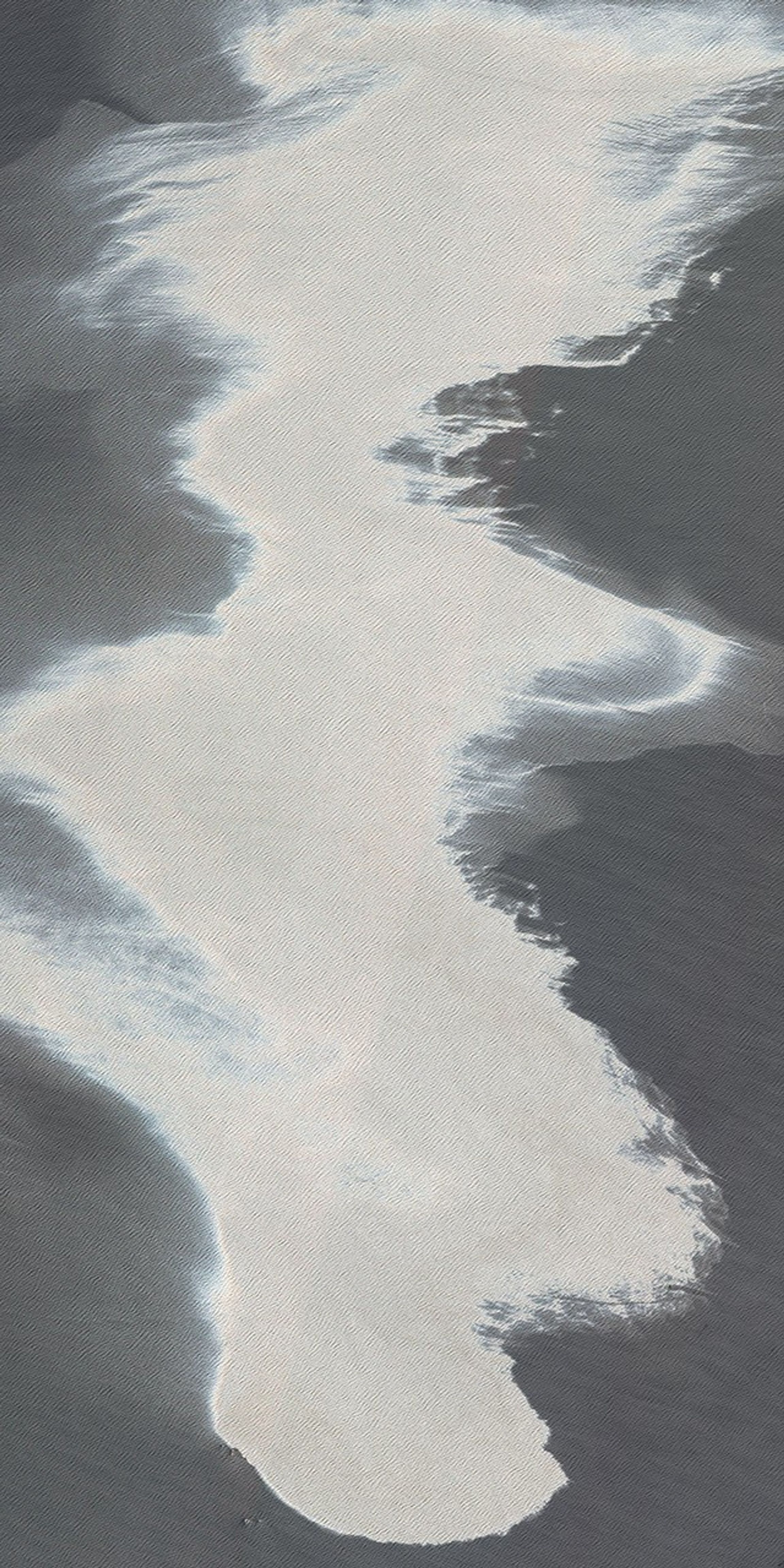
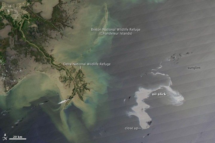
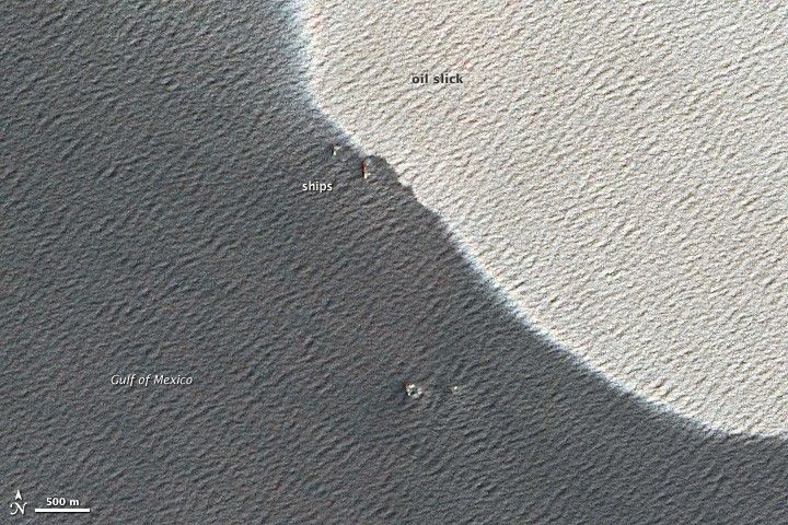
These images of the affected area were captured on April 25 by the Moderate Resolution Imaging Spectroradiometer (MODIS) on NASA’s Aqua satellite (top, wider view) and the Advanced Land Imager on NASA’s Earth Observing-1 (EO-1) satellite (bottom, close up).
In the top image, the Mississippi Delta is at image center, and the oil slick is a silvery swirl to the right. The oil slick may be particularly obvious because it is occurring in the sunglint area, where the mirror-like reflection of the Sun off the water gives the Gulf of Mexico a washed-out look. The close-up view shows waves on the water surface as well as ships, presumably involved in the clean up and control activities.
The initial explosion killed eleven people and injured several others, and a fire burned at the location for more than a day until the damaged oil rig sank. An emergency response effort is underway to stop the flow of oil and contain the existing slick before it reaches wildlife refuges and beaches in Louisiana and Mississippi.
The slick may contain dispersant or other chemicals that emergency responders are using to control the spread of the oil, and it is unknown how much of the 700,000 gallons of fuel that were on the oil rig burned in the fire and how much may have spilled into the water when the platform sank.
On April 25, 2010, the National Oceanic and Atmospheric Administration’s Emergency Response Division issued the following update on the Deepwater Horizon oil spill incident in the Gulf of Mexico: “An attempt to control the leaking well using a Remotely Operated Vehicle (ROV) was not successful, and the well continues to leak.”
Twice-daily images of the Gulf Coast are available from the MODIS Rapid Response Team in additional resolutions and formats, including a georeferenced file that can be used with Google Earth.
References & Resources
- National Oceanic and Atmospheric Administration. (2010, April 25). Deepwater Horizon Incident: NOAA Situation Update 25 Apr 10. Emergency Response Division, Office of Response and Restoration Website. Retrieved April 26, 2010.
NASA image courtesy the MODIS Rapid Response Team. Caption by Rebecca Lindsey.