


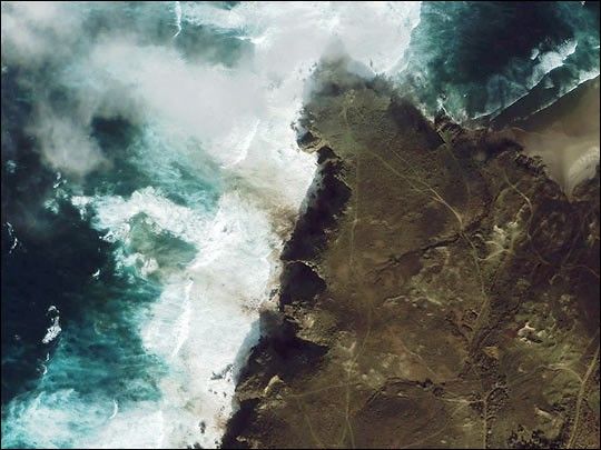
This close-up image of the northwest coast of Spain was captured onNovember 21, 2002, by the IKONOS satellite from 423 miles in space. Thearea was very cloudy and this was one of only two areas where there werebreaks in the clouds. The coastline was in shadow at the time of theoverpass, but several dark-colored fingers of oil are visible reachingthrough white waves towards the cliffs along the shoreline.
The area pictured here is just north of Cape Finisterre, which is thewesternmost part of Spain. The oil tanker sank some 130 miles due westof Cape Finisterre, and ecologists are predicting an environmentalcatastrophe as the oil covers the ocean surface and washes ashore.
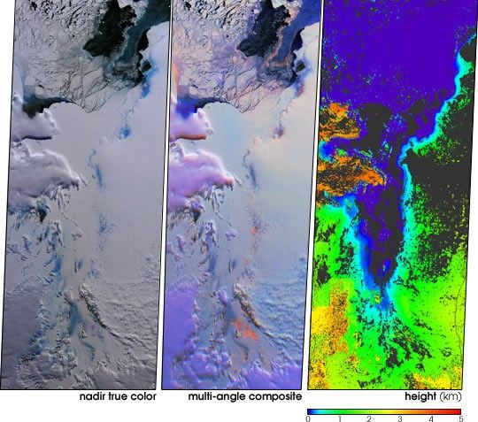
An earlierradar image revealed oil on the ocean’s surface.
References & Resources
© All Rights Reserved: Use of IKONOS, GeoEye, QuickBird and WorldView imagery must be coordinated with Maxar.
Image copyright DigitalGlobe © All Rights Reserved: Use of IKONOS, GeoEye, QuickBird, WorldView, and Digital Globe imagery must be coordinated with Maxar .


