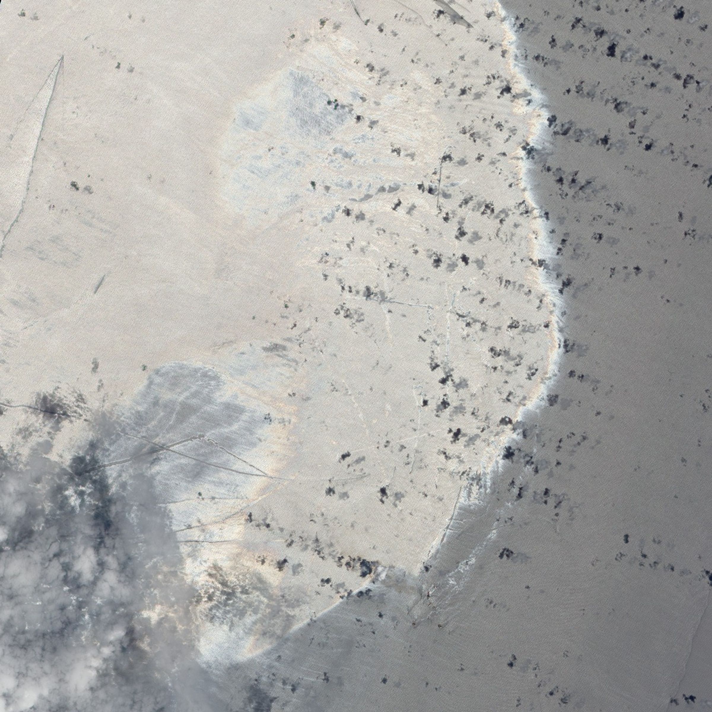
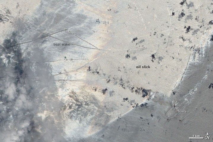
Boats left discernible wakes on the oil slick south and east of the Mississippi Delta in late May 2010. The Advanced Land Imager (ALI) on NASA’s Earth Observing-1 (EO-1) satellite captured this natural-color image on May 21, one month and one day after the deadly explosion at the Deepwater Horizon rig.
Sunglint—the mirror-like reflection of sunlight off water—helps differentiate the oil slick from nearby oil-free surface waters. Boat wakes appear as slightly curved lines, accentuated by the pastel tones of the oil slick. One boat wake, running roughly west-to-east through the upper middle part of this image, can be traced to the ship that has made it, which is heading toward the east-northeast. Southeast of the brightest part of the slick, a cluster of boats appears. These boats are in approximately the same area where the Deepwater Horizon rig had been located before the April 20 accident.
References & Resources
- Gulf of Mexico Oil Spill Response, the official site of the Deepwater Horizon unified command.
- Current information about the extent of the oil slick is available from the Office of Response and Restoration at the National Oceanic and Atmosphere Administration.
- Information about the impact of the oil slick on wildlife is provided by the U.S. Fish and Wildlife Service.
NASA Earth Observatory image created by Jesse Allen and Robert Simmon, using EO-1 ALI data provided courtesy of the NASA EO-1 team. Caption by Michon Scott.