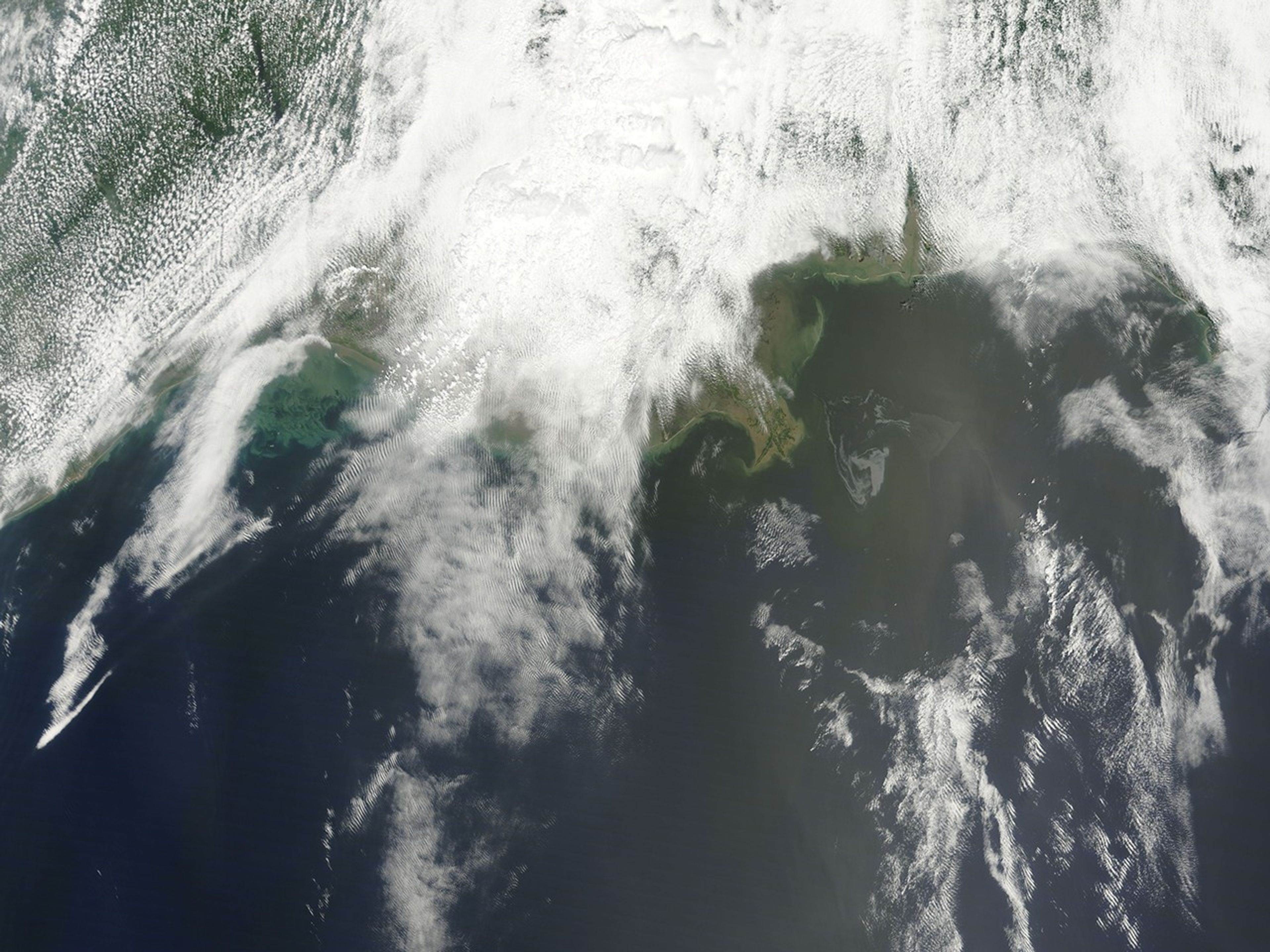
An oil slick that resulted from an accident at the Deepwater Horizon rig in the Gulf of Mexico lingered near the Mississippi River Delta on May 1, 2010. The Moderate Resolution Imaging Spectroradiometer (MODIS) on NASA’s Terra satellite captured this natural-color image the same day. The oil slick appears as a tangle of dull gray on the ocean surface, made visible to the satellite sensor by sunglint—the mirror-like reflection of the Sun off the water. Most of the oil slick occurs southeast of the Mississippi Delta.
An April 20 explosion at the rig led to a leak of crude oil at the sea floor, roughly 5,000 feet (1,500 meters) below the ocean surface, where intense pressure impedes most mitigation efforts. The New York Times reported that bad weather further hampered cleanup efforts as Gulf Coast communities braced for arrival of the oil along the shore.
References & Resources
- Kaufman, L., Robertson, (2010, May 1). In Gulf oil spill, fragile marshes face new threat. The New York Times. Accessed May 1, 2010.
NASA image courtesy MODIS Rapid Response Team at NASA GSFC. The MODIS Rapid Response team provides daily images of this area. Caption by Michon Scott.