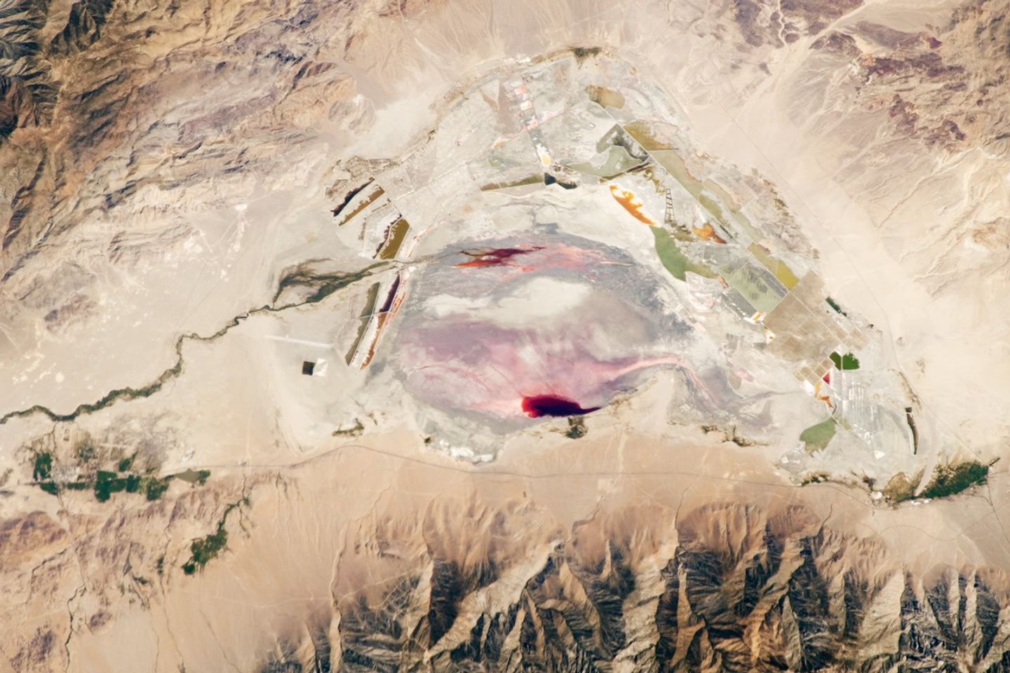
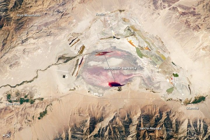
This astronaut photograph highlights the mostly dry bed of Owens Lake, located in the Owens River Valley between the Inyo Mountains and the Sierra Nevada. Shallow groundwater, springs, and seeps support minor wetlands and a central brine pool. Two bright red areas along the margins of the brine pool indicate the presence of halophilic (salt-loving) organisms known as archaeans. Gray and white materials within the lake bed are exposed sediments and salt crusts. The nearby towns of Olancha and Lone Pine are marked by the presence of green vegetation, indicating a more constant availability of water.
The present-day Owens Lake was once part of a much larger lake and river system along the northeastern border of California and Nevada during the Pleistocene Epoch (about 3 million to 12,000 years ago). Melt water from alpine glaciers in the Sierra Nevada filled the regional valleys of the Basin and Range to form glacial lakes—ancestors of the now-dry lakebeds (or playas) of Owens, Searles Lake, and China Lake.
While Searles and China Lakes dried out because of regional changes to a hotter and drier climate, Owens Lake became desiccated largely due to the diversion of the Owens River in the early 20th century to serve the needs of Los Angeles, 266 kilometers (165 miles) to the south. Following complete desiccation of the lakebed in 1926, significant amounts of windblown dust were produced. Residents of the now largely abandoned town of Keeler (on the eastern side of the lake) coined the term “Keeler fog†to describe the airborne dust.
In addition to adverse health effects on local residents, dust from Owens Lake has been linked to reductions of visibility in nearby national parks, forests, and wilderness areas. Recently, the City of Los Angeles has undertaken efforts to control dust evolution from the lakebed.
References & Resources
Astronaut photograph ISS028-E-35137 was acquired on August 30, 2011, with a Nikon D2Xs digital camera using a 200 mm lens, and is provided by the ISS Crew Earth Observations experiment and Image Science & Analysis Laboratory, Johnson Space Center. The image was taken by the Expedition 28 crew. The image has been cropped and enhanced to improve contrast. Lens artifacts have been removed. The International Space Station Program supports the laboratory as part of the ISS National Lab to help astronauts take pictures of Earth that will be of the greatest value to scientists and the public, and to make those images freely available on the Internet. Additional images taken by astronauts and cosmonauts can be viewed at the NASA/JSC Gateway to Astronaut Photography of Earth. Caption by William L. Stefanov, Jacobs/ESCG at NASA-JSC.