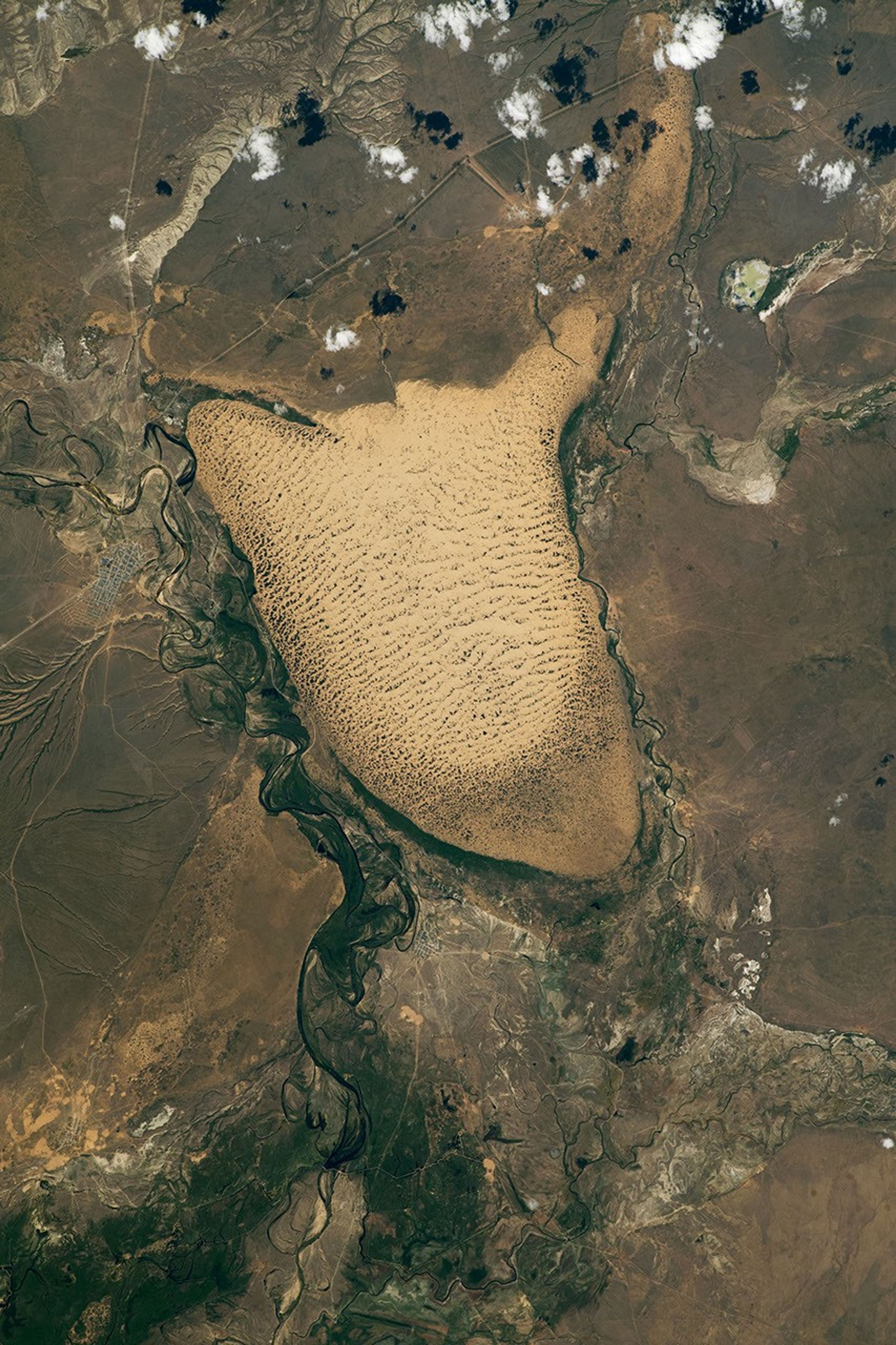


An astronaut looking down from the International Space Station (ISS) photographed this dune field near the village of Oyyl, Kazakhstan. The dunes are situated on the Kazakh Steppe and within a broad floodplain where three rivers converge. The dunes span approximately 190 square kilometers (75 square miles) in area and are located 280 kilometers (175 miles) northeast of the Caspian Sea.
Dune fields grow in regions where there is a significant supply of sand and sufficient wind speeds to transport the grains. Fluvial floodplains are one common source of sand, so dune fields often form immediately downwind of them. Floodplains and dune fields often occupy regions known as “sinks”—topographic low areas where sediment is deposited. The sink shown here sits approximately 90 meters (300 feet) below the elevation of the surrounding steppe.
Although sand dunes dominate the landscape, vegetation adds a variety of small, darker-colored patches to the interdune areas. Clusters of vegetation are more abundant on the lower-elevation south side of the dune field, where the surface is likely closer to the water table. The presence of vegetation may indicate that some dunes are in the process of becoming anchored in place.
Beyond the landscape features, the photo also shows human-made signatures. Most evident is a road between the villages of Oyyl and Kumzhargan. An agricultural field is also visible on the northern outskirts of Kumzhargan.
References & Resources
Astronaut photograph ISS067-E-133142 was acquired on June 15, 2022, with a Nikon D5 digital camera using a focal length of 400 millimeters. It is provided by the ISS Crew Earth Observations Facility and the Earth Science and Remote Sensing Unit, Johnson Space Center. The image was taken by a member of the Expedition 67 crew. The image has been cropped and enhanced to improve contrast, and lens artifacts have been removed. The International Space Station Program supports the laboratory as part of the ISS National Lab to help astronauts take pictures of Earth that will be of the greatest value to scientists and the public, and to make those images freely available on the Internet. Additional images taken by astronauts and cosmonauts can be viewed at the NASA/JSC Gateway to Astronaut Photography of Earth. Caption by Cadan Cummings, Jacobs, JETS Contract at NASA-JSC.