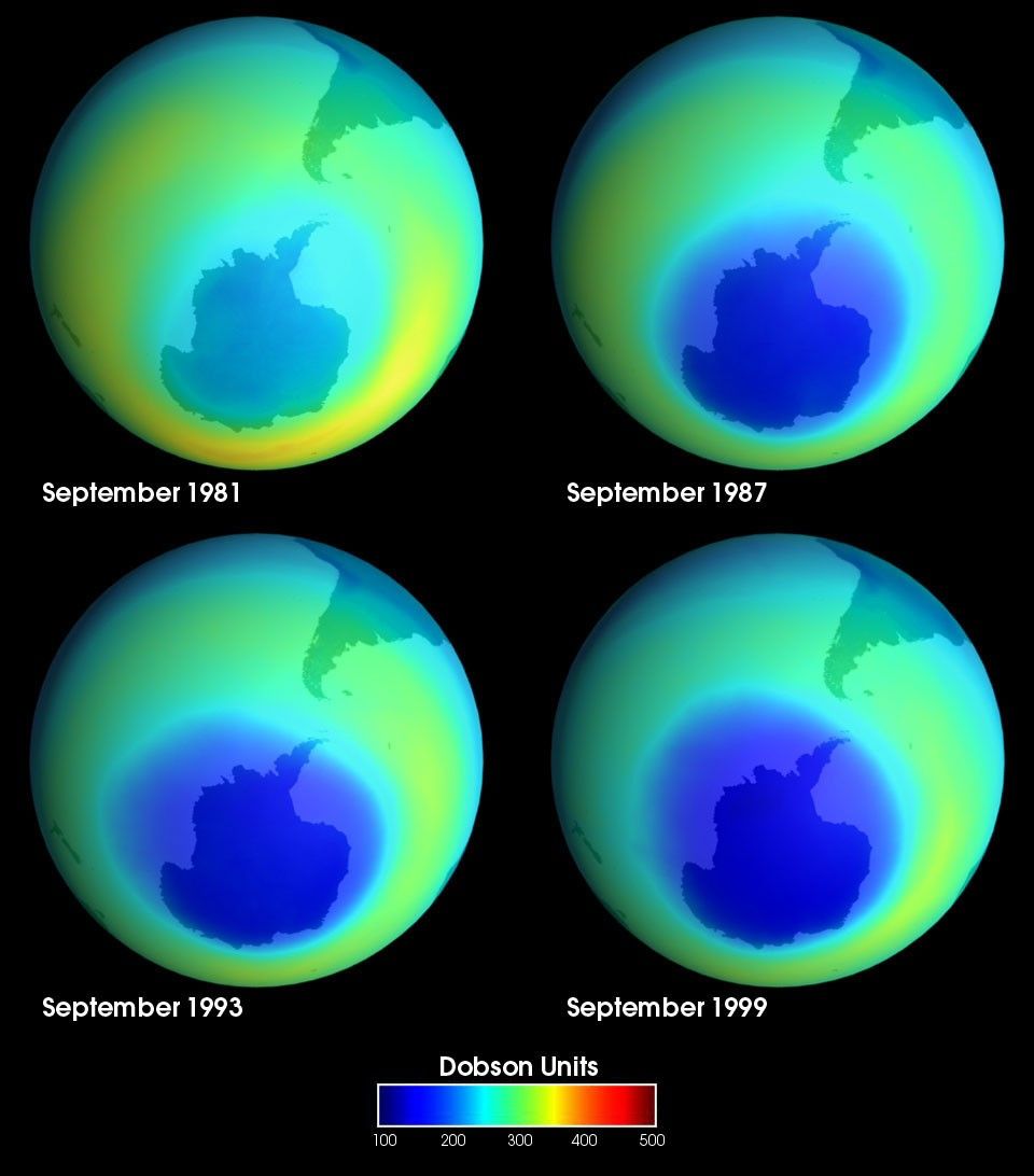
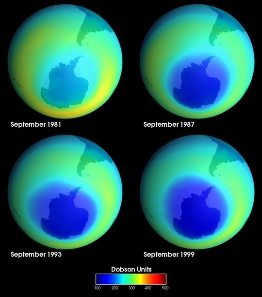
These images from the Total Ozone Mapping Spectrometer (TOMS) show the progressive depletion of ozone over Antarctica from 1979 to 1999. This "ozone hole" has extended to cover an area as large as 10.5 million square miles in September 1998. The previous record of 10.0 million square miles was set in 1996.
The Antarctic ozone hole develops each year between late August and early October. Regions with higher levels of ozone are shown in red. NASA and NOAA instruments have been measuring Antarctic ozone levels since the early 1970s. Large regions of depleted ozone began to develop over Antarctica in the early 1980s. Ozone holes of substantial size and depth are likely to continue to form during the next few years, scientists hope to see a reduction in ozone loss as levels of ozone-destroying CFCs (chlorofluorocarbons) are gradually reduced.
For more information, please visit:
Ozone Fact Sheet
TOMS Project
References & Resources
Images by Greg Shirah, NASA Goddard Space Flight Center Scientific Visualization Studio