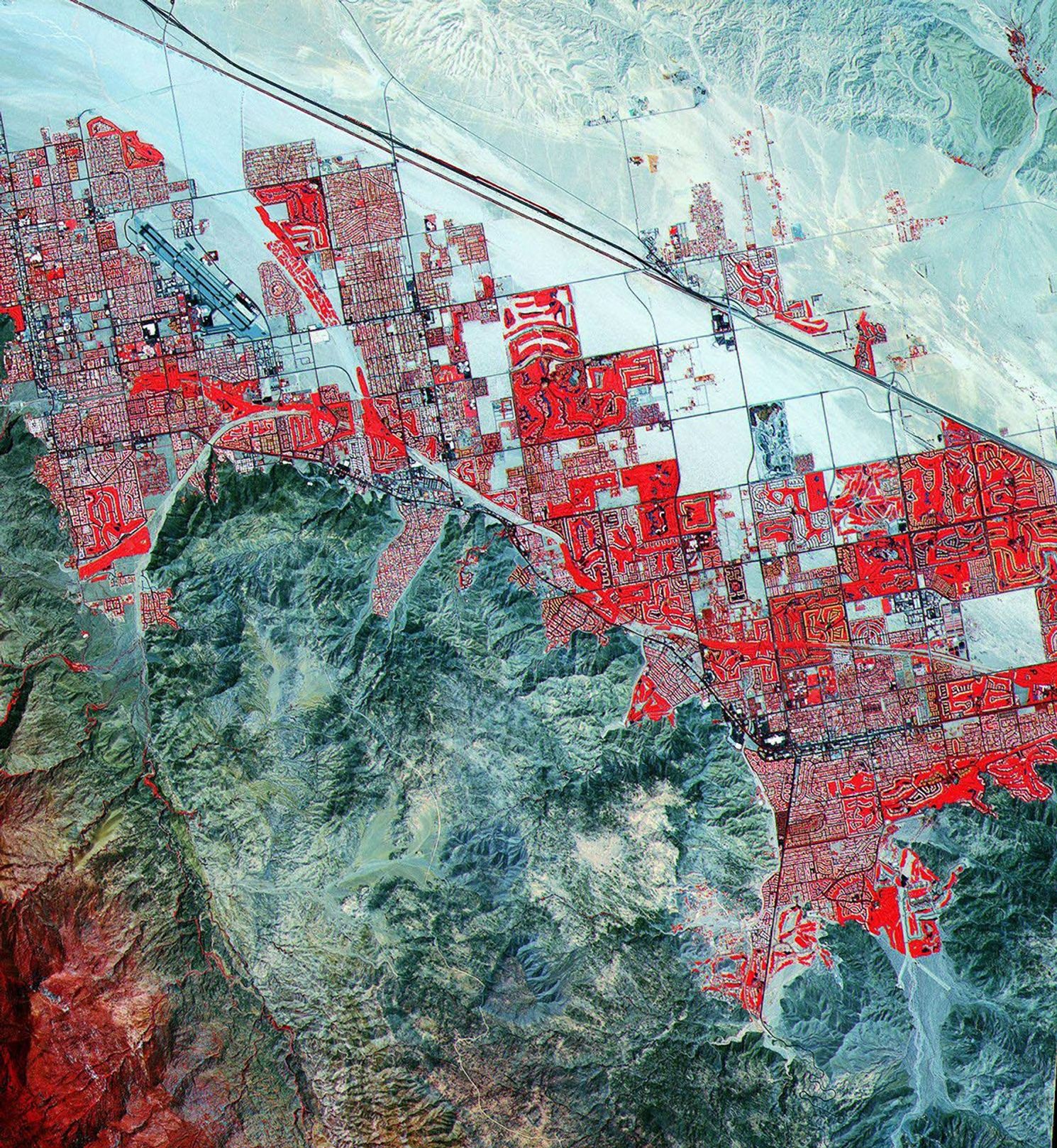

This Advanced Spaceborne Thermal Emission and Reflection Radiometer(ASTER) image shows the cities of Palm Springs, Cathedral City, and Palm Desert,California, located 160 km east of Los Angeles. The scene is 22km wide by 24 km high, and was acquired on May 10, 2000. The false-colorimage combines near-infrared, red, and green wavelengths of light,resulting in vegetation that appears red, while bare ground isrepresented by varying shades of blue-green.
A verdant oasis in the desert of southern California, Palm Springs isa fashionable residential community and winter resort noted for its finegolf courses. The lush grass of the heavily irrigated courses acount formost of the bright red areas in this image. In the southwest (lowerleft) corner of the image are the flanks of Mount San Jacinto (3,301meters/10,831 feet). Alpine plants--such as douglas fir--thrive at high elevations here. Interstate 10 cuts across to the north of Palm Springs, heading northwest/southeast. In the southeast (lower right), nestled against the mountains, is the Living Desert Wildlife and Botanical Park.
Originally called Agua Caliente (Spanish for "warm water"), the site ofpresent-day Palm Springs was selected in 1863 as a stop on thestagecoach line between New Mexico Territory and Los Angeles. It wasdeveloped as a residential community in the 1880s.
References & Resources
Image courtesy NASA/GSFC/MITI/ERSDAC/JAROS, and U.S./Japan ASTER Science Team