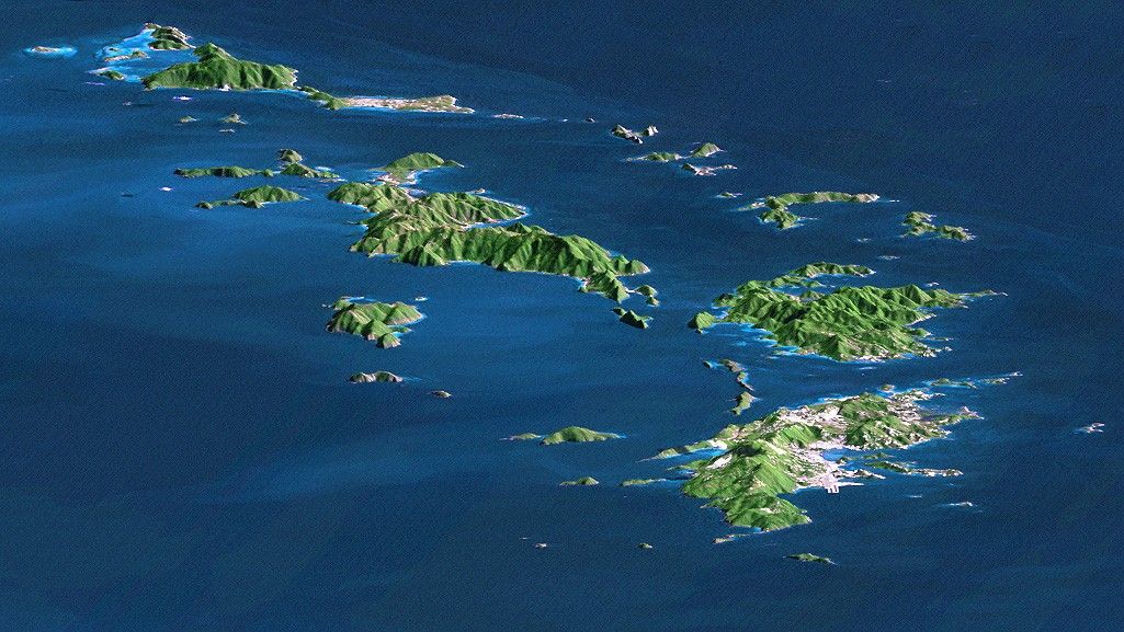
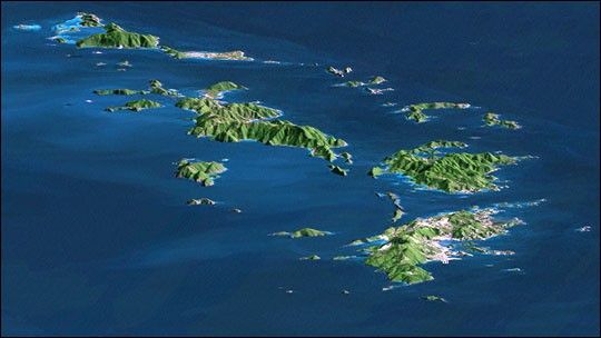
St. Thomas, St. John, Tortola, and Virgin Gorda are the four main islands (front to back) of this east-looking view of the U.S. Virgin Islands and British Virgin Islands, along the northeast perimeter of the Caribbean Sea. For this view, a nearly cloud-free Landsat image was draped over elevation data from the Shuttle Radar Topography Mission (SRTM), and shading derived from the SRTM data was added to enhance the topographic expression. Elevation is shown with 1.5x scaled vertical exaggeration. Coral reefs fringe the islands in many locations and appear as very light shades of blue. Tropical vegetation appears green, and developed areas appear in shades of brown and white.
As in much of the world, topography is the primary factor in the pattern of land use development in the Virgin Islands. Topography across most of the islands is quite rugged, and although the steep slopes create a scenic setting, they crowd most development into the small areas of low relief terrain, generally along the shoreline. The topographic pattern also affects water supply, wastewater disposal, landfill locations, road construction, and most other features of the development infrastructure. Topography also defines the natural drainage pattern, which is the major consideration in anticipating tropical storm water runoff dangers, as well as the dangers of heightened sediment impacts upon the adjacent coral reefs.
- Size: 94.7 kilometers (58.7 miles) view distance, 29.2 kilometers (18.1 miles) view width
- Location: 18.25 degrees North latitude, 64.75 degrees West longitude
- Orientation: Looking East
- Image Data: Landsat Bands 1,2+4, 3 as blue, green, red, respectively
- Original Data Resolution: SRTM and Landsat 30 meters (99 feet)
- Date Acquired: February 2000 (SRTM), January 21, 1985 (Landsat)
References & Resources
Image Courtesy SRTM Team NASA/JPL/NIMA