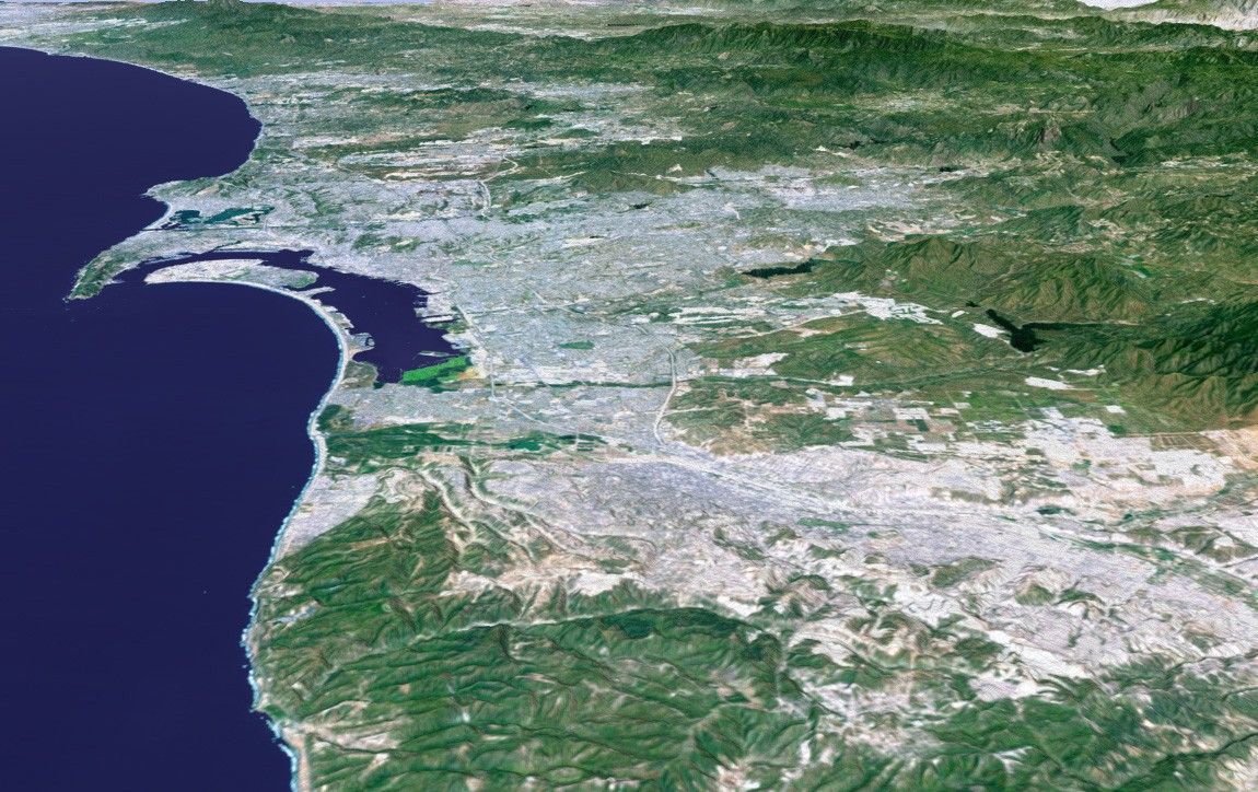
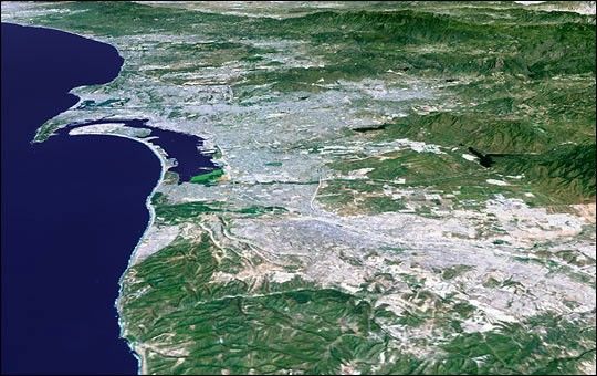
The influence of topography on the growth of the city of San Diego isseen clearly in this computer-generated perspective viewed from thesouth. The Peninsular Ranges to the east of the city have channeleddevelopment of the cities of La Mesa and El Cajon, which can be seen just above the center of the image. SanDiego itself clusters around the bay enclosed by Point Loma and CoronadoIsland. In the mountains to the right, Lower Otay Lake and SweetwaterReservoir show up as dark patches.
This 3-D perspective view was generated using topographic data fromthe Shuttle Radar Topography Mission (SRTM) and an enhanced colorLandsat 5 satellite image. Topographic expression is exaggerated twotimes.
Landsat has been providing visible and infrared views of the Earthsince 1972. SRTM elevation data matches the 30-meter (98-foot)resolution of most Landsat images and will substantially help inanalyzing the large and growing Landsat image archive.
Elevation data used in this image was acquired by the Shuttle RadarTopography Mission (SRTM) aboard the Space Shuttle Endeavour, launchedon Feb. 11, 2000. SRTM used the same radar instrument that comprised theSpaceborne Imaging Radar-C/X-Band Synthetic Aperture Radar (SIR-C/X-SAR)that flew twice on the Space Shuttle Endeavour in 1994. SRTM wasdesigned to collect 3-D measurements of the Earth’s surface. To collectthe 3-D data, engineers added a 60-meter (approximately 200-foot) mast,installed additional C-band and X-band antennas, and improved trackingand navigation devices.
Size: scale varies in this perspective image
Location: 32.6 deg.North lat., 117.1 deg. West lon.
Orientation: looking north
Image Data: Landsat Bands 3, 2, 1 as red, green, blue, respectively
Original Data Resolution: SRTM 1 arcsecond (30 meters or 98 feet),Thematic Mapper 1 arcsecond (30 meters or 98 feet)
Date Acquired:February 2000 (SRTM)
References & Resources
Image Courtesy SRTM Team NASA/JPL/NIMA