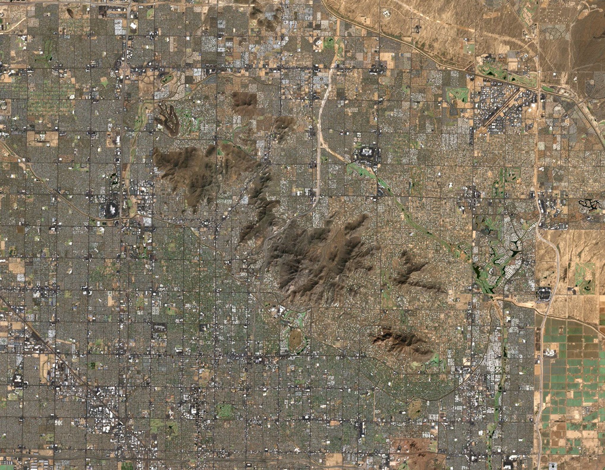

The Phoenix Mountains Preserve consists of scattered, undeveloped islands in the middle of a sprawling city. The parks and recreation areas of the preserve are under pressure from Phoenix's spreading suburbs. Private land adjoining the preserve's parks continues to be developed, angering environmentalists and outdoor enthusiasts.
In the above Landsat 7 image, the rough terrain of the Phoenix Mountain Preserve areas stands out against the regular grid of city streets, grey buildings, and green irrigated areas (such as ornamental trees and golf courses). Data from the Landsat satellites are used to monitor urban growth, providing city planners and citizens with the information needed to guide development.
References & Resources
Image courtesy Arizona Regional Image Archive, based on data from the Landsat 7 Science Team.