.png?w=1024)


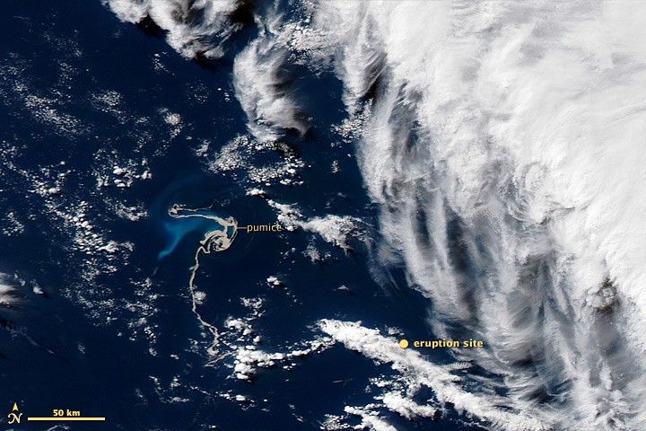
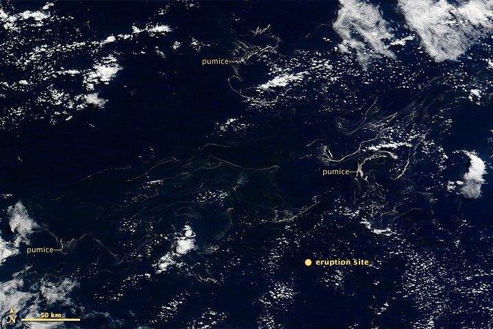
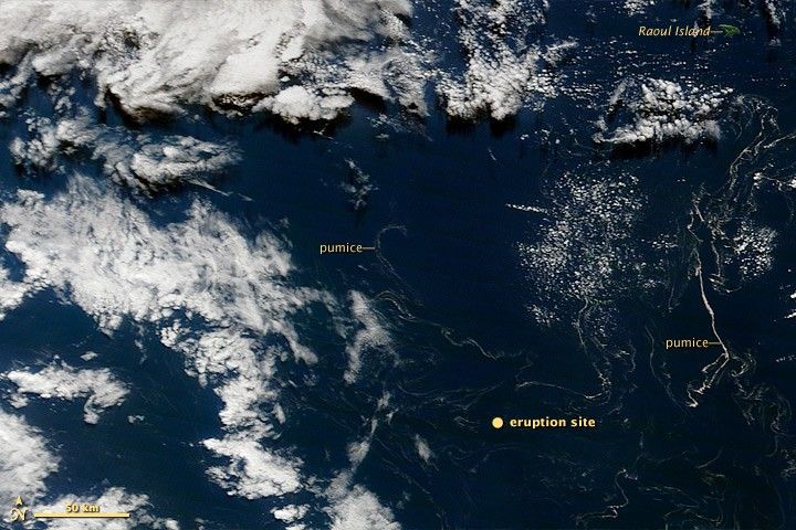
The Havre Seamount volcano erupted a tightly-packed raft of floating pumice on July 19 and 20, 2012. Over several weeks, wind and waves dispersed the pumice among the remote Kermadec Islands, northeast of New Zealand. These satellite images show the spread of the pumice.
On july 28, shortly after the eruption, the pumice raft remained compact, albeit twisted by ocean currents. By August 6, the pumice was largely dispersed, spread over an area at least 450 kilometers (280 miles) wide. Filaments of pumice remained in the area on August 13. None appeared to reach Raoul Island, site of a permanently staffed meteorological station.
These natural-color satellite image were acquired by the Moderate Resolution Imaging Spectroradiometer (MODIS) aboard the Aqua (July 28) and Terra (August 6 and 13) satellites.
Related Reading
- Eruptions Blog: Submarine Eruption Makes It Three for New Zealand.
References & Resources
NASA image courtesy Jeff Schmaltz LANCE/EOSDIS MODIS Rapid Response Team, GSFC. Caption by Robert Simmon.