

















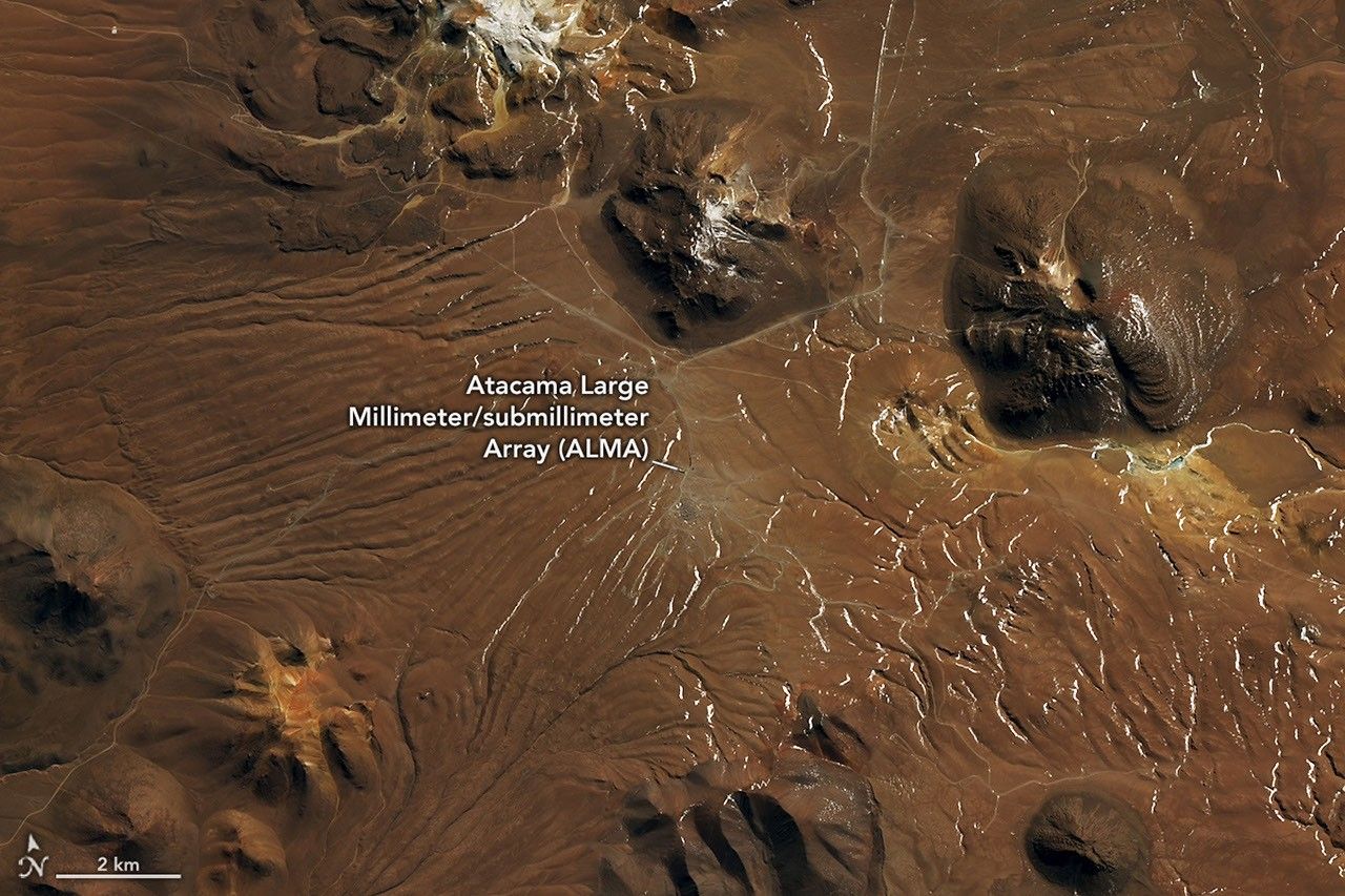
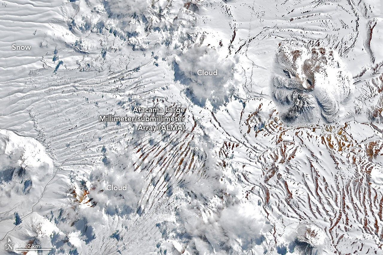
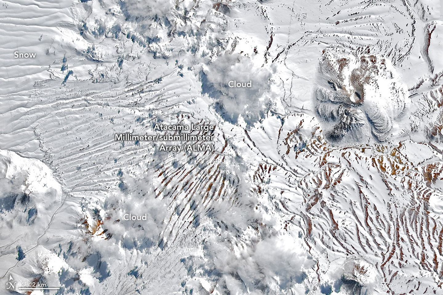
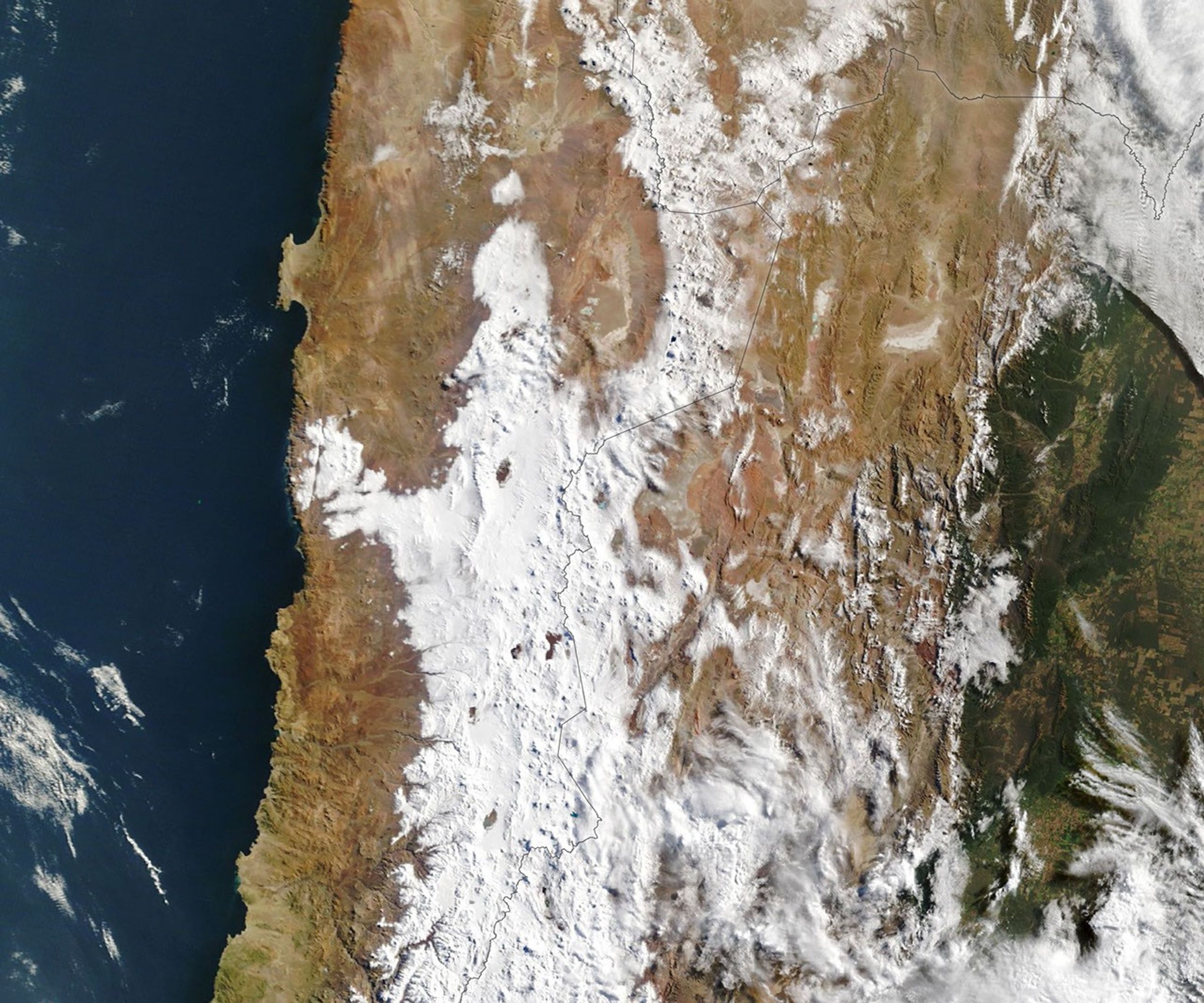
In August 2026, back-to-back winter storms left parts of the Atacama Desert in northern Chile covered in a rare blanket of snow. The typically arid region has seen snowfall before, notably in 2025 and before that in 2011. But one of the 2026 events was unusually widespread, stretching from the Andes to near the Pacific coast.
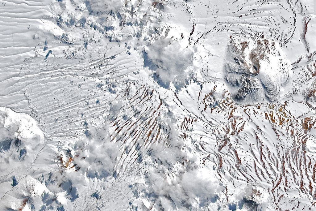
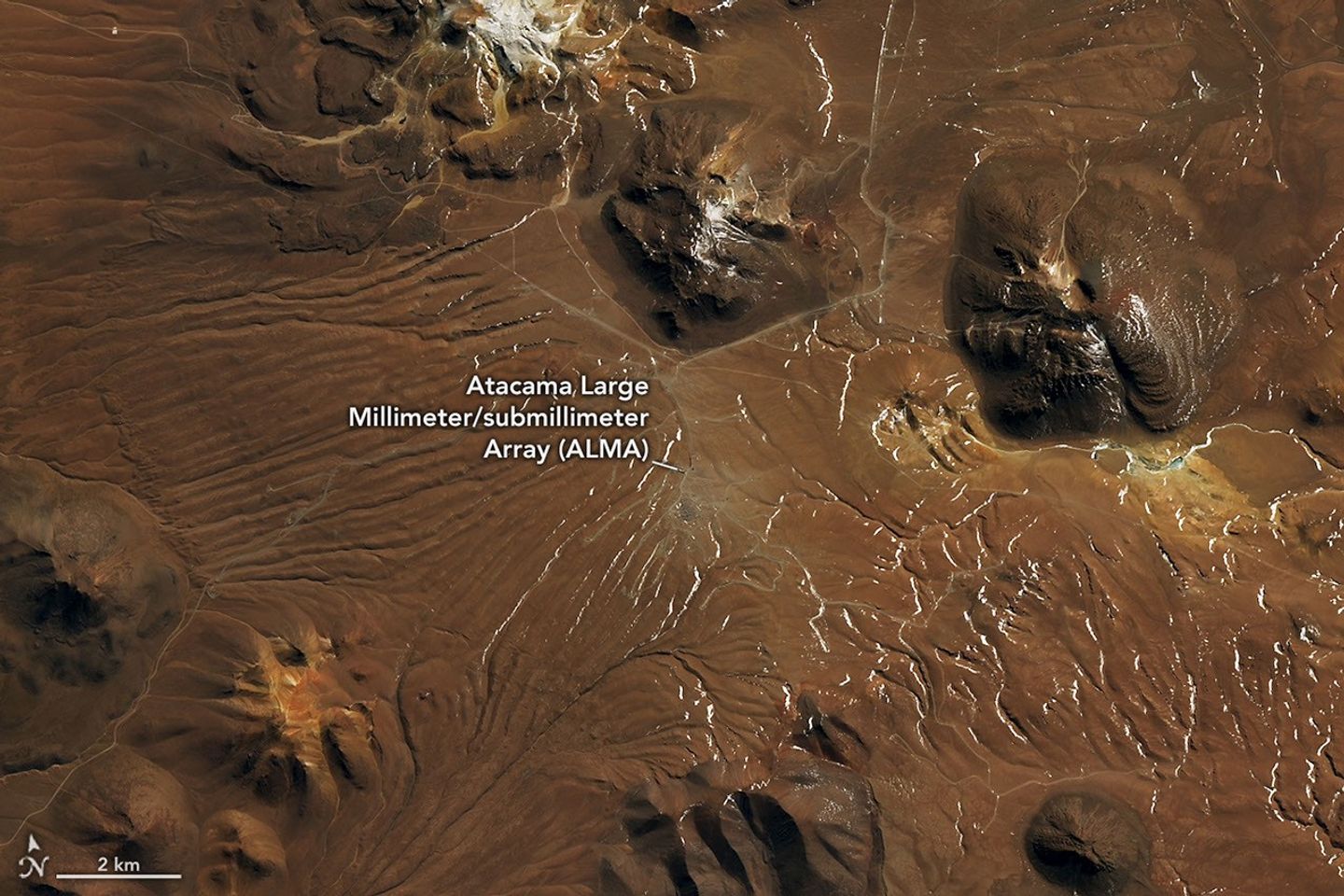
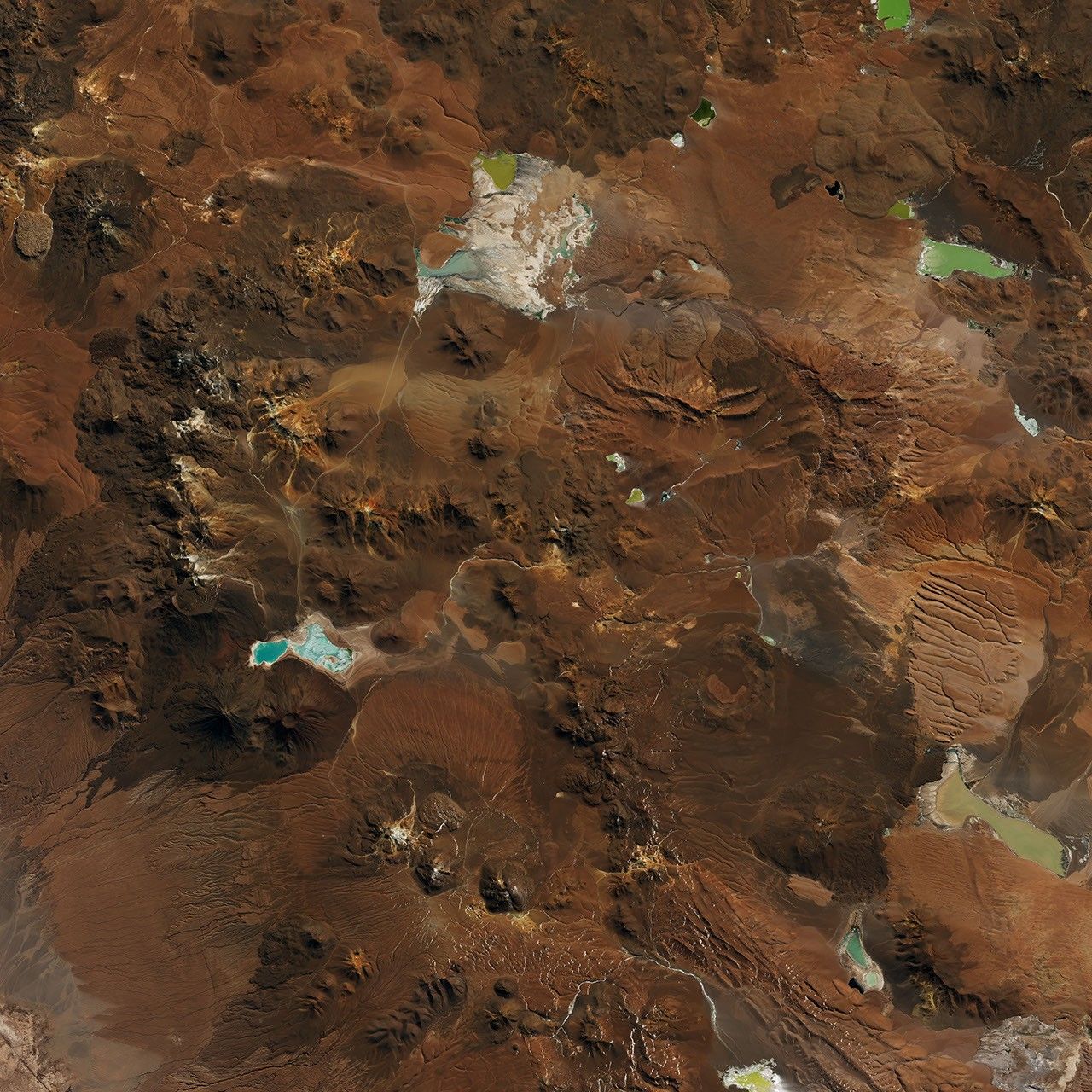
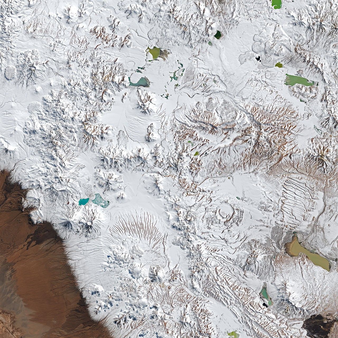
The OLI (Operational Land Imager) on the NASA-USGS Landsat 8 and Landsat 9 satellites captured these images (above) on August 6 and August 14, before and after a period of severe weather, respectively. They show a detailed view of the Chajnantor plateau within the Altiplano-Puna volcanic complex, home to the Atacama Large Millimeter/submillimeter Array (ALMA)—one of the planet’s most powerful radio telescopes. As snow and high winds set in, ALMA suspended operations, moving its antennas into a protective survival mode.
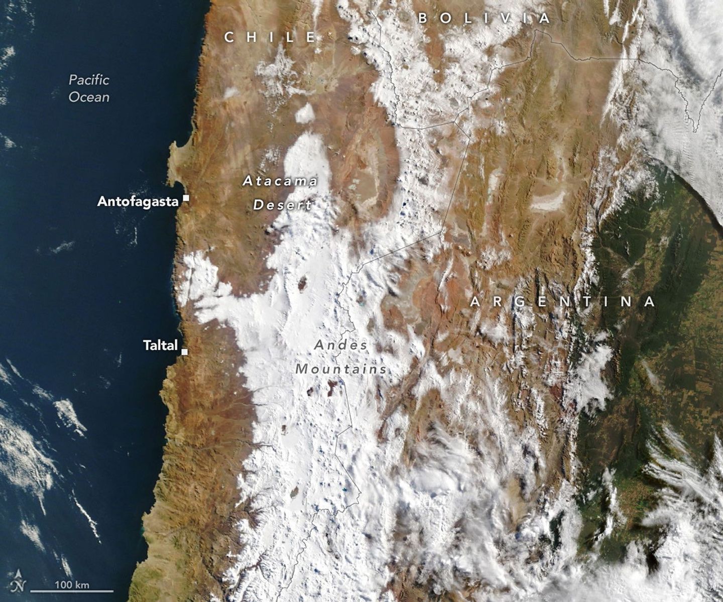
Another storm in the second half of the month blanketed an even wider area with fresh snowfall. This image, captured by the MODIS (Moderate Resolution Imaging Spectroradiometer) on NASA's Terra satellite on August 19, shows snow extending westward from the Andes, across the desert’s hyper-arid core, and close to the Pacific coast south of the Chilean port city of Antofagasta. This coastal area is home to several other major astronomical observatories, some of which also suspended operations during the event.
Most of the region’s winter precipitation comes from cutoff lows—low-pressure systems that become cut off from the jet stream and can occasionally reach northern Chile. That’s what happened in 2025, said René Garreaud, an atmospheric scientist at the University of Chile. The late-August 2026 storm also came from a cutoff low, but this one spun off from an unusually large trough—an elongated area of relatively low atmospheric pressure—that spanned an enormous stretch of the hemisphere, from the tip of South America up into the subtropics.
The atmospheric disruption, combined with ample coastal moisture, produced precipitation that spanned an unusually wide swath of the region—offshore, along the coast, across the core of the Atacama, and over the Andes. Totals reached a magnitude “rarely seen in the otherwise extremely arid region,” Garreaud said.
In some areas it fell as rain, not snow. Taltal, for instance, on Chile’s northern coast, accumulated nearly 40 millimeters (1.6 inches) of rain in three days—about 10 times its annual mean, Garreaud said. “We see these kinds of events only a few times, if any, per decade.”
The abundant precipitation spurred destructive mudflows and flash flooding in parts of northern Chile. The National Disaster Prevention and Response Service (SENAPRED) reported thousands were affected and hundreds of homes had major damage.
Garreaud noted that the strengthening El Niño is the backdrop for the anomalously wet winter in north-central Chile. In addition to the August storms, a major event in July brought significant impacts to the country’s Norte Chico region. During El Niño, the subtropical Pacific high—which normally keeps the region dry—weakens, while a blocking high tends to form in the South Pacific near the tip of the continent. Together, these shifts push the Southern Hemisphere storm track equatorward.
NASA Earth Observatory images by Lauren Dauphin, using Landsat data from the U.S. Geological Survey and MODIS data from NASA EOSDIS LANCE and GIBS/Worldview. Story by Kathryn Hansen.
Downloads
References & Resources
- CR2 (2026, July 23) The extreme event of July 15-20, 2026, within the context of the developing El Niño. Accessed August 26, 2026.
- NASA Earth Observatory (2025, July 19) Rare Snowfall in the Atacama Desert. Accessed August 26, 2026.
- National Weather Service, Climate Prediction Center (2026, August 13) El Niño/Southern Oscillation (ENSO) Diagnostic Discussion. Accessed August 26, 2026.
- The Watchers (2026, August 18) Snow and 90 km/h (55 mph) winds suspend ALMA observations in the Atacama Desert, Chile. Accessed August 26, 2026.