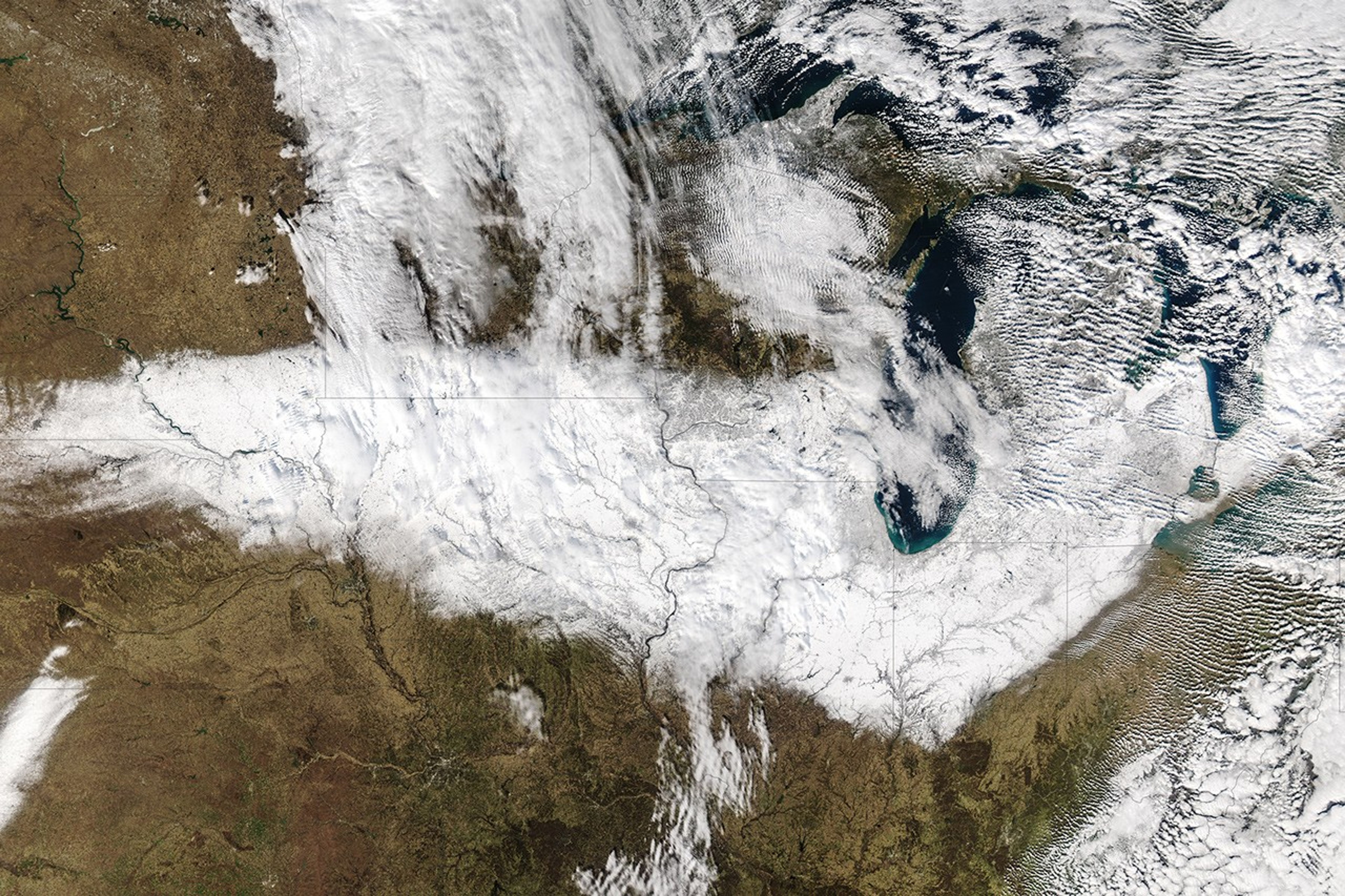
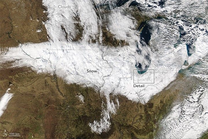
Much of the midwestern United States was drier and significantly warmer than normal in October and November 2015. So when snow blanketed the region from South Dakota to Ohio on November 20–21, it probably gave some people weather whiplash. For an area that is quite familiar with snow, it was still a storm for the history books, with a few records set for the highest snowfall totals for a first snow of the year.
At Chicago’s O’Hare International Airport, 11.2 inches (28.4 cm) of snowfall were recorded by the time the storm moved out on November 21. It was the second highest November snowfall since records were started in 1884 and the highest total for the first snow of the season. A new record for first snowfall also was set in Rockford, Illinois (8.8 inches or 22.4 cm). Nearly 800 flights into and out of Chicago were canceled by the snow.
The long-term average November snowfall for Chicago is 1.4 inches, and the average date of the first snow is December 7, according to The Weather Channel. Last winter, Chicago did not accumulate 6 inches of snow until January 5, 2015.
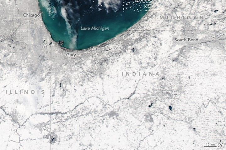
The Moderate Resolution Imaging Spectroradiometer (MODIS) on NASA’s Aqua satellite caught a glimpse of the snowy Midwest at 1:15 p.m. Central Standard Time (19:15 Universal Time) on November 22, 2015. Urban areas tend to appear more gray than white amidst the wide swath of snow.
In its report about the storm, meteorologists from the Chicago office of the National Weather Service wrote: “Interestingly, prior to Saturday the average temperature for the month had been running 6.5 degrees above normal. So this could end up being one of the warmer Novembers, as well as one of the snowiest.” Staff at The Weather Channel also noted that in the past five strong El Niños (1997-98, 1982-83, 1972-73, 1965-66, and 1957-58), Chicago saw snowfall totals reduced by a third to half.
According to the Midwestern Regional Climate Center, at least 51 stations across the U.S. Midwest recorded snowfall of at least 10 inches from the November 20–21 event. Tea, South Dakota, measured 18 inches; Grayslake, Illinois, caught 16 inches; Footville, Wisconsin, saw 17 inches; and Bloomfield, Nebraska, reported 16 inches.
References & Resources
- Capital Weather Gang, via The Washington Post (2015, November 23) Chicago sees snowiest ‘first storm’ on record; Midwest snowfall totals up to 19 inches. Accessed November 23, 2015.
- Midwestern Regional Climate Center, via Twitter (2015, November 23) What a snowstorm on Friday & Saturday. Accessed November 23, 2015.
- NASA Earth Observatory (2015, November 19) Early Winter Weather Across North America.
- National Weather Service (2015, November 23) November 20-21, 2015, Snow Storm. Accessed November 23, 2015.
- NBC News (2015, November 21) Chicago Records Snowiest November Storm in Over 100 Years. Accessed November 23, 2015.
- The Weather Channel (2015, November 22) Winter Storm Bella Dumps Up to 16 Inches of Snow in Chicago Suburbs. Accessed November 23, 2015.
- WunderBlog at Weather Underground (2015, November 23) Eastern Pacific's Invest 91E A Threat to Mexico; Potent mid-autumn snowstorm socks Midwest. Accessed November 23, 2015.
NASA images by Jeff Schmaltz, LANCE/EOSDIS Rapid Response . Caption by Mike Carlowicz.