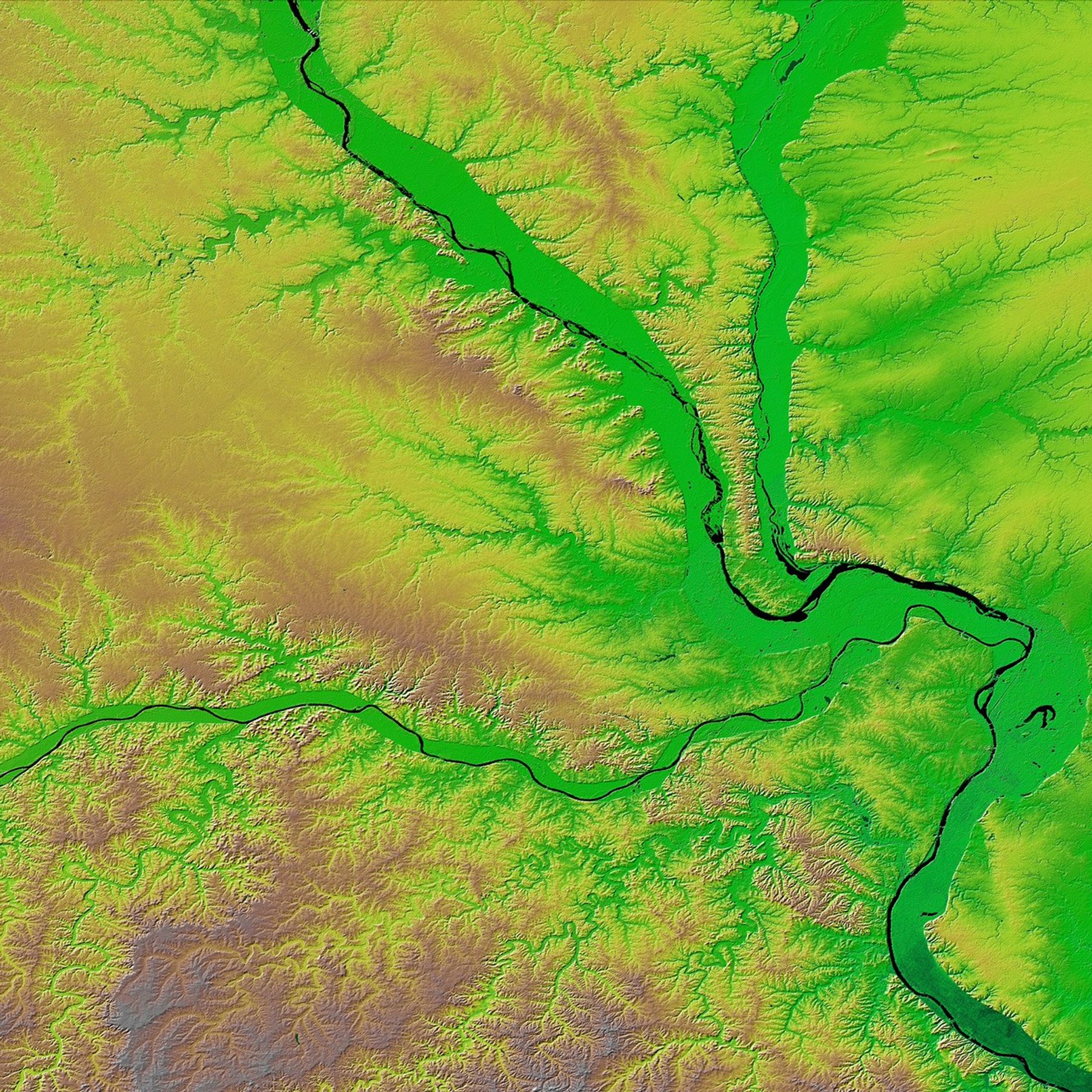

The confluence of the Mississippi, Missouri, and Illinois Rivers are shown inthis view of the St. Louis area from the Shuttle Radar Topography Mission (SRTM). TheMississippi flows from the upper left of the image and first meets the Illinois,flowing southward from the top right. It then joins the Missouri, flowing fromthe west across the center of the picture. The rivers themselves appear blackhere, and one can clearly see the green-colored floodplains in which they arecontained. These floodplains are at particular risk during times of flooding.The Mississippi forms the state boundary between Illinois (to the right) andMissouri (to the left), with the city of St. Louis located on the Mississippijust below the point where it meets the Missouri. This location at the hub ofthe major American waterways helped establish St. Louis’ reputation as the#147;Gateway to the West.”
Two visualization methods were combined to produce this image: shading andcolor coding of topographic height. The shade image was derived by computingtopographic slope in the northwest-southeast direction. North-facing slopesappear bright and south-facing slopes appear dark. Color coding is directlyrelated to topographic height, with blue and green at the lower elevations,rising through yellow and brown to white at the highest elevations.
Size: 173.0 by 222.6 kilometers (107.5 by 138.3 miles)
Location: 339 degrees North latitude, 91 degrees West longitude
Orientation: North toward the top
Image Data: shaded and colored SRTM elevation model
Original Data Resolution: SRTM 1 arcsecond (30 meters or 98 feet)
Date Acquired: February 2000 (SRTM)
For a very high resolution (7200 by 7200 pixel) version of this image,visit PIA03346 at the JPL Planetary Photojournal.
References & Resources
Image Courtesy SRTM Team NASA/JPL/NIMA