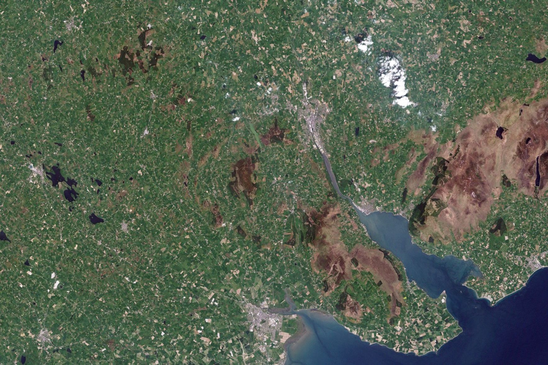


Covered in heath, the solitary rocky hill known as Slieve Gullion rises above the farmland of Northern Ireland in this true-color Landsat image from May 24, 2001. According to Irish mythology, hunter and warrior Finn McCool bathed in the lake on Slieve Gullion and emerged decades older. However, we don’t need a dip in the lake to move through time. A glance at the landscape reveals millions of years of history.
Looking out from the summit Slieve Gullion, the mythical Finn McCool (or anyone else who climbed to the top, for that matter) would see a ring of rocky hills surrounding the Slieve. From a satellite view hundreds of kilometers above Earth, the circular shape of the formation is even more evident. Known as the Ring of Gullion, the ancient hills are nearly 60 million years old. They formed either when an ancient volcano collapsed—leaving a circular fault into which molten rock seeped—or when layers of magma built up in layers in the volcano. This type of formation is called a ring dyke.
The Ring of Gullion was the first ring dyke geologists mapped. It is a distinctive feature on geologic maps, as shown in the lower image. Made with information from the Geologic Survey of Ireland, the map shows the volcanic rock that form the ring in dark pink, blue green, and purple. Each color represents a different type of volcanic rock (tertiary granite, tertiary basic intrusion, and tertiary volcanics), distinguished by their chemical makeup and the way each was deposited.
The surrounding rock is even older. Yellow represents silurian sandstone, formed on the floor of an ancient sea more than 400 million years ago. Blue shows caledonian granite, left when magma poured into the sandstone as mountains rose about 390 million years ago.
The older rock is covered by soil that was deposited under glaciers during the last ice age. Green fields—farms—now grow in that soil. The newer volcanic rock in the Ring of Gullion appears brown in the Landsat image.
Related Links
- To read about the first geologic maps of England, Scotland, and Wales, see the Earth Observatory’s biography of William Smith.
References & Resources
- To read about the first geologic maps of England, Scotland, and Wales, see the Earth Observatory’s biography of William Smith.
NASA Earth Observatory images created by Jesse Allen and Robert Simmon, using Landsat data provided by the United States Geological Survey. Geological data provided courtesy of the Geological Survey of Ireland. Caption by Holli Riebeek.