![Request for Information – Potential [Placeholder for Prize]](https://assets.science.nasa.gov/dynamicimage/assets/science/missions/a-step/FFR_Earth_Background_20251120%20.png?w=1024)


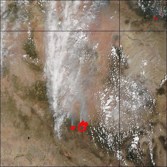
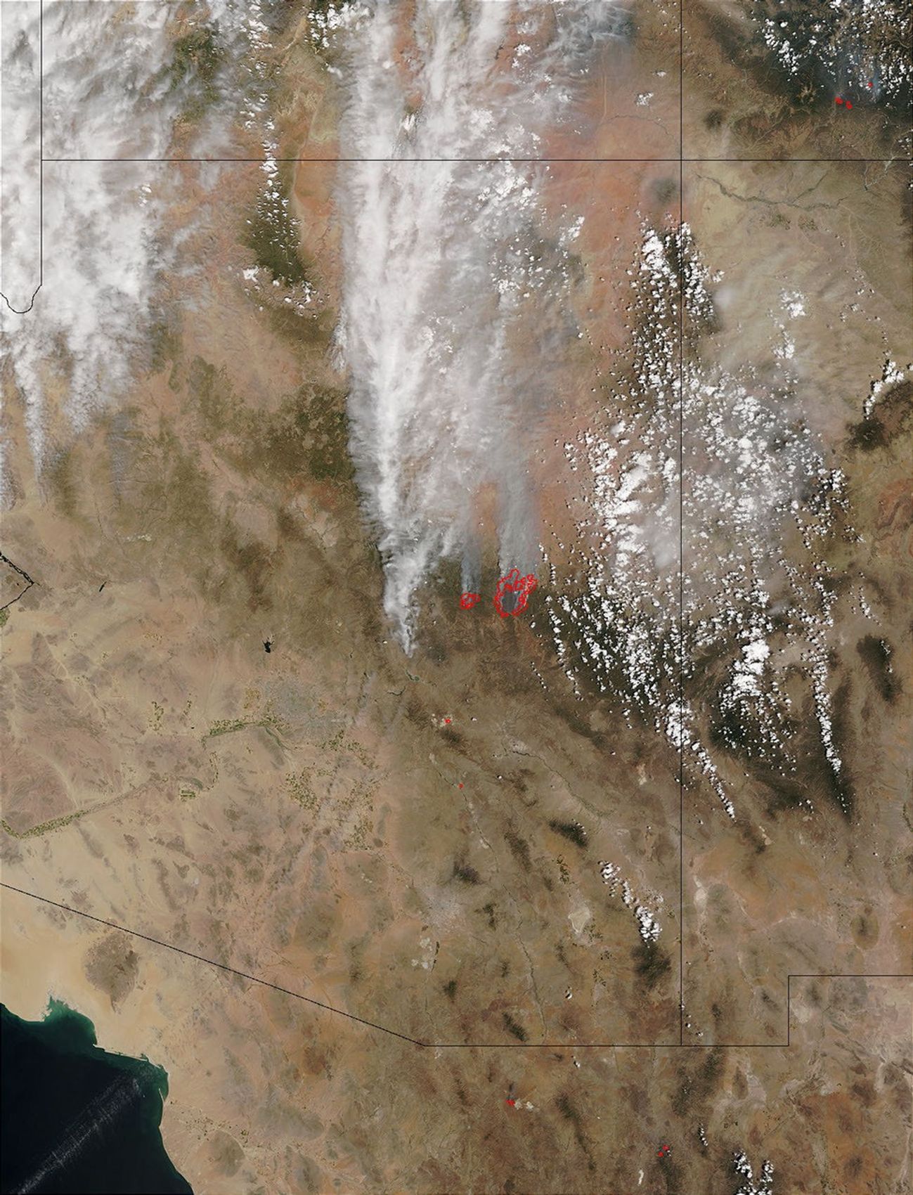
In the last week, large fires roared to life in east-central Arizona on the Fort Apache Indian Reservation northeast of Phoenix. This image from the Moderate Resolution Imaging Spectroradiometer (MODIS) on NASA’s Terra satellite was captured on Friday, June 21, 2002, and shows the massive smoke plumes created by the fires.
The Rodeo Fire (east) began on June 18, and has engulfed at least 85,000 acres. Only a few days later, a second fire began less than 10 miles away. The Chediski Fire (west) began on Thursday, June 20, and by Friday morning had already grown to 7,000 acres. Thousands of people have been evacuated and at least a hundred structures have been lost.
Please note that the high-resolution scene provided here is 500 meters per pixel. For a copy of the scene at the sensor's fullest resolution, visit the MODIS Rapid Response Image Gallery.
References & Resources
Image courtesy Jacques Descloitres, MODIS Land Rapid Response Team at NASA GSFC