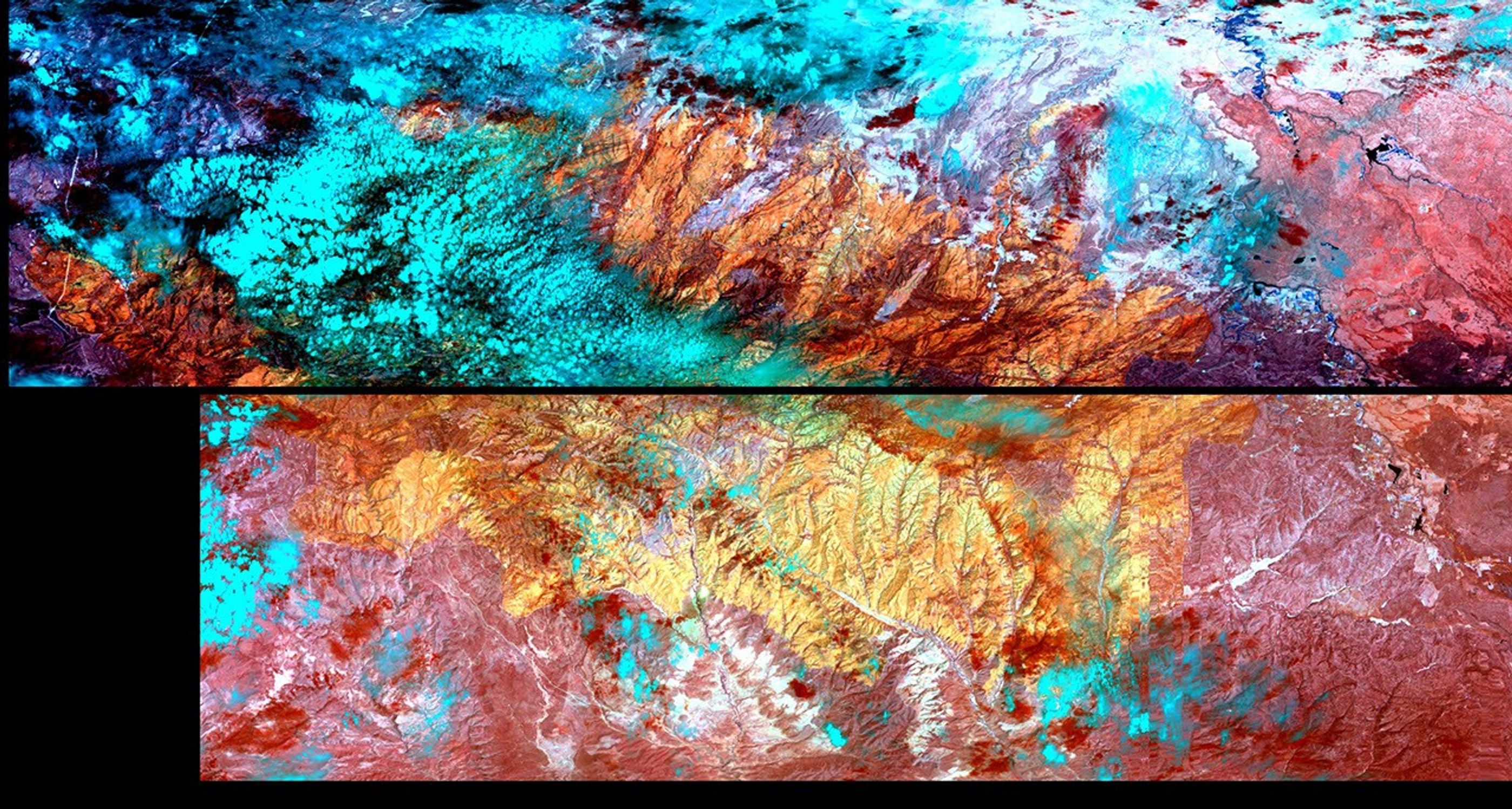
New images of Arizona's Rodeo-Chediski wildfire, which according to news reports is the largest in the state's history, have been acquired by NASA's MODIS Airborne Simulator flying aboard the space agency's ER-2 aircraft. The images show the extent of the burn area--now more than 450,000 acres--and pinpoint areas of active burning as of the morning of July 1.
This thermal and short-wave infrared image shows burned areas as shades of yellow and orange; unburned areas are deeper red, and clouds are pale blue. There is very little active burning visible. The image was acquired during a transit of the ER-2 aircraft from NASA's Dryden Flight Research Center, Edwards, Calif. to Key West Naval Air Facility, Fla. in preparation for an upcoming field experiment.
The newly acquired wildfire images will be used to validate rapid response wildfire maps produced by NASA's Moderate Resolution Imaging Spectroradiometer (MODIS) instrument aboard the Terra spacecraft. They will also be provided to the U.S. Forest Service for potential use in post-fire damage assessments.
Top-level Earth Observatory Page
References & Resources
Image courtesy of MODIS Airborne Simulator ER-2 team, NASA Dryden Flight Research Center, Edwards, California.