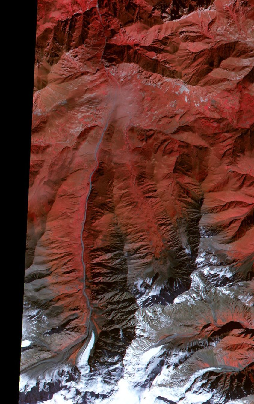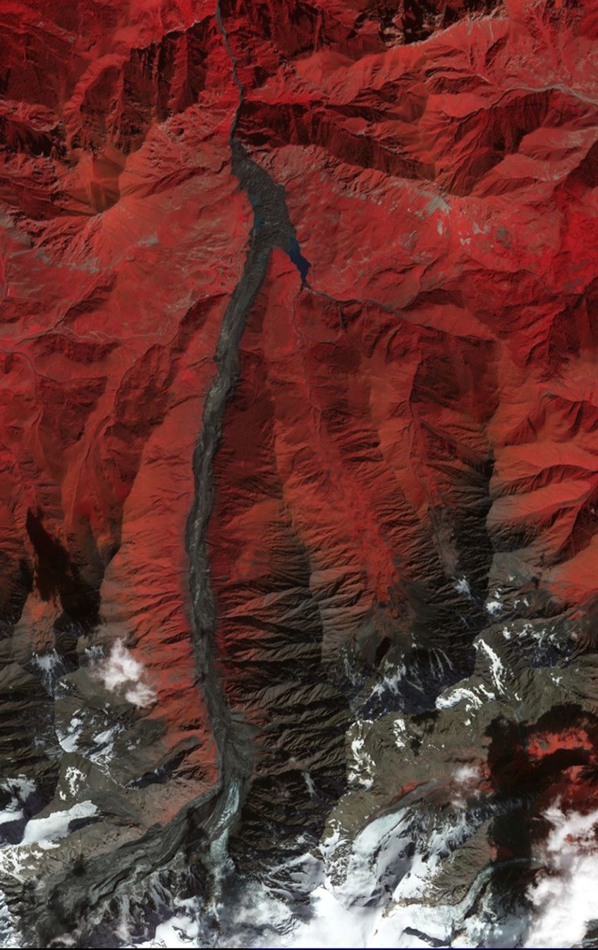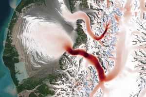
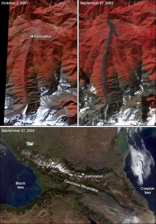
This pair of false-color images (top) from the Advanced Spaceborne Thermal Emission and Reflection Radiometer (ASTER), flying aboard NASA’s Terra satellite, shows Mt. Kazbek in Southern Russia before and after the recent collapse of the Kolka Glacier. On September 20, a collapse of a hanging glacier from the slope of Mt. Dzhimarai-Khokh onto the Kolka Glacier triggered an avalanche of ice and debris that went over the Maili Glacier terminus then slid more than 15 miles (24 km). The avalanche buried small villages in the Russian Republic of North Ossetia, killing dozens of people.
The top left scene was acquired on October 3, 2001, and the top right scene was acquired on September 27, 2002. The long, dark grey streak running upward through the center of the scene shows the gorge that was overrun by ice and debris from the avalanche. The deep reds show vegetated land surfaces, grey areas are bare rock, and white shows ice-covered lands.
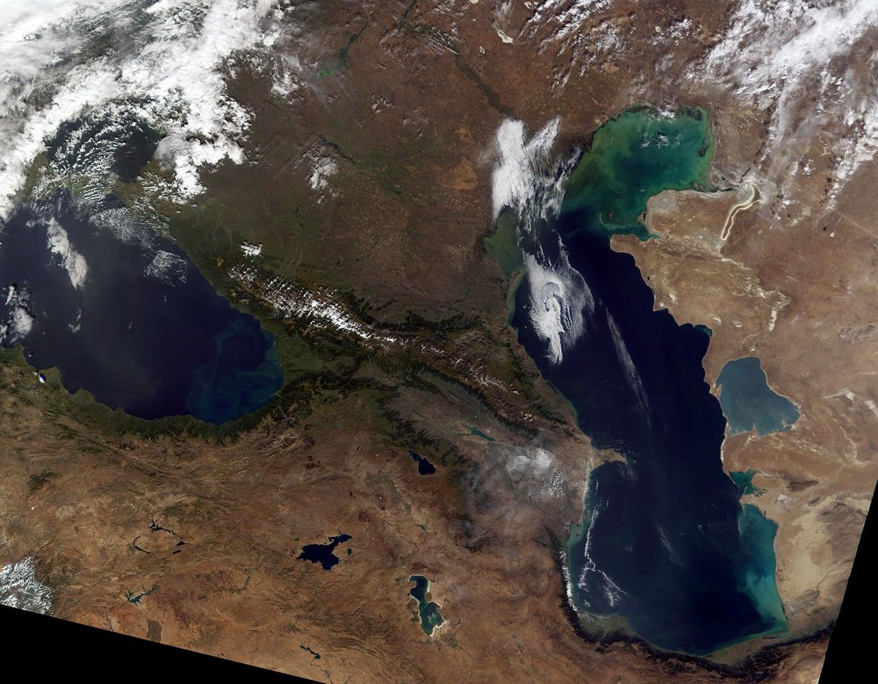
The bottom image was also acquired on September 27, 2002, by the Terra MODIS sensor. This scene shows the location of the landslide relative to distinguishing features in the larger region. Click to read more about the Kolka Glacier collapse and see an astronaut photo of theregion.
References & Resources
Images by Robert Simmon and Jesse Allen, based on data from the NASA/GSFC/MITI/ERSDAC/JAROS, and U.S./Japan ASTER Science Team and the MODIS Science Team