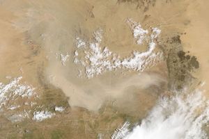

A wall of Saharan Desert dust that was captured in an image from March 3, 2004, had billowed out over the Atlantic and begun to spread northward by the next day. The leading edge of the dust storm in several places was advancing at speeds of up to 50 km per hour. The above image of the massive plume of dust was captured by the Moderate Resolution Imaging Spectroradiometer (MODIS), aboard NASA’s Terra satellite on March 4, 2004. West of Morocco are the Canary Islands, partially veiled by the windblown dust in this scene. The photograph below, provided by Foro Canariasmet, shows the dust as it looked from atop a mountain on the Canary Islands.
The high-resolution image provided above is 250 meters per pixel. The MODIS Rapid Response System provides this image at additional resolutions.
References & Resources
Image courtesy Jeff Schmaltz, MODIS Land Rapid Response Team at NASA GSFC