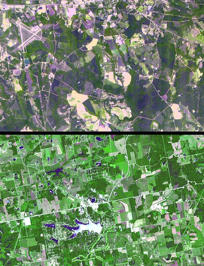
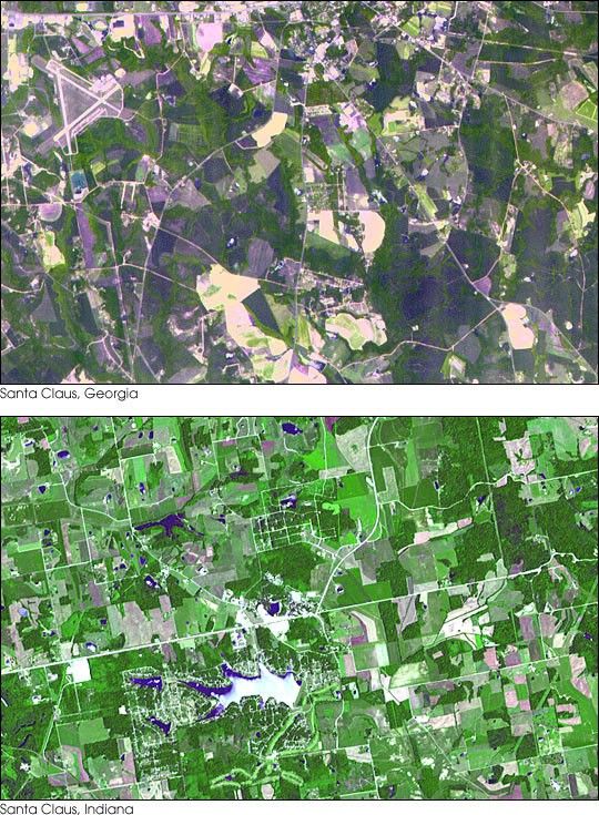
The towns of Santa Claus, Georgia (top) and Santa Claus, Indiana (bottom), areshown in these two images from the Advanced Spaceborne Thermal Emissionand Reflection Radiometer (ASTER) instrument on NASA’s Terra satellite.There are 11 towns with this name in theUnited States. Santa Claus, Ga. is located in Toombs County, and has apopulation of 237. Santa Claus, Ind. is located in Spencer County, andhas a population of 2,041. Its name was accepted by the United StatesPostal Service in 1856. The images were acquired on July 3, 2000 (top), and June 16, 2001 (bottom), respectively.
Size: 10.5 by 6.75 kilometers (6.5 by 4.2 miles)
Location: 32.2 degrees North latitude, 82.3 degrees West longitude; and 38.1 degrees North latitude, 86.9 degrees West longitude
Orientation: North at top
Image Data: ASTER bands 1, 2 and 3
Original Data Resolution: 15 meters (49.2 feet)
Dates Acquired: June 16, 2001 and July 3, 2000
References & Resources
Image courtesy NASA/GSFC/MITI/ERSDAC/JAROS, and U.S./Japan ASTER Science Team