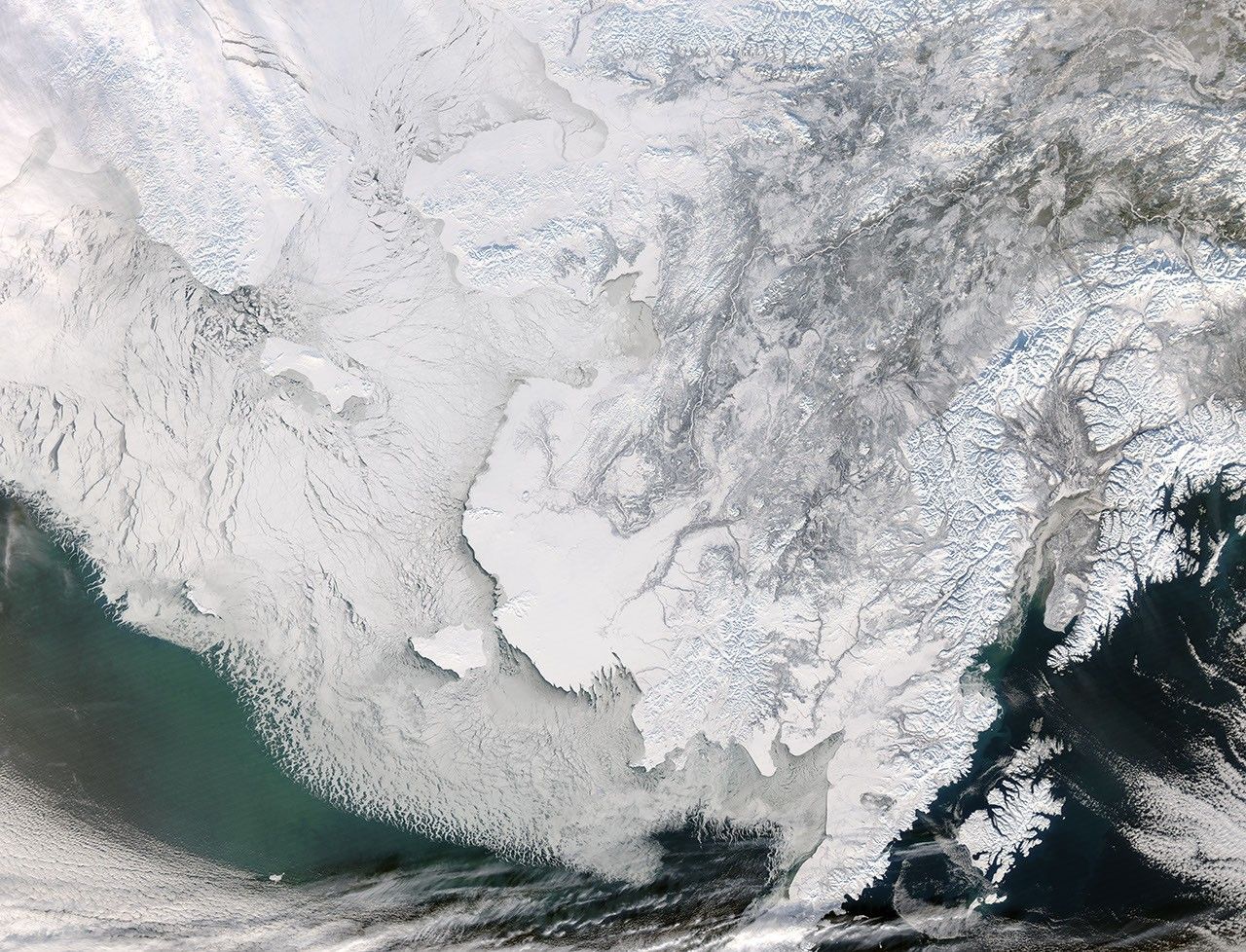
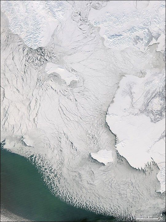
A mosaic of sea ice shifted across the Bering Sea west of Alaska on February 5, 2008. On either side of the Bering Strait (top center), the land was blanketed with snow that highlighted the mountainous terrain. Left of center, the twisting branches of the Yukon River Delta make a gray-brown outline shaped like a tree.
In the northern part of the image, the sea ice is composed of a mixture of large and small blocks, while along the southern margin, it becomes so fine that is looks like foam from this distance. South of the ice, the sea appears greenish. This color is a sign of life. While the vegetation on land is dormant for the winter, the ocean still blooms with an abundance of microscopic, plant-like organisms called phytoplankton. This image was captured by the Moderate Resolution Imaging Spectroradiometer (MODIS) on NASA’s Aqua satellite.
References & Resources
NASA image by Jeff Schmaltz, MODIS Rapid Response Team, Goddard Space Flight Center. Caption by Rebecca Lindsey.