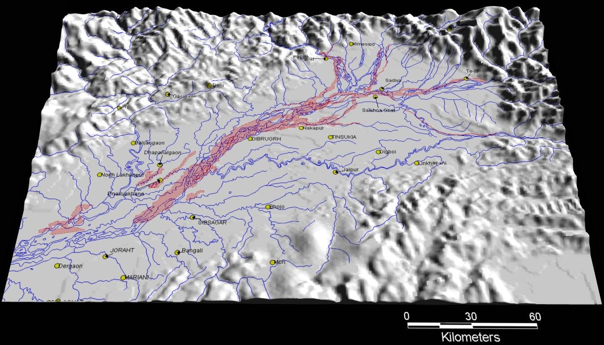
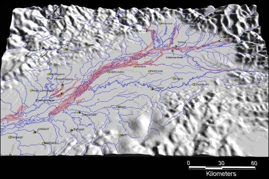
Floods devestated parts of eastern India along the Brahmaputra Riverin June 2000. In some tributaries of the Brahmaputra, the water reachedmore than 5 meters (16.5 feet) above flood stage. At least 40 residentsdied, and the flood waters destroyed a bridge linking the region to therest of India. High water also threatened endangered Rhinos in KazirangaNational Park.
Flooded areas are shown in red in the above image. The map was derivedfrom Advanced Very High Resolution Radiometer (AVHRR) data takenon June 15, 2000.
For more information on observing floods with satellites, see:UsingSatellites to Keep our Head above Water and the Dartmouth Flood Observatory
References & Resources
Image by the Dartmouth Flood Observatory