Suggested Searches

1 min read

Shetland Islands


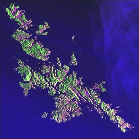
Like a many-faceted jewel in an indigo setting, the Shetland Islands lie210 kilometers (130 miles) north of the Scottish mainland in the North Atlantic Ocean. Despitetheir 60-degree north latitude, the Shetlands enjoy a relatively temperate climatethanks to the warming influence of the Gulf Stream.

This image was acquired by Landsat 7’sEnhanced Thematic Mapper plus (ETM+) sensor.

References & Resources

Image provided by the USGS EROS Data Center Satellite Systems Branch as part of the Earth as Art II image series

You may also be interested in:

Stay up-to-date with the latest content from NASA as we explore the universe and discover more about our home planet.

A Full Moon Checkup
3 min read

Once a month during the full Moon, Landsat 9 turns from Earth to image the lunar surface, helping keep the…

Article
Megaberg Ends Its Long Odyssey at Sea
5 min read

Antarctic Iceberg A-23A’s journey ends in fragmentation in the South Atlantic Ocean, after a 40-year lifespan documented by satellites.

Article
Fire Chars Santa Rosa Island
2 min read

The blaze spread across the southern side of the second-largest island in California’s Channel Islands National Park.

Article