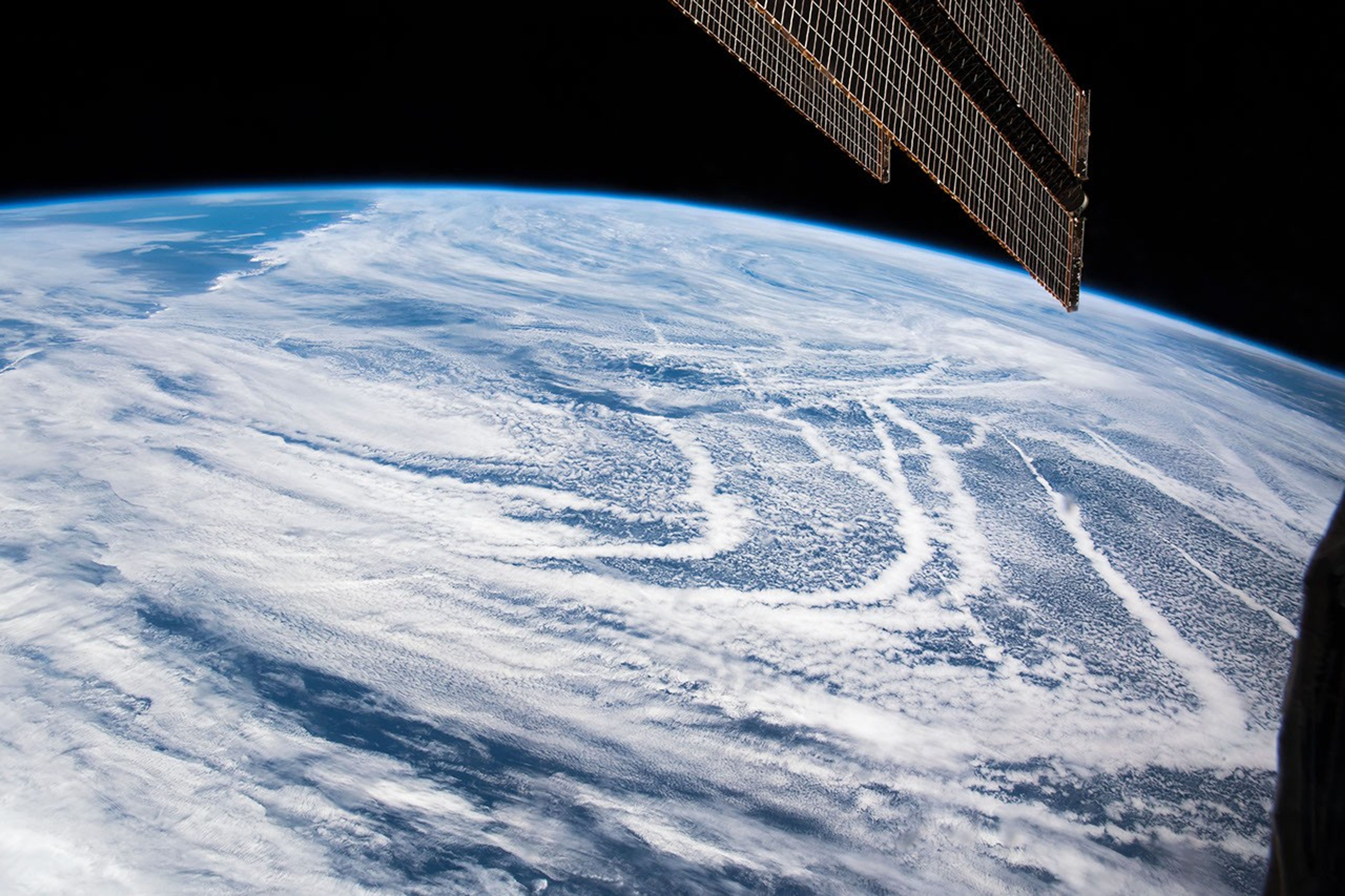
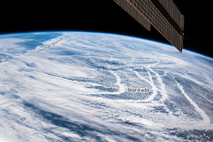
Using a short lens to give a wide view, an astronaut on the International Space Station (ISS) focused on at least a dozen thin lines stretching across the North Pacific Ocean near the Aleutian Islands. The thin lines were first interpreted to be contrails, but a former Naval oceanographer (now an ISS payload scientist) in the NASA’s Earth Science and Remote Sensing (ESRS) office recognized them as ship tracks. A solar panel of the ISS cuts into the top right of the photograph.
Ship tracks generally form under stable, fairly calm atmospheric conditions where there is a temperature inversion (warm air above the layer of cooler air). Particles emitted from the smoke stacks of ships are carried up into the atmosphere and act as cloud condensation nuclei in the low-level clouds. Water molecules cling to these particles and make smaller and denser cloud droplets within stable marine-layer air masses. The cloud lines trace out the curved trajectories of ships. This is a well-known phenomenon to scientists and weather forecasters who study the atmosphere and aerosols.
Under light wind conditions, ship tracks can remain visible for many hours. The same cloud patterns and ship tracks were also visible that day in imagery from the MODIS instrument on NASA’s Terra satellite.
References & Resources
Astronaut photograph ISS059-E-36734 was acquired on April 28, 2019, with a Nikon D5 digital camera using a 24 millimeter lens and is provided by the ISS Crew Earth Observations Facility and the Earth Science and Remote Sensing Unit, Johnson Space Center. The image was taken by a member of the Expedition 59 crew. The image has been cropped and enhanced to improve contrast, and lens artifacts have been removed. The International Space Station Program supports the laboratory as part of the ISS National Lab to help astronauts take pictures of Earth that will be of the greatest value to scientists and the public, and to make those images freely available on the Internet. Additional images taken by astronauts and cosmonauts can be viewed at the NASA/JSC Gateway to Astronaut Photography of Earth. Caption by M. Justin Wilkinson, Texas State University on the Jacobs Contract at NASA-JSC, and Susan Runco, ARES, NASA-JSC.