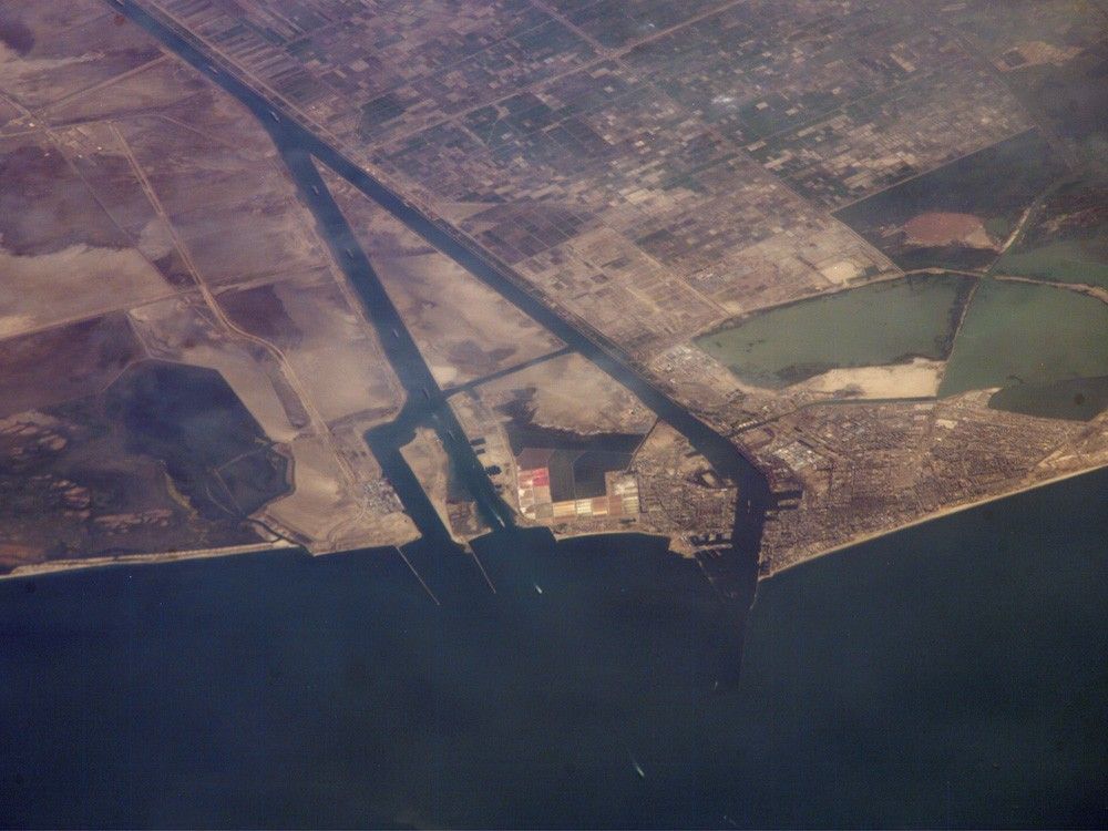
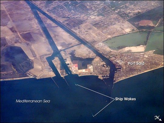
This astronaut photograph captures a northbound convoy of cargo ships entering the Mediterranean Sea from the Suez Canal in Egypt (leftmost canal branch at image center). The Suez Canal connects Port Said on the Mediterranean Sea with the port of Suez on the Red Sea, and provides an essentially direct route for transport of goods between Europe and Asia. The Canal is 163 kilometers (approximately 100 miles) long, and 300 meters (almost 1,000 feet) wide at its narrowest point—wide enough for ships as large as aircraft carriers to traverse it. Transit time from end to end is 14 hours on average.
The Canal was built under the direction of Ferdinand de Lesseps of France using primarily Egyptian labor, and it was opened to traffic in 1869. Subsequent wars and skirmishes have passed control of the Canal to various powers including the United Kingdom, Egypt, Israel, and the United Nations. A multinational observer force including the United States, Israel, and Egypt currently oversees the Canal.
This is an oblique image of the canal, meaning it has been taken at an angle. Astronauts and cosmonauts on the International Space Station (ISS) can photograph the part of the Earth directly below the station as it passes overhead, or they can photograph different parts of the globe. When they photograph different parts of the globe, they take pictures at an angle to provide a sense of perspective. In this case, the ISS was located above the eastern coast of Cyprus, and the astronaut was looking at Egypt to the southwest. Regions of reduced clarity in the image result from thin cloud cover. The day this image was taken, the total number of Earth photographs acquired by astronauts aboard the ISS passed 200,000.
References & Resources
Astronaut photograph ISS013-E-44847 was acquired June 30, 2006, with a Kodak 760C digital camera using an 800 mm lens, and is provided by the ISS Crew Earth Observations experiment and the Image Science & Analysis Group, Johnson Space Center. The image in this article has been cropped and enhanced to improve contrast. The International Space Station Program supports the laboratory to help astronauts take pictures of Earth that will be of the greatest value to scientists and the public, and to make those images freely available on the Internet. Additional images taken by astronauts and cosmonauts can be viewed at the NASA/JSC Gateway to Astronaut Photography of Earth.