


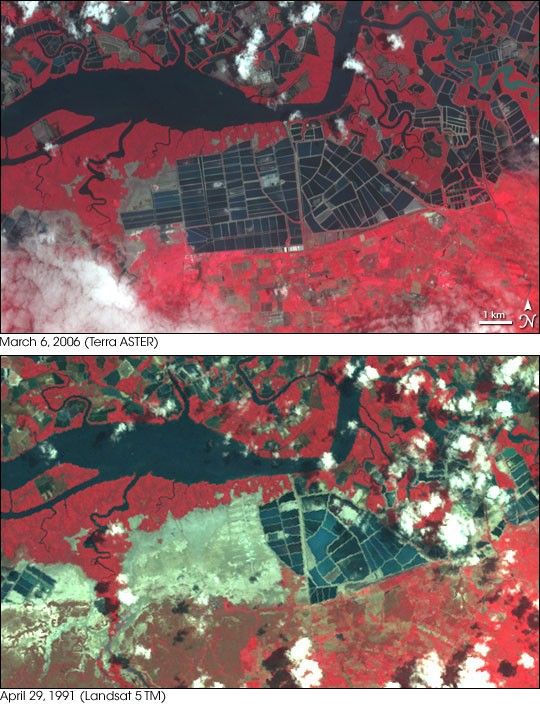
- March 6, 2006 (2.7 MB; Terra ASTER; 15 m)
- April 29, 1991 (2.2 MB; Landsat 5 TM; 28.5 m)
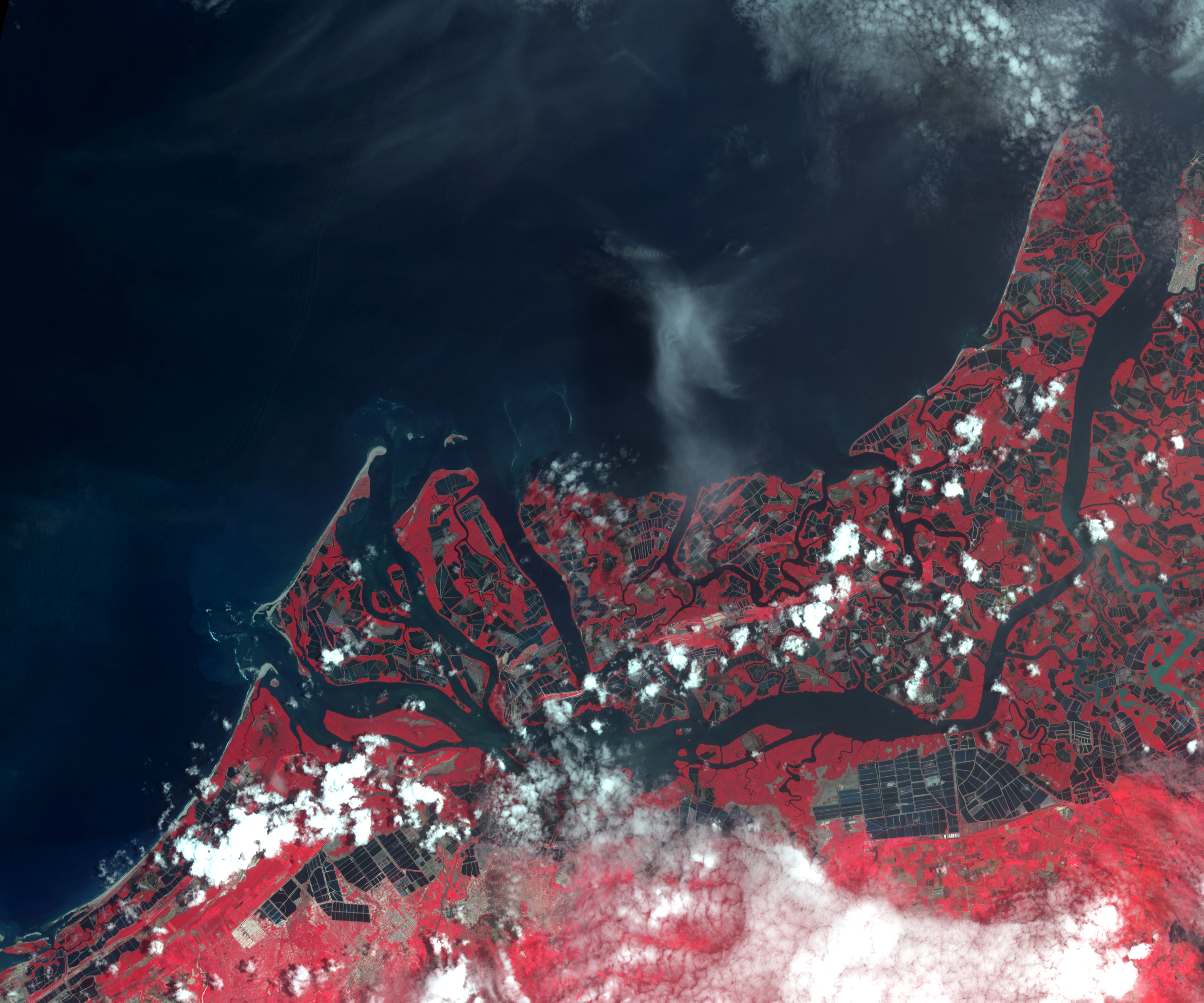
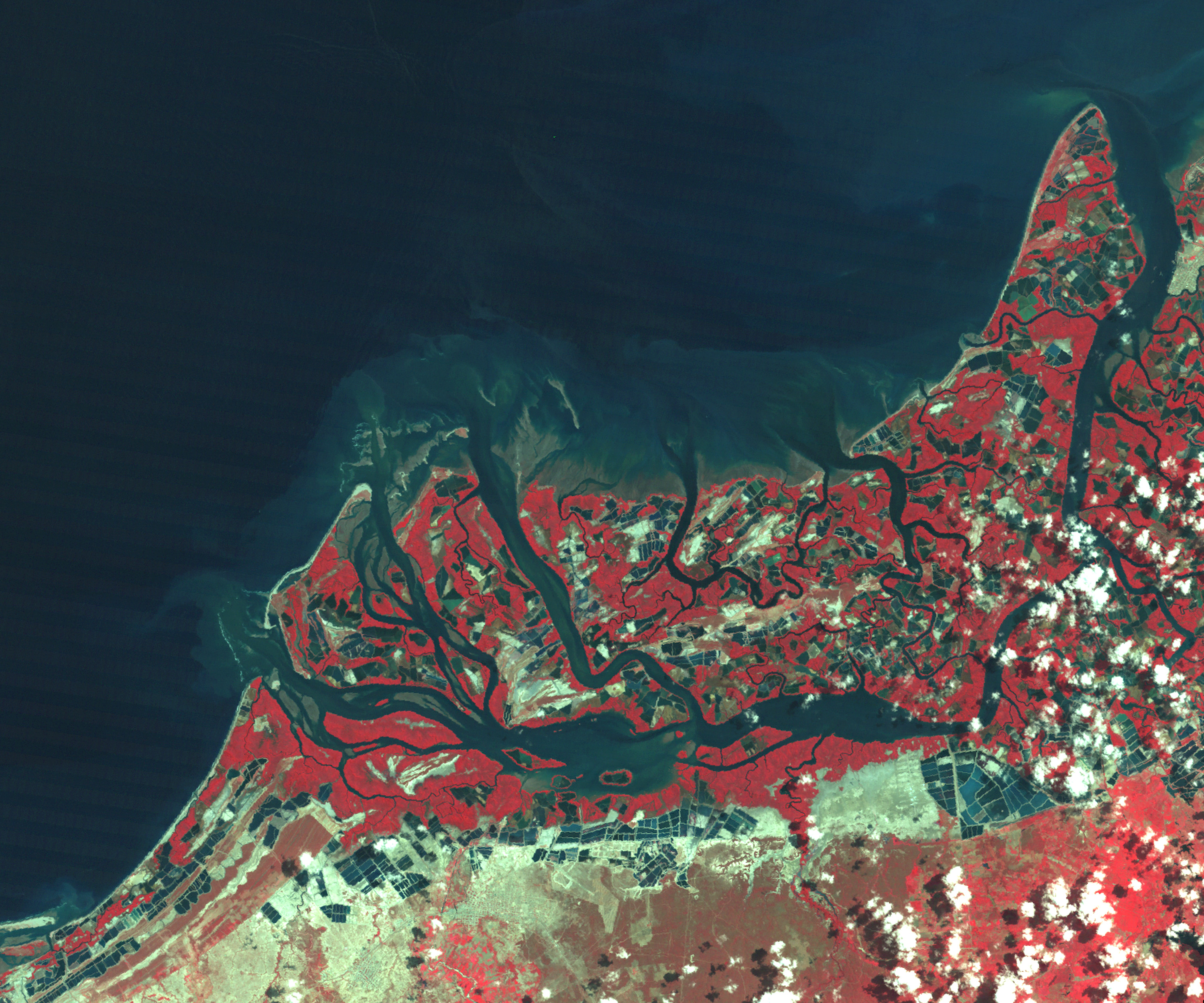
Like fields of blue, rectangular shrimp farms line the coast of Ecuador south of the city of Guayaquil in these images. Worldwide, wetlands and coastal mangrove forests have been converted to shrimp ponds in order to farm these crustaceans for food and sale. In Ecuador, the industry started in the late 1960s and rapidly grew. By 1999, 175,255 hectares of land had been converted to shrimp farms. That year, Ecuador was the fourth largest shrimp producer in the world, and the largest in the Western Hemisphere, according to the United Nations Food and Agriculture Organization.
In Ecuador, as elsewhere, shrimp farms are typically built along the shore where salt water is easily accessible. Though Ecuador’s mangrove forests declined as shrimp farming and other coastal development occurred, salt flats or salt marshes on slightly higher ground have also been converted, as illustrated in these images. The lower image was taken by the Landsat satellite on April 29, 1991. Shrimp farms cover much of the land shown in the image, but a broad swath of tan-gray salt flat still lines the inlet. By March 6, 2006, when the Advanced Spaceborne Thermal Emission and Reflection Radiometer (ASTER) satellite took the top image, the salt flat had almost entirely been converted to shrimp farms. A small canal connects the network of shrimp tanks to the inlet, providing a fresh source of water.
The large images provide a broader perspective on the extent of the development. In the 1991 Landsat image, 143 square kilometers of land had been converted to shrimp ponds. In the 2006 ASTER image, shrimp farms cover 243 square kilometers. Roughly 83 percent of the region’s wetlands and salt flats were eliminated by shrimp farms.
- Further Reading:
- Shrimp Farming in Honduras, on the Earth Observatory.
- Thematic Review on Coastal Wetland Habitats and Shrimp Aquaculture, by Lewis, R.R. III, M.J. Phillips, B. Clough and D.J.Macintosh. The report was prepared under the World Bank, NACA, WWF and FAOConsortium Program on Shrimp Farming and the Environment. Work in Progress for Public Discussion, and published by the Consortium in 2003.
- Shrimp Farm article on Wikipedia.
References & Resources
NASA images created by Jesse Allen, Earth Observatory. ASTER data provided courtesy of the NASA/GSFC/MITI/ERSDAC/JAROS, and U.S./Japan ASTER Science Team. Landsat data obtained from the University of Maryland’s Global Land Cover Facility.
None


