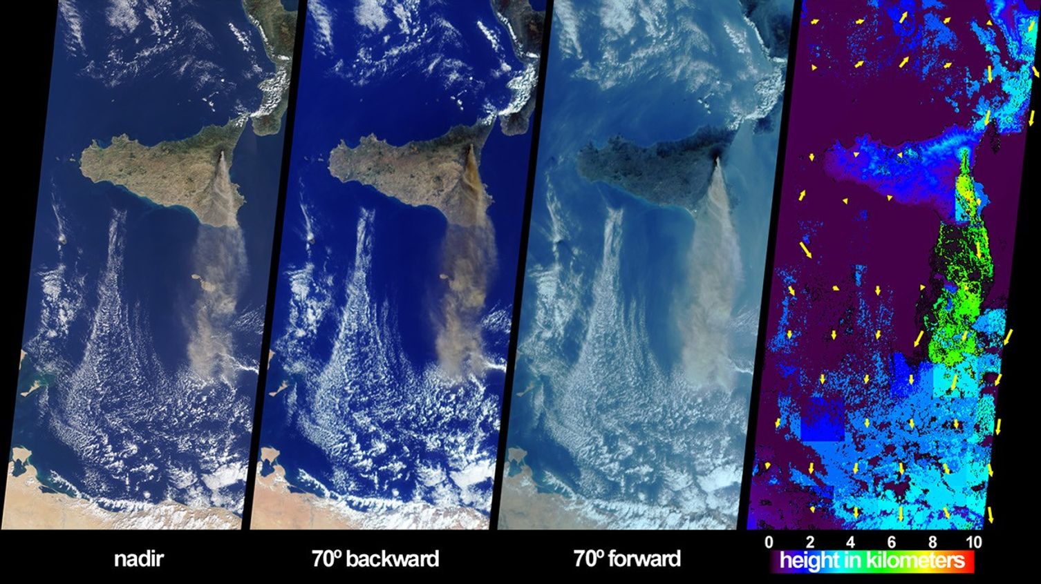
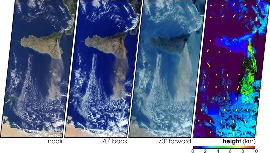
The height and southward extent of the ash plume emanating from Sicily’sMount Etna volcano on October 27 are captured in these four image panelsfrom the Multi-angle Imaging SpectroRadiometer (MISR). Mount Etna,Europe’s most active volcano, was revived when a series of intermittentminor earthquakes shook the eastern edge of Sicily and parts of mainlandItaly during September and October. The eruption of Etna sent a thickblanket of volcanic ash over much of eastern Sicily, sparked forestfires, and destroyed or damaged hundreds of buildings with lava flowsand pyroclastic activities. October 27, 2002, marks the start of thesecond period of intense activity from Etna in little over a year. Theprevious period of activity occurred during July and August 2001, duringwhich time MISR also observed extensiveash plumes emanating from the volcano.
The three natural-color (red, green and blue) images depict the sceneas observed by MISR’s downward-looking (nadir) camera and most oblique(70-degree) backward and forward-viewing cameras. Both images from theoblique cameras enhance the appearance of the ash plume, which extendssouthward about 400 kilometers toward Libya.
The right-hand panel provides a stereoscopically retrieved heightfield of the clouds and ash plume. Clouds are generally situated between2 and 4 kilometers above the surface, and Etna’s ash plume extendsskyward to altitudes of 5 to 6 kilometers. Retrieved cloud-tracked windvectors are indicated by yellow arrows superimposed over the heightfield. The vectors point in the direction of motion and their lengthsare proportional to speed. The longest vector corresponds to a windspeed of about 7 meters per second. (In this display, the vectors havenot been classified by height, and may represent winds associated withclouds at different altitudes.) Heights and motion vectors are derivedfrom automated matching of spatial features among different viewingangles, and accurate camera-to-camera geometric registration isimportant for this process to achieve accurate results. Since the landsurface is static, the low speeds obtained over clear land indicate thatthe retrievals are working properly. When the stereoscopic retrievaldetermines that a location is at a near-surface altitude, or if there isinsufficient spatial contrast but MISR’s nadir-camera radiometric cloudmask indicates clear sky, digital surface elevation data are displayedinstead. Some parts of the ash plume exhibit insufficient spatialcontrast for stereoscopic retrieval but were classified as cloudy by theradiometric cloud mask; these areas are shown in dark gray.
The Multi-angle Imaging SpectroRadiometer observes the daylit Earthcontinuously from pole to pole, and every 9 days views the entire globebetween 82 degrees north and 82 degrees south latitude. The MISR Browse Image Viewer provides access tolow-resolution true-color versions of these images. These dataproducts were generated from a portion of the imagery acquired duringTerra orbit 15204. The panels cover an area of 380 kilometers x 845kilometers, and utilize data from blocks 59 to 64 within World ReferenceSystem-2 path 189.
References & Resources
Image courtesy NASA/GSFC/LaRC/JPL, MISR Team. Text by Clare Averill (Acro Service Corporation/JPL).