


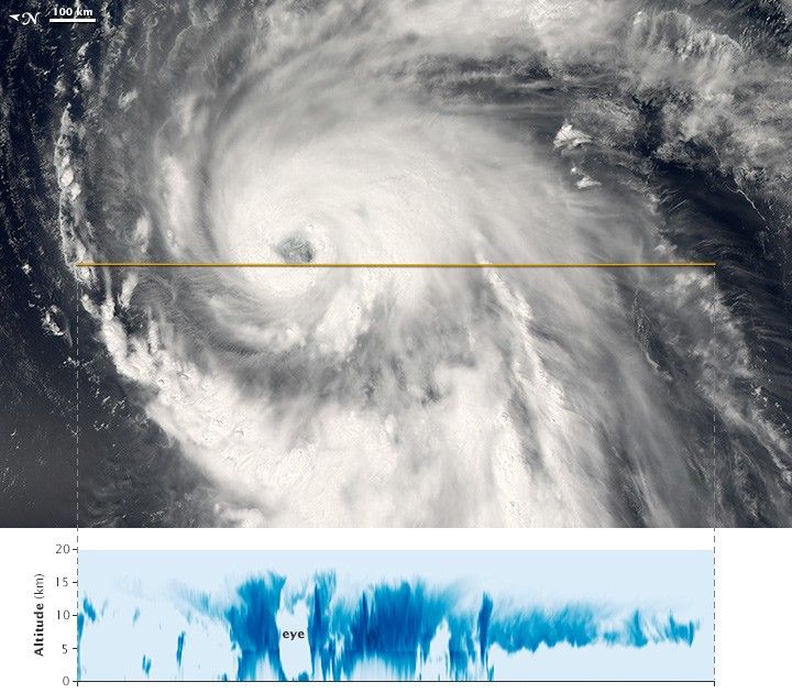
The Moderate Resolution Imaging Spectroradiometer (MODIS) on NASA’s Aqua satellite captured a natural-color view (top) of Typhoon Neoguri around 1:25 p.m. local time (0425 Universal Time) on July 5, 2014. At the time, the storm had sustained winds of approximately 110 knots (130 miles or 200 kilometers per hour), a category 3 typhoon. Note that the image has been rotated so that North is to the left.
Moments later, NASA’s CloudSat flew over and acquired a vertical profile of the storm clouds. (The satellite track is shown as a yellow line across the top image.) The lower image shows a cross-section of Neoguri—what the storm would look like if it had been sliced near the middle and viewed from the side. The darkest blues represent areas where clouds and raindrops reflected the strongest signal back to the satellite radar. These areas had the heaviest precipitation and the largest water droplets. Notice the relative lack of clouds in the eye of the typhoon.
References & Resources
NASA Earth Observatory image by Jesse Allen, using CloudSat FirstLook data provided courtesy of the CloudSat team at Colorado State University. Caption by Mike Carlowicz.


