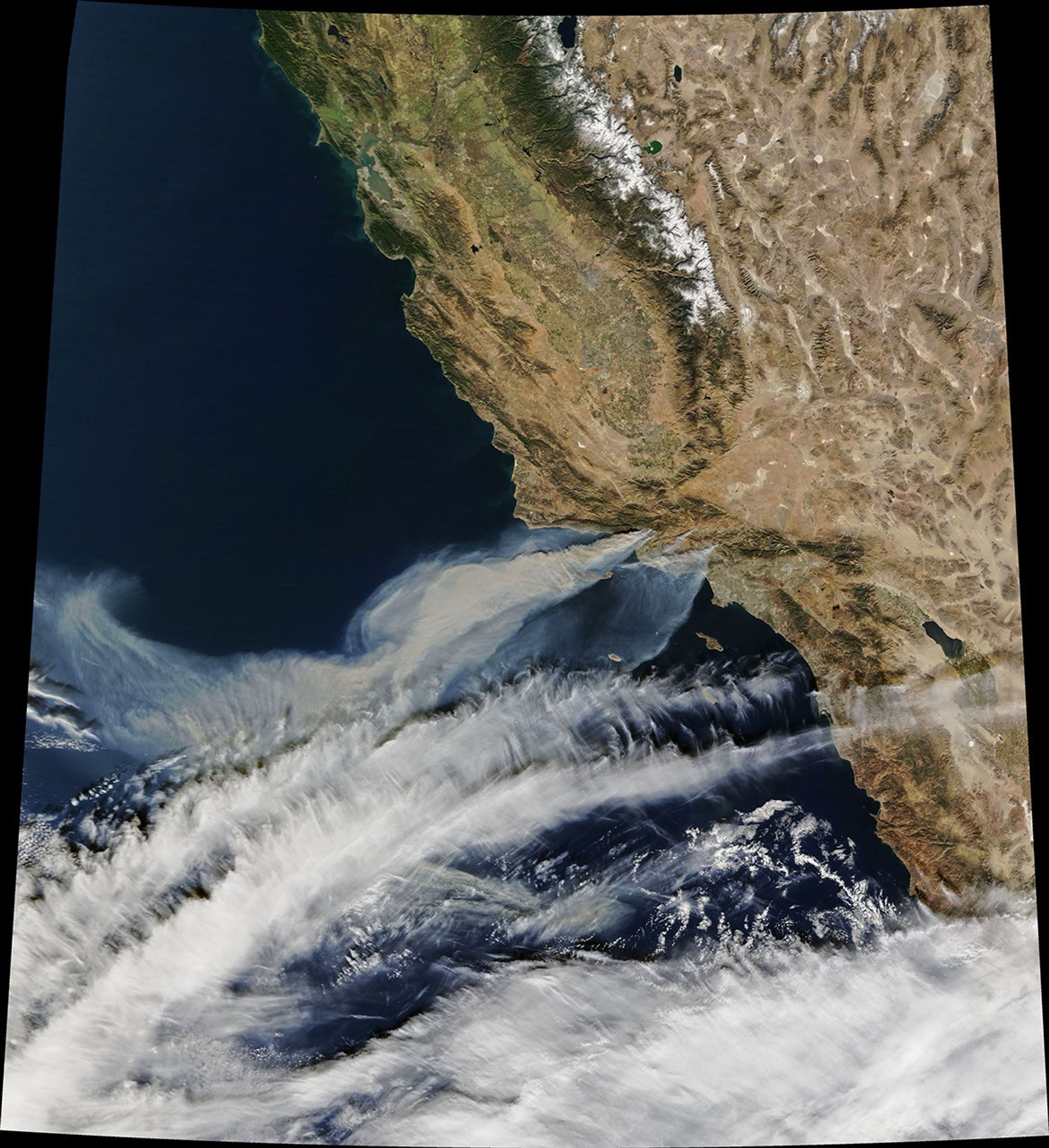
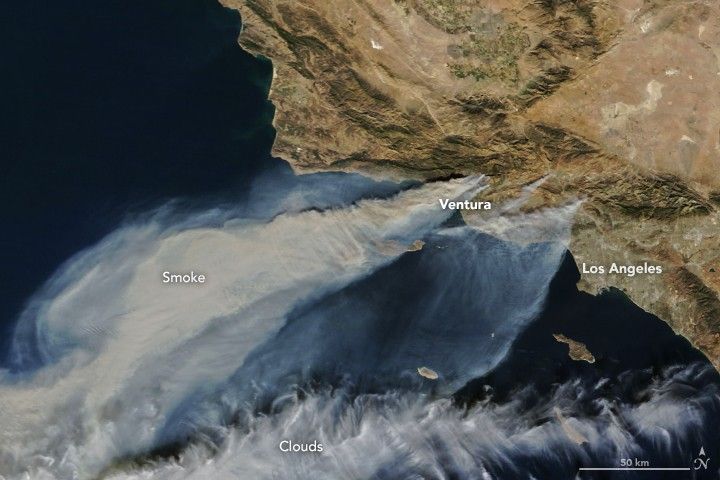
Thick smoke was streaming from several fires in southern California when the Moderate Resolution Imaging Spectroradiometer (MODIS) on NASA’s Terra satellite acquired a natural-color image in the afternoon on December 5, 2017.
The largest of the blazes—the fast-moving Thomas fire in Ventura County—had charred more than 65,000 acres (24,000 hectares or 94 square miles), according to Cal Fire. Smaller smoke plumes from the Creek and Rye fires are also visible.
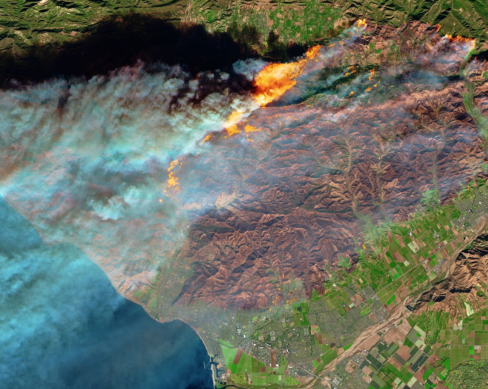
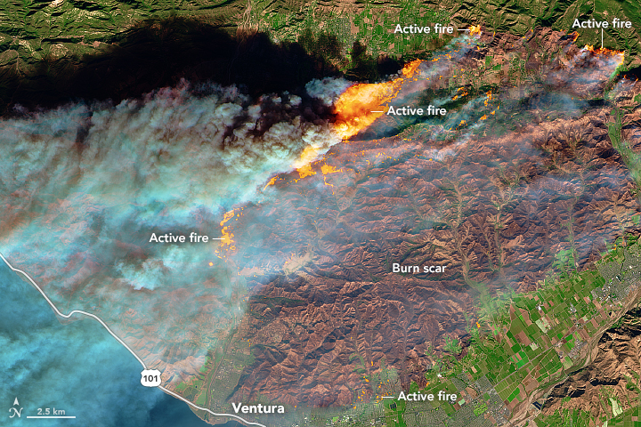
On the same day, the Multi Spectral Imager (MSI) on the European Space Agency’s Sentinel-2 satellite captured the data for a false-color image (below) of the burn scar. Active fires appear orange; the burn scar is brown. Unburned vegetation is green; developed areas are gray. The Sentinel-2 image is based on observations of visible, shortwave infrared, and near infrared light.
The fires mainly affected a forested, hilly area north of Ventura, but flames have encroached into the northern edge of the city. On December 6, 2017, Cal Fire estimated that at least 12,000 structures were threatened by fire.
Powerful Santa Ana winds fanned the flames. Forecasters with the Los Angeles office of the National Weather Service warned that the region is in the midst of its strongest and longest Santa Ana wind event of the year. They issued red flag warnings for Los Angles and Ventura counties through December 8, noting that isolated wind gusts of 80 miles (130 kilometers) per hour are possible.
A prolonged spell of dry weather also primed the area for major fires. This week’s winds follow nine of the driest consecutive months in Southern California history, NASA Jet Propulsion Laboratory climatologist Bill Patzert told the Los Angeles Times. “Pile that onto the long drought of the past decade and a half, [and] we are in apocalyptic conditions,” he said.
References & Resources
- Cal Fire (2017, December 6) Current Incidents. Accessed December 6, 2017.
- CIMSS Satellite Blog (2015, December 5) Wildfires in southern California. Accessed December 6, 2017.
- Los Angeles Times (2017, December 6) Southern California Fires Live Updates. Accessed December 6, 2017.
- Los Angeles Times (2015, October 29) Infographic Where do the Santa Ana winds come from? Accessed December 6, 2017.
- Weather Underground (2017, December 4) Extreme Holiday-Season Fire Threat Puts Southern California on Edge Accessed December 6, 2017.
NASA Earth Observatory images by Joshua Stevens, using MODIS data from LANCE/EOSDIS Rapid Response and modified Copernicus Sentinel data (2017) processed by the European Space Agency. Story by Adam Voiland.