


June 19, 2013
Smoke Engulfs Singapore
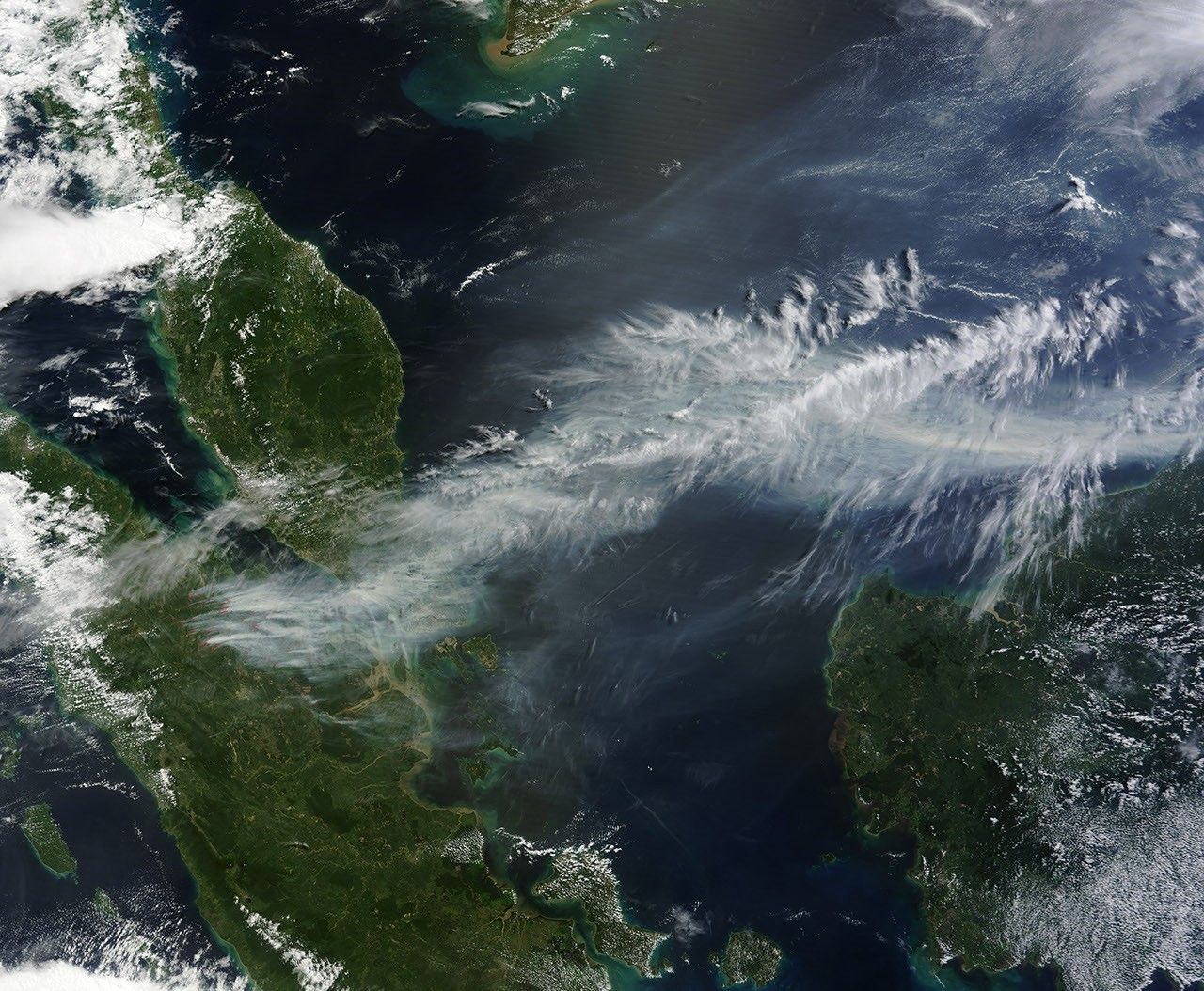
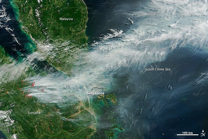
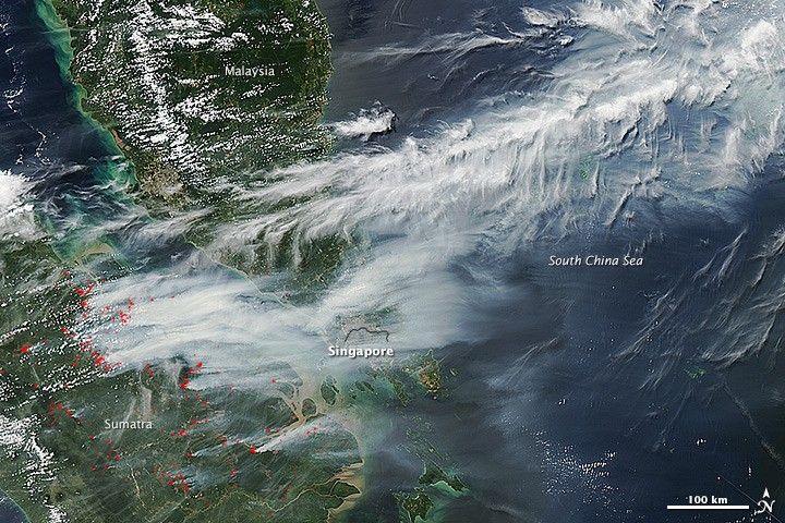
On June 19, 2013, NASA’s Terra and Aqua satellites captured striking images of smoke billowing from illegal wildfires on the Indonesian island of Sumatra. The smoke blew east toward southern Malaysia and Singapore, and news media reported that thick clouds of haze had descended on Singapore, pushing pollution to record levels.
Singapore’s primary measure of pollution, the Pollutant Standards Index (PSI)—similar to the Air Quality Index (AQI) used by the U.S. Environmental Protection Agency—rose to 371 on June 20, 2013, the highest level ever recorded. The previous record occurred in 1997, when the index hit 226. Health experts consider any level above 300 to be “hazardous” to human health. Levels above 200 are considered “very unhealthy.”
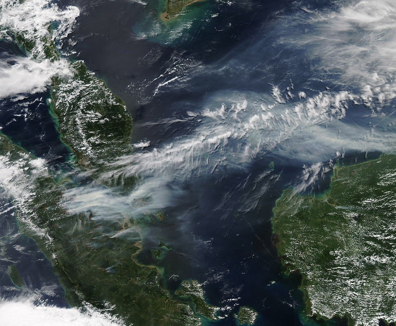
Both images above were captured by the Moderate Resolution Imaging Spectroradiometer (MODIS), an instrument that observes the entire surface of Earth’s every 1 to 2 days. The top image shows smoke blowing east at 3:30 Universal Time (11:30 a.m. local time); the lower image shows the same area on the same afternoon at 6:30 UTC (2:30 p.m. local time).
Though local laws prohibit it, farmers in Sumatra often burn forests during the dry season to prepare soil for new crops. The BBC reported that Singapore’s Prime Minister Lee Hsien Loong warned that the haze could “easily last for several weeks and quite possibly longer until the dry season ends in Sumatra.”
Further Reading
- Atwood, S. (2013, May 3) et al (2013, April 15) Analysis of source regions for smoke events in Singapore for the 2009 El Nino burning season. In press.
- Earth Observatory (2007, March 30) Tropical Deforestation.
- Hyer, E. et al (2012, June 7) Patterns of fire activity over Indonesia and Malaysia from polar and geostationary satellite observations. 122, 504-519.
References & Resources
- Channel News Asia (2013, June 20) Palm oil producers deny slash-and-burn practices in Indonesia. Accessed June 20, 2013.
- New York Times (2013, June 20) Pollution in Singapore Hits Record Level. Accessed June 20, 2013.
- Singapore National Environment Agency PSI and PM2.5 Readings. Accessed June 20, 2013.
- Voice of America (2013, June 20) Singapore Haze Soars to Hazardous Levels. Accessed June 20, 2013.
- Wall Street Journal (June 20, 2013) Singapore Air Pollution Hits Record. Accessed June 20, 2013.
- Reuters (June 20, 2013) Slideshow: Asia Haze. Accessed June 20, 2013.
NASA image by Jeff Schmaltz, LANCE/EOSDIS Rapid Response. Caption by Adam Voiland.