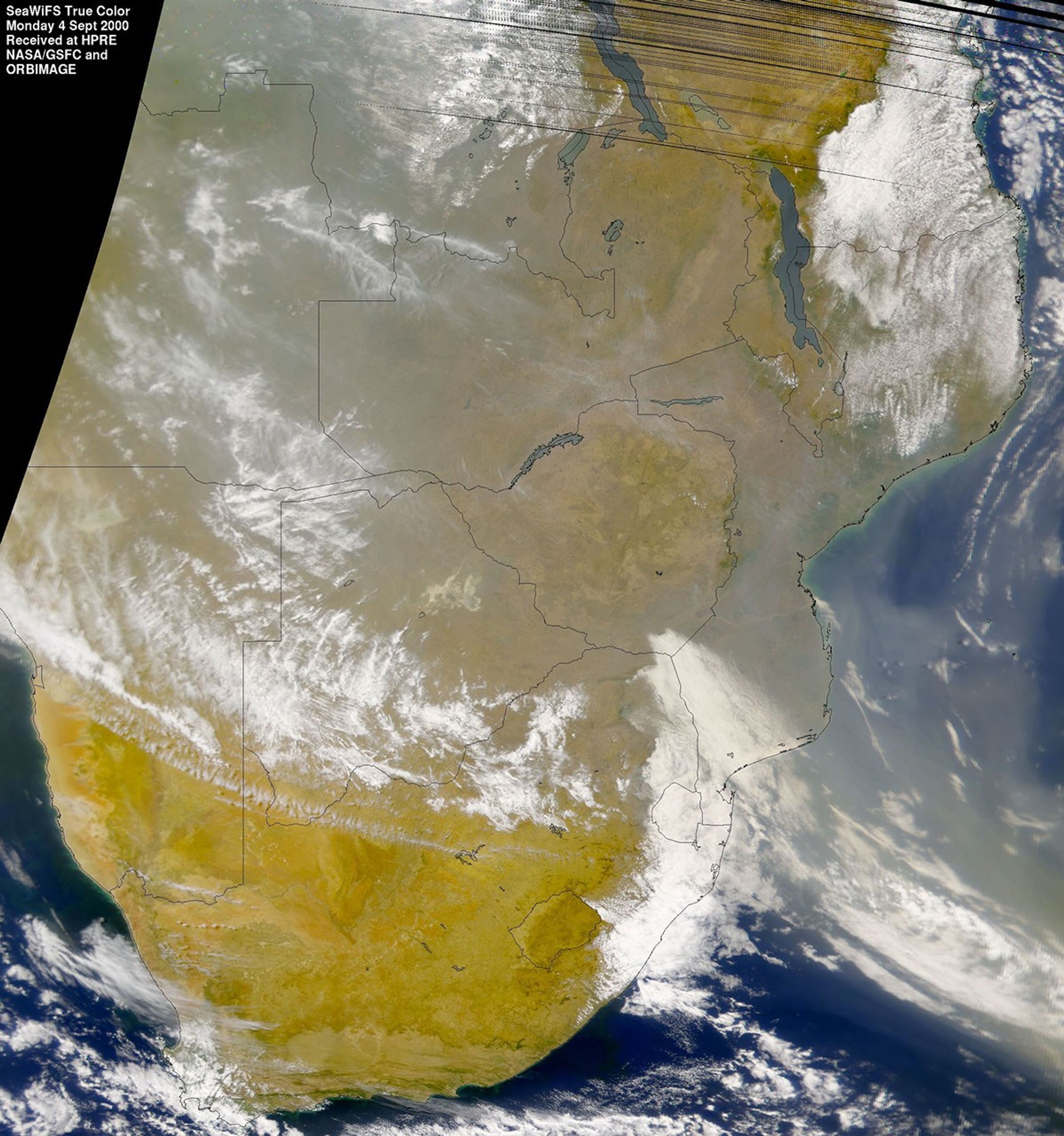
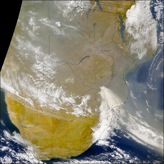
This SeaWiFS true-color image acquired over Southern Africa on Sept.4, 2000, shows a thick shroud of smoke and haze blanketing much of thesouthern half of the continent. The smoke in this scene is beinggenerated by a tremendous number of fires burning over a large areaacross the countries of Angola, Zambia, Mozambique, Zimbabwe, Botswana,and the Northern Province of South Africa. In this image, the smoke(grey pixels) is easily distinguished from clouds (bright white pixels).Refer to the Images & Data section for a larger scale view of thefires in Southern Africa.
Data from both the SeaWiFSand Terra satellites are being used byan international team of scientists participating in the SAFARI fieldexperiment. The objective of SAFARI is to measure the effects ofwindblown smoke and dust on air quality and the Earth's radiant energybudget.
This image was produced using SeaWiFS channels 6, 5, and 1 (centeredat 670 nm, 555 nm , and 412 nm, respectively). The data were acquiredand provided by the Satellite Applications Center in Pretoria, SouthAfrica.
References & Resources
Image courtesy Gene Feldman, SeaWiFS Project and Orbital Sciences