Suggested Searches

1 min read

Smoke in the Gulf of Mexico


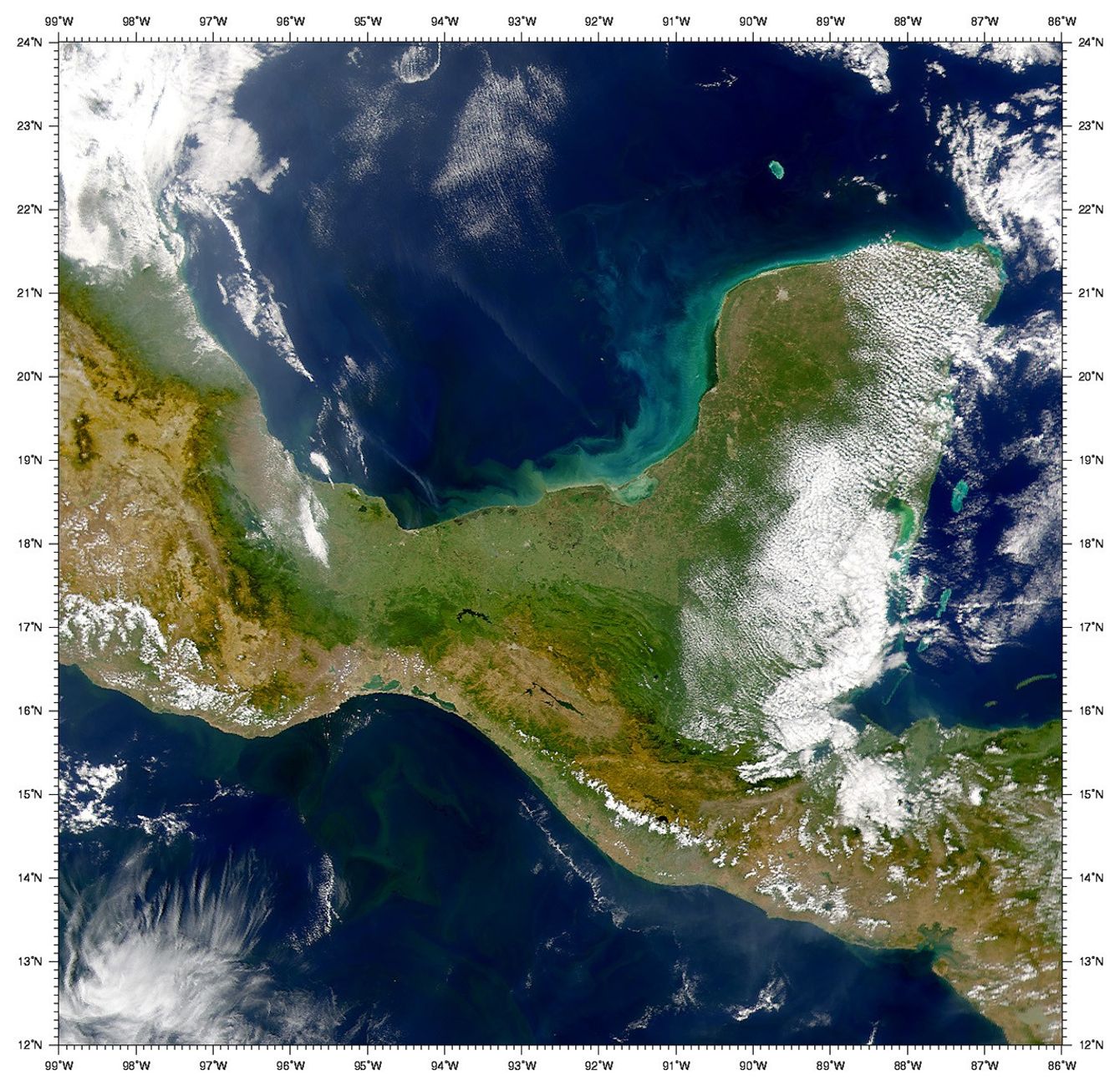
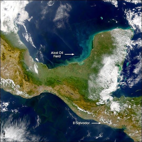
This Sea-viewing Wide Field-of-view Sensor (SeaWiFS)image of the Bay of Campeche, acquired January 17, 2001, shows a 300-kilometer long smoke plumestreaming towards the northwest from around 19.4° North and 92° West, thelocation of the Akal oil field.

In the lower right (southeast) cornerof the image is the country of El Salvador, site of a magnitude 7.6earthquake on January 13, 2001.

On the Pacific side of Southern Mexico, the productive waters of theGulf of Tehuantepec are visible.

References & Resources

Provided by the SeaWiFS Project, NASA/Goddard Space Flight Center, and ORBIMAGE

You may also be interested in:

Stay up-to-date with the latest content from NASA as we explore the universe and discover more about our home planet.

A Subtle Return of La Niña 
3 min read

A weak La Niña emerged in the equatorial Pacific in late 2025, and scientists are watching how it may help…

Article
The Galaxy Next Door
3 min read

The Large Magellanic Cloud—one of our closest neighboring galaxies—is a hotbed of star formation that is visible to both astronauts…

Article
The Towers of Tràng An
3 min read

Over millions of years, water has sculpted limestone in northern Vietnam into an extraordinary karst landscape full of towers, cones,…

Article