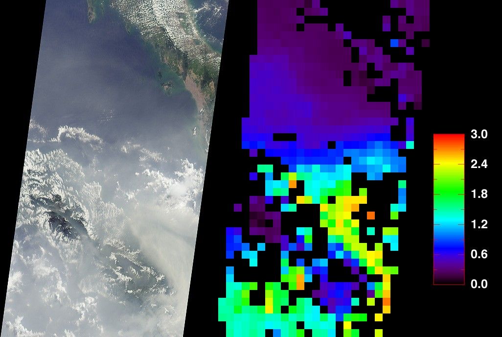


At least once a year for a period lasting from a week to several months,northern Sumatra is obscured by smoke and haze produced by agricultural burningand forest fires. These data products from the Multi-angle ImagingSpectroRadiometer (MISR) document the presence of airborne particulates on March 13,2002. On the left is an image acquired by MISR’s70-degree backward- viewing camera. On the right is a map of aerosol opticaldepth, a measure of the abundance of atmospheric particulates. This productutilized a test version of the MISR retrieval that incorporates an experimentalset of aerosol mixtures. The haze has completely obscured northeastern Sumatraand part of the Strait of Malacca, which separates Sumatra and the MalaysianPeninsula. A northward gradient is apparent as the haze dissipates in thedirection of the Malaysian landmass. Each panel covers an area of about 760kilometers x 400 kilometers.
Haze conditions had posed a health concern during late February (when schoolsin some parts of North Sumatra were closed), and worsened considerably in thefirst two weeks of March. By mid-March, local meteorology officials askedresidents of North Sumatra’s provincial capital, Medan, to minimize theiroutdoor activities and wear protective masks. Poor visibility at Medan airportforced a passenger plane to divert to Malaysia on March 14, and visibilityreportedly ranged between 100 and 600 meters in some coastal towns southeast ofMedan.
The number and severity of this year’s fires was exacerbated by dry weatherconditions associated with the onset of a weak to moderate El Niño. Thegovernments of Indonesia, Malaysia, and Brunei have agreed to ban open burningin plantation and forest areas. The enforcement of such fire bans, however, hasproven to be an extremely challenging task.
References & Resources
Image courtesy NASA/GSFC/LaRC/JPL, MISR Team